The thread about the history of Jock’s Lodge; just who was “Jock”?

It’s a Friday, so let’s start the day with an animated image transition to visualise a bit of local history. The view below shows Jock’s Lodge toll house in the mid-late 19th century, looking east down the Portobello Road at the junction with Willowbrae.

#NowAndThen transition of old Jock’s Lodge, looking east.

The original image here is from Old & New Edinburgh by James Grant, which was published 1885. The toll house is in the middle of the image, you can see the barriers, one on each side of the cottage opened against its walls and another on the left side of the road.

Jock’s Lodge toll house from Old & New Edinburgh by James Grant

Other features we can see are what was the Jock’s Lodge Tavern (for now, The Willow), with a cavalryman from Piershill Barracks standing outside. The belfry behind belongs to the barracks’ chapel.

A cavalry trooper stands outside the Jock’s Lodge Tavern, with the belfry of the barracks chapel behind him.

Another cavalryman is in the foreground, the pillbox undress hats of the troopers suggest a date of 1870s or thereabouts. Behind him is the row of taverns and villas at Piershill that grew up around the barracks, and where many of the officers and their families would have lived. In the distance is a stagecoach.

A cavalryman on the Portobello Road, with a row of buildings beyond.

And on the right of the scene we can see a haycart approaching from the direction of Duddingston, a reminder that this part of Edinburgh was thoroughly rural and not even with the city’s administrative limits until the very end of the 19th century.

Haycart in front of a thatched byre. This is coming from the road to Duddingston, now known as Willowbrae

The 1876 OS Town Plan matches this view more or less exactly. The rounded western gable of the toll house, sitting in the middle of the road junction, the buildings beyond, the Jock’s Lodge public house on the left, the barracks and its chapel on the right.

1876 OS Town Plan. Reproduced with the permission of the National Library of Scotland

There had long been a village here at it was about the only settlement of note on the King’s Highway between Edinburgh and Musselburgh. It was conveniently located at a road junction, where alternative routes east via either Easter Duddingston or the Figgate whins met a road to Restalrig Village. This village seems to have included in the 18th century stables, taverns, lodging houses and a brewery, exactly what you’d expect on a Georgian transport route. The area was long the haunt of highwaymen, one of the earliest recorded incidents being in 1692.

William Roy’s Lowland Map of Scotland, showing Jock’s Lodge on the route from Edinburgh (the red area on the left of the frame) to Musselburgh and on to Berwick. Reproduced with the permission of the National Library of Scotland

As for the toponymy – the meaning of the place name – Jock’s Lodge is mentioned back in the 1650s in Nicoll’s Diary as Jokis Ludge. Oliver Cromwell mustered the New Model Army infantry here in July 1650 before his failed assault on Leith. Other forms of the name were always plural; Joks, Jokes, Jocks and Jock’s. So who was Jock? Well Jock wasn’t one person, Jock was a whole lodge of persons. Specifically, the Jockies.

The Jockies were also known as King’s Bedesmen or Bluegowns; they were a class of Royally-appointed beggars, first licensed to beg by King James VI. They had a uniform of a licence badge and blue gown. Every birthday of the monarch each Bluegown received a new cloak, a tin badge with the motto “pass and repass“, a Scots shilling for every year of the monarch’s age and their dinner. David Allan, who painted lots of the city’s lower classes at work, has an illustration of a late 18th century Bluegown wearing his badge, begging at one of the city ports, the steeple of St. Giles’ in the background. Clearly an old soldier, he has lost a leg – possibly why he was accorded the “privilege” of his station.

David Allan, 1785ish, A Peg-Legged Beggar, with Donkey and Children, Asking a Lady for Alms Outside One of the City Gates

Pass and repass” on the beggar’s badge referred to the holder being allowed to pass freely through the land, not being subject to local begging laws or charges of vagrancy.

1847 Bluegown’s badge, issued in the reign of Victoria. CC-BY-SA 3.0 Roy Oaks

The Bluegowns referred to themselves as Jockies and reputedly had a lodge house outside the city; the Jockies Lodge. I do not know of any further details or images of what this house may have looked like, or where exactly it was, but this 1818 sketch is the earliest view identified as being Jock’s Lodge that I could find.

Cottage at Jock’s Lodge, by Daniel Somerville, c. 1818. © Edinburgh City Libraries

A photo in the Book of the Old Edinburgh Club (vol. 23) shows the back of the toll house and a now-demolished villa beyond, which may have been the site of the Jockies Lodge. This house in turn was cleared away to widen the road to Restalrig, also known as Smokey Brae, in the 1930s.

Jock’s Lodge “as it used to be” an old photo, 1860s-80s of the lodge house and a villa beyond.

A thread about Jock’s Lodge cannot fail to mention Piershill (and indeed, already has!). Suffice to say that in 1794 a big cavalry barracks was built immediately to the east on the site of a house called Piershill. This illustration below was made in 1798 and it is almost certain that the prominent central block of the barracks, the officers’ mess and accommodation, was an extension of the original Piershill House.

Late 18th century illustration of Piershill Barracks, looking towards the Forth. From collection at Blickling Hall © National Trust/ Tania Adams

The origin of Piershill as a placename is lost to time, but it’s probably descriptive, something to do with willow trees, and nothing to do with a man named Piers or Pierre. The name is much older than the house which adopted it in the 1760s.

Piershill Barracks in 1894. The Officer’s Mess in the centre is likely partly comprised of the original Piershill House. © Edinburgh City Libraries

The barracks were demolished in the 1930s and replaced with two large U-shaped circuses of show-piece council housing by the City Architect, Ebenezer James Macrae. Much of the masonry from the barracks was re-cut and used in the façade dressing and as boundary walls of these houses. Macrae was a big fan of traditional Scottish building style and techniques and was not alone in Scottish City Architects of his time in persisting in the old ways, in the face of modernity, for a variety of reasons including job creation and the fact many of the tried and tested features performed their functions well in their native climate.

Piershill Housing, Edinburgh, John Harper Campbell, 1951. © Edinburgh City Libraries

If you wander down Smokey Brae towards Marionville Fire Station and Restalrig, you can still find the old back gate of the barracks.

Smokie Brae, former back gate and perimeter wall of Piershill BarracksSmokie Brae, former back gate and perimeter wall of Piershill Barracks“BACK GATE”“BACK GATE”

As if there was any doubt that this was from the Piershill barracks, if you look at an old photo of the main gate, the legend is a perfect match:

The main gate to Piershill Barracks © Edinburgh City Libraries

You can see this gate on old maps. The railway cut through the northern part of the barracks site in the 1840s, so rather than leave some of it marooned on the wrong side of the tracks, the North British Railway bought a parcel of land to the east of the barracks and transferred it to the government, to where the barracks’ riding school, stabling, grazing ground and hospital were relocated. In turn it kept the exclave to the north and built itself a gasworks here.

1849 OS Town Plan, showing the back gate of Piershill Barracks, with a slope up to the main parade ground level. Reproduced with the permission of the National Library of Scotland

Note to readers: unfortunately in April 2026, a third-party plug-in more than exceeded its authority and broke many of the image links on this site. No images were lost but I will have to restore them page-by-page, which may take some time. In the meantime please bear with me while I go about rectifying this issue.

If you have found this site useful, informative or amusing then you can help contribute towards its running costs by supporting me on ko-fi. This includes my commitment to keeping it 100% advert and AI free for all time coming, and in helping to find further unusual stories to bring you by acquiring books and paying for research.
Or please do just share this post on social media or amongst friends and like-minded people, sites like this thrive on being shared.

Explore Threadinburgh by map:

Travelers' Map is loading...
If you see this after your page is loaded completely, leafletJS files are missing.

These threads © 2017-2026, Andy Arthur.

NO AI TRAINING: Any use of the contents of this website to “train” generative artificial intelligence (AI) technologies to generate text is expressly prohibited. The author reserves all rights to license uses of this work for generative AI training and development of machine learning language models.

#Lochend #Logan #Restalrig #StMargaret

The thread about Marionville; the house that thread built and home to the unfortunate “Fortunate Duellist”

This thread was originally written and published in November 2019. It has been lightly edited and corrected as applicable for this post.

There’s an old Georgian villa in the east of Edinburgh called Marionville. It lends its name to the district, a few streets and a fire station. It’s your typical regular, 3-storey, 5-bay, 6-over-6 window, sandstone job and although it is quite a rarity in a largely 20th century part of town, at first glance it is otherwise unremarkable for Edinburgh.

Marionville. Cc-BY-SA Kim Traynor

Unremarkable that is until you find out a little bit about the place’s history! It was built some time between the 1760s and 1780s by the Misses Ramsay of Old Lyon Close, milliners renowned in the burgh for their ribboned hats. When built it was called Viewfrith (as in a house where one could view the Frith, or Firth of Forth. On account of its occupants trade, it was scornfully nicknamed the Lappet Ha‘, lappet referring to the woven lacework that was common in Georgian women’s hats. Ha’ for ball; the house that lappet built. The misses Ramsay saw out their days in their fine house and its gardens, and in October 1780 it was noted as being for sale:

Sale notice for Viewfrith, Caledonian Mercury, October 16 1780

About 1786 it passed to one James Macrae of Holmains Esq. who liked to be known as Captain Macrae on account of his service in the 6th Dragoon Guards (Irish Carabiniers), a Hanoverian cavalry regiment. By accounts he was both a sophisticated, cultured charmer and an arrogant, pompous “Goth“. It was Macrae who renamed the house, calling it for his wife, Maria Cecile le Maistre.

Uniforms of horsemen of the Irish Carabiniers (6th Dragoon Guards)

Captain Macrae had a quick temper and an overinflated sense of his own status. He was nicknamed the “fortunate duellist” on account of his propensity to call for satisfaction and on not being dead as a result. He practised by firing at a barber’s block kept specially for the purpose, or so John Kay caricatured him.

“The Fortunate Duellist”: caricature of Captain Macrae with an inset image of him practising duelling with the barber’s block, from “Original Portraits and Caricature Etchings” by John Kay, 1799

The Macraes soon built up a reputation as a home of the “gayest private theatricals, perhaps in Britain“. Being wealthy and aspirational with tastes “gay and fashionable” they had a 150-seat private theatre built, complete with stage, curtain and scenery in the house where the couple themselves took the starring roles. The great and the good of Edinburgh were invited and the shows were a hot ticket in town, being well reviewed in the papers. The Scots Magazine and Caledonian Mercury were full of gushing praise for them.

Edinburgh Advertiser, May 9 1789

Maria Macrae was the daughter of the Swedish ambassador’s wife and had spent time in Paris with her cousins. It was there she got a taste for the private theatricals of the time and it was she who was chiefly responsible for reproducing them at Marionville. The Macrae’s inner circle was a centre of Georgian high fashion in Edinburgh, the women wore head-dresses so tall that they had to “sit on the carriage floor” and the men wore “bright coats with tails to their heels” and “wigs with great side curls“. The innermost of their circle were the Ramsays (no relation to the Misses), Sir George Ramsay of Bamff, 6th Baronet and his wife, Eleanor Fraser. They were “warmly attached and intimate” with the Macraes.

An engraving of Marionville in happier times from Old & New Edinburgh by James Grant.

So all was good. Everyone was happy and Marionville was the place to be seen around town. Macrae was highly regarded in the right circles, but his pomposity and temper would be his unravelling. An example of this was when a messenger of the law tried to arrest his cousin, the Reverend John Cunningham, Earl Glencairn, at a private party in Drumsheugh House. Macrae was outraged that a common man would insult a gentleman, and threw the messenger over the stairwell. When it later came to light that Cunningham was a debtor who had refused all chance to settle his obligations and that the messenger had been gravely injured, Macrae made an apology and paid compensation of 300 guineas to settle the matter.

And then we come to the fateful night of April 7th 1790. Captain Macrae had been out at the Theatre Royal, which stood on Shakespeare Square, opposite the General Register Office and where the General Post Office would later be built. Being a gentleman, he was helping a lady to get a chair to convey her home (this meant a sedan chair; at this time were still the principal form of public transport of choice for the moneyed classes around town). He had secured the lady her chair when a liveried footman appeared on the scene and seized one of the poles of the chair to reserve it for his mistress. The outraged Macrae rapped the impertinent servant’s knuckles with his cane.

The Theatre Royal on Shakespeare Square, the corner of Princes Street, North Bridge, Leith Street and what is now Waterloo Place. John Le Conte, 1857. Credit; Edinburgh City Libraries

The footman, not to be cowed, denounced Macrae as a scoundrel and punched him in the chest. Macrae responded by striking him across the head with his cane. An almighty fracas ensued, sucking in passers-by on both sides. Somehow the conflict was defused and the lady was spirited to safety in another chair. And there it might have ended until Macrae was made aware that the footman in question was an employee of his dear friend, Sir George Ramsay.

A Georgian cartoon of a drunken gentleman fighting with a coachman and footman. Isaac Cruikshank, 1809. © The Trustees of the British Museum

And so, the following day Macrae sought out Ramsay at his place of business. His friend informed him that the servant in question was recently engaged by his wife and he felt that he had no hand in the matter. Macrae insisted that he would therefore apologise to the lady at once. Hurrying to the Ramsay’s house on St. Andrew Square, he found her sitting for an up and coming your artist, one Henry Raeburn. Theatrically going down on one knee, Macrae begged forgiveness for having chastised her servant. And there it would have ended. But…

A few days later at Marionville, an anonymous letter arrived stating that Macrae had meddled with the “Knights of the Shoulder Knot” (the name given to footmen for their elaborate uniforms) and they would have their revenge for the insult to their brother. The footman in question, James Merry, took the matter further by making it known he would take legal proceedings against his assailant for the injuries he had suffered. Piqued, Macrae wrote to Ramsay and demanded that the man be put in his place and discharged. For whatever reason, Ramsay declined to satisfy his friend and their relationship quickly soured as the two engaged in a protracted series of increasingly intemperate letters. This culminated in Macrae having his messenger inform Ramsay that he was not a gentleman, but a scoundrel!

Georgian caricature of a foppish, arrogant footman. George Moutard Woodward, 1799. © The Trustees of the British Museum

That was that! Macrae had overstepped the mark for sure, Ramsay was a proper gentleman, with a title, not someone you could go around insulting. The intermediary, one Captain Amory, arranged a meeting of both parties in Bayle’s Tavern at which “rough epithets were exchanged“. The outcome was inevitable and satisfaction was demanded by Macrae. But he let it be known that he considered Ramsay the challenger, for refusing to deal with his servant.

The time and place was set for the shore outside of Musselburgh at noon the next day. What better place to settle your differences than in the cool sea breeze of the Honest Toun? And so it was that the next day the two gentlemen, each with another in tow as second, met at Wards Inn off of the Musselburgh Links. A surgeon, Benjamin Bell, was sensibly arranged for.

Benjamin Bell (left), following a different duelist on his way to Musselburgh to settle a score. Bell must have been the go-to man for calling to a duel. The woman heading the other way is a salter, carrying her load in a basket, supported by a leather strap around her head. From John Kay’s caricatures, Vol. 2. Credit; Edinburgh City Libraries

A parlay took place to see if things could be settled amicably, without either side losing face. Macrae demanded that if Ramsay dismiss his servant he would apologise profusely for all that had followed and consider it closed. Ramsay demanded an apology first, before any further progress could be made. Both sides were intransigent. The seconds which each side had brought as counsel declined further compromise and the course of action was now set. Each man took a pistol from a pair and made his way to the allotted spot on the Links. Each then walked 14 paces away from the other and the duel commenced. Ramsay shot first and nicked the collar of his late friend, grazing the neck. Macrae did not miss and Ramsay was mortally wounded. Macrae would later claim that he had planned to shoot high and miss on purpose, but was so outraged that Ramsay had not deliberately missed and had drawn blood that he decided to settle the matter once and for all by not missing. For a sure shot like Macrae, the outcome was inevitable.

“The Duel”, a cartoon in the style of Kay by amateur Edinburgh artist J. Jenkins in 1805. CC-BY 4.0 National Library of Scotland

The deed done, Macrae was suddenly remorseful and had to be convinced to leave his dying friends’ side by Ramsay’s second, Sir William Maxwell. Edinburgh society was outraged and it was Macrae, the lower status gentleman that they squarely blamed for this calamity. Being a proper class scandal, the detail was all printed at the time (then, as now, controversy was good for sales) and Macrae was immortalised as “The Fortunate Duellist” by Edinburgh caricaturist John Kay. By trade Kay was a barber, so the story of the practice target may have appealed to him as much as the chance to satirise events.

Facing a potential murder charge, Macrae abandoned Marionville and his family and fled to Paris accompanied by his second, Captain Amory. They took up lodgings in the Hôtel de la Dauphine. A summons soon arrived from Edinburgh to return and face the law. Ignoring it, both were declared outlaws and consigned themselves to live out their days in exile. To add insult to Macrae’s injury, 2 years later the Sheriffs awarded damages and compensation to the footman for his original injuries, which were paid from Macrae’s estate in his absence. Macrae stayed in Paris until the coming of the French revolution compelled his to flee further, this time to Altona in Italy. He had hoped that the passage of time would allow him to return home to Marionville, but society and the law were resolved against it.

And so it was that the gayest house in town fell into “an air of depression and melancholy such as could barely fail to strike the most unobservant passenger“. It was advertised as being to let in 1793 and the following year it was for sale. Macrae was soon forgotten by the chattering classes of Edinburgh. That is until 1814, when publisher Robert Chambers relates that “a gentleman of my acquaintance was surprised to meet him one day in a Parisian coffee house“. “The wreck or ghost of the handsome, sprightly man he had once been.” “The comfort of his home, his country and his friends, the use of his talents to all these, had been lost, and himself obliged to lead the life of a condemned Cain, all through the one fault of a fiery temper“.

Captain Macrae, late of Marionville, died alone in Paris on the 16th January 1820, 30 years an exile from his home, wife and 2 children. “Captain Macrae was a strange character. To those of his own class a tyrant and bully. To those below him he was kind and obliging”. At this time his old house was in the possession of a Mr and Mrs Dudgeon although it was for sale again shortly after, the new owner being Walter Stirling Glas, esq. The house was repeatedly for sale and let throughout the 19th century. A flick through some old Post Office directories enlightens us that from approximately 1858 to 1869, it was being used by Dr. Guthrie’s “Original Ragged Industrial School” .

In 1932, Marionville was purchased by the Roman Catholic Archdiocese of Edinburgh and St. Andrews for use as the manse for St. Ninian’s & Triduana’s Church, which was built in the grounds at this time. Its last occupant before the church took it over would appear to be one Miss W. Crawford Brown and the house  was sold back into private use within the past few years. The church, which was never actually completed to the intended design, is surprisingly the work of that most British of British architects, Sir Giles Gilbert Scott (of red telephone box and Battersea power station fame).

St. Ninian’s & Triduana’s R.C. church in the grounds of Marionville.

Note to readers: unfortunately in April 2026, a third-party plug-in more than exceeded its authority and broke many of the image links on this site. No images were lost but I will have to restore them page-by-page, which may take some time. In the meantime please bear with me while I go about rectifying this issue.

If you have found this site useful, informative or amusing then you can help contribute towards its running costs by supporting me on ko-fi. This includes my commitment to keeping it 100% advert and AI free for all time coming, and in helping to find further unusual stories to bring you by acquiring books and paying for research.
Or please do just share this post on social media or amongst friends and like-minded people, sites like this thrive on being shared.

Explore Threadinburgh by map:

Travelers' Map is loading...
If you see this after your page is loaded completely, leafletJS files are missing.

These threads © 2017-2026, Andy Arthur.

NO AI TRAINING: Any use of the contents of this website to “train” generative artificial intelligence (AI) technologies to generate text is expressly prohibited. The author reserves all rights to license uses of this work for generative AI training and development of machine learning language models.

#Lochend #Logan #Restalrig #StMargaret

Around Craigentinny: the thread about Scots, English, Gaelic, Dutch, Cornish and Irish origins of suburban streetnames

I recently wrote a thread about the meanings of the street names on the old Easter Duddingston estate, and how nearly all are linked to the Abercorn family. So now it is the time to boldly stray north of Moira Terrace and the Portobello Road to see what lies on the other side and where its street names come from (spoiler: it’s Craigentinny, and once again they come almost entirely from one family!)

By Craigentinny I mean the area defined by the old estate on that name, which was itself the eastern portion of the older Barony of Restalrig. The origins of Craigentinny are somewhat obscure but the most frequently told version says it was land acquired by one James Nisbet1 from the Logans of Restalrig in 1604. Here he built a tower house (or improved an existing one) which for reasons known to himself Christened Craigentinny. The roots of that name are Gaelic but the precise meaning is lost to time, the usual explanation is Creag an t’Sionnaich or Fox Rock. You can read a bit more on the origins and history of the house over at Stravaiging Around Scotland.

Craigentinny House, much modified in a Scottish Baronial Revival style in Victorian times, c. 1880. © Edinburgh City Libraries

After 160 years in hands of various Nisbets the house and estate was bought in 1762 by William Miller (1722-1799), a wealthy Quaker seed merchant from the Canongate who was known locally as “King of the Quakers“. He had a single surviving son late in life by his third wife, his heir William Henry Miller. William Henry inherited on his father’s death in 1799.

  • James Nisbet (1557-1621), son of Henry Nisbet of Dean, established the Nisbet of Craigentinny line.
    He was followed by his son
    Sir Henry Nisbet (1584-1667), who was followed by his 4th son Sir Patrick Nisbet (1623-1682). Patrick exchanged titles with his cousin – Sir Alexander Nisbet of Dean – in 1672 with the latter becoming Sir Alexander Nisbet of Craigentinny (1630-1682). He was succeeded by his second son, Capt. Alexander Nisbet (1688-1735), his eldest son Sir William having succeeded instead to the Nisbet of Dirleton line. The former did not have a male heir, so Craigentinny passed via Alexander’s sister – Christian Nisbet (1692-1738) – to his nephew John Scott (1729-1764), the oldest grandson of Sir Alexander Nisbet. John took the double-barrelled surname Scott-Nisbet to inherit the title and sold Craigentinny to William Miller the Quaker in 1762, whose father already possessed Fillyside Farm on the estate. ↩︎
  • The image below shows the 1847 estate boundary, which was altered slightly when the North British Railway came through this district to make sure there were no isolated parts of Craigentinny or Duddingston on the respectively wrong side of the tracks.

    Outline of the Craigentinny estate (and surrounding principal estates) projected onto a modern 2023 aerial photo.

    William Henry Miller became MP for Newcastle-Under-Lyme in 1830, spending most of his time on an estate he purchased in England, where he set about amassing one of the most important book collections of its time. It is he who is buried far beneath the magnificent Craigentinny Marbles mausoleum on his Edinburgh estate, which you will find sticking out like a sore thumb amongst the 1930s bungalows of Craigentinny Crescent.

    The Craigentinny Marbles, CC-by-SA 4.0 Blackpuddinonabike

    When William Henry Miller died in 1848 he was unmarried and without heir (there are baseless antiquarian rumours that he may have been variously a Roman Catholic, adopted, a woman or even intersex, but those are beside the point here). His will disbarred his closest relations from inheriting and the estate was instead bequeathed to his “nieces” or “cousins”, Sarah and Ellen Marsh, who continued to lived at Britwell and Craigentinny. There is an unsolved mystery as to the precise relation of the Marsh sisters to Miller; they certainly weren’t direct relations and may instead have been close companions of his Mother. The sisters had to defend the will in court – there were years of legal wrangling and competing claims by other Miller relative – before they could inherit. When they did, the Lord Lyon granted them the use of the Miller title and arms.

    On the death of the surviving sister, Ellen, the estate was inherited by a distant cousin of the Millers, Samuel Christy. He was an English hatter from the well known firm Christy & Co. and also a Quaker. As part of his inheritance Samuel formally changed his surname to Christy-Miller. This was was soon changed to the Scottish form of Christie-Miller (the Christys were, after all, descendants of an Aberdeen Christie).

    Cover of “One Hundred and Seventy Five Years of the House of Christy” by Arthur Sadler FRSA

    Note that some sources will tell you that William Henry Miller was also known as Christiemiller; that’s patently not true. He died in 1848, and Samuel Christy didn’t fully inherit and change his name until fourteen years after his death in 1862! To confuse matters further, Samuel also had an unrelated uncle called William Miller Christy! It was this establishment of the new family name of Christie-Miller that gives us our first street name on this local history tour – Christiemiller Avenue (and later Place and Grove), which was developed from 1931 onwards.

    Christiemiller Avenue, Place and Grove highlighted. 1944-45 OS Town Plan of Edinburgh. Reproduced with the permission of the National Library of Scotland

    Samuel Christie-Miller was predeceased by his only son so Craigentinny passed to his nephew Wakefield Christy in 1889, who thus became Wakefield Christie-Miller and gives his name to Wakefield Avenue. (Wakefield being his mother’s maiden name.)

    Wakefield Avenue highlighted. 1944-45 OS Town Plan of Edinburgh. Reproduced with the permission of the National Library of Scotland

    At the other end of the bungalow belt from Wakefield Avenue is Britwell Crescent. Britwell is a medieval Cambridgeshire name (from Bright Well) and it was where William Henry Miller had bought the estate and house of Britwell Place as his southern residence on becoming an MP in 1830. It was here where Miller built a library for his book collection in a purpose-built, fireproof wing. This property passed via the Marsh sisters to the Christie-Millers and is now known as Grenville Court.

    Britwell Place, now Grenville Court, site of William Henry Miller’s library

    Moving east through Craigentinny again, we come to Sydney Terrace, Place and Park. These are named for Sydney Richardson Christie-Miller, who inherited the estate in 1898 on the death of his father Wakefield.

    Sydney Terrace, Place and Park highlighted. 1944-45 OS Town Plan of Edinburgh. Reproduced with the permission of the National Library of Scotland

    Bordering these last streets are Vandeleur Avenue, Grove and Place, which are named for Evelyn Vandeleur, wife of Sydney. She was of the Anglo-Irish gentry but Vandeleur is an old Dutch and Flemish name – Van de Laer or Vanderloo means one who lives in a grove. There have been Vandeleurs in Kilrush, Co. Clare, since Oliver Cromwell’s time. That Dutch / Flemish connection is highly unusual in Edinburgh place names (it may be unique!) and I think we can say the same of the next street along, Kekewich Avenue, which is Cornish! The connection here is that the Christie-Miller family lawyer when this street was formed was one C. Granville Kekewich, esq.

    General Sir John Ormsby Vandeleur, great Grandfather of Evelyn Vandeleur. By William Salter, pre-1849. National Portrait Gallery, London, NPG3762.

    Up from Kekewich is the solidly Scottish Bryce Avenue and Grove. Andrew Bryce of Southside Bank Farm was the estate factor for the Christie-Millers. His Victorian farmhouse still exists, hiding in plain site between Vandeleur and Kekewich Avenues off the Portobello Road.

    Southside Bank Farmhouse, also known as Craigentinny Mains

    Off of Bryce is Goff Avenue. Goff is from the Anglo-Irish wing of the Christie-Miller family again, from the English Goffe or Gough – Wakefield Christie-Miller’s youngest son was Edward Goff Christie-Miller. The Goff branch descended from Major General William Goffe, or William the Regicide, a parliamentarian army officer and Cromwell loyalist who had put his seal and signature on the death warrant of King Charles I. This connection again may be unique in Edinburgh street names.

    William Goffe’s signature and seal on the death warrant of King Charles I. Parliamentary Archives, HL/PO/JO/10/1/297A

    In the northern sector of the Craigentinny Bungalowopolis we find Nantwich Drive and Stapeley Avenue. Both are Cheshire placenames: Stapheley House in Nantwich was bought by the Christie-Millers in 1910 and Geoffrey Christie-Miller settled there. It was turned over to a war hospital in 1914-18. Geoffrey, another of Wakefield’s sons, was a decorated war hero in that conflict with the Oxfordshire & Buckinghamshire Light Infantry. He and his wife honeymooned at Craigentinny House in 1908 and he took an active interest in the running of the Craigentinny estate and family hat business

    Geoffrey Christie-Miller, 1881-1969 Buckinghamshire County Archives Roll of Honour.

    The last 2 streets with Christie-Miller connections lie to the south of Moira Terrace: Parker Road / Avenue / Terrace and Farrer Terrace and Grove. Christopher Parker and Helen Farrer were parents-in-law to Sydney Christie-Miller’s brother Charles and were godparents to a number of his children.

    Parker and Farrer street names highlighted. 1944-45 OS Town Plan of Edinburgh. Reproduced with the permission of the National Library of Scotland

    All of these streets are part of the bungalow belt sprawl (although there are some earlier Edwardian villa flats) dating from around 1934 and on the lands of the Southside Bank and Fillyside Bank farms. But the estate had a third farm in addition to these, that of Wheatfield. The Georgian farmhouse of Wheatfield is another of those “oh, I didn’t realise I’d been looking at it the whole time” buildings, it’s just down from the Marbles, set back far enough from Moira Terrace behind a tall, gateless wall to be quite unobtrusive and it does not lend its name to any streets.

    Wheatfield farmhouse off of Moira Terrace.

    Much of the lands of the farm of Wheatfield were purchased by the Corporation of Edinburgh in 1932, along with Craigentinny House and its gardens, the old Piershill Barracks and Piersfield portion of the Parson’s Green Estate for council housing and a new school. These streets were given Loganlea and Loaning names. The former comes from Loganes Ley, a field elsewhere on the old Logan Restalrig barony where the wappenschaw took place: the muster and demonstration of men and their weaponry who were obliged to perform military service for the town or laird. The latter street names come from loaning, a generic and common old Scots placename; a loan being a lane, and a loaning implying a public right of way along it. This refers to the old route across the Craigentinny Meadows, which began at the gates of Craigentinny House.

    Loganlea council housing

    The Craigetinny Loaning lead across those “Irrigated Meadows” to the farm of Fillyside Bank. Most of the land of this farm was not built upon for housing, it instead was developed to form the Craigentinny Golf Course, with portions containing a Corporation refuse depot and sewage pumping station and the Meadows Yard railway sidings.

    Kirkwood’s 1817 Town Plan, with Craigentinny House and Fillyside Bank farm highlighted. The loaning runs between the two. Reproduced with the permission of the National Library of Scotland

    But there was some bungalow building on the farmland, inclduing the streets of Fillyside Road, Terrace and Avenue. Fillysydebank, also known as Greenbank, is first mentioned in 1553. It was also at times the East Mains and North Mains of Restalrig. Filly- comes from the Scots Falu-, a topographical descriptor for “yellowish” land. There is yet another old house hiding in plain site nearby, off Seafield Street, that takes the name Fillyside. However it took this purely as a loan when it was built in 1810 and was never on the Nisbet / Miller / Christie-Miller Craigentinny estate land, but just over the boundary from it.

    Fillyside House, as seen from Seafield Street

    Note to readers: unfortunately in April 2026, a third-party plug-in more than exceeded its authority and broke many of the image links on this site. No images were lost but I will have to restore them page-by-page, which may take some time. In the meantime please bear with me while I go about rectifying this issue.

    If you have found this site useful, informative or amusing then you can help contribute towards its running costs by supporting me on ko-fi. This includes my commitment to keeping it 100% advert and AI free for all time coming, and in helping to find further unusual stories to bring you by acquiring books and paying for research.
    Or please do just share this post on social media or amongst friends and like-minded people, sites like this thrive on being shared.

    Explore Threadinburgh by map:

    Travelers' Map is loading...
    If you see this after your page is loaded completely, leafletJS files are missing.

    These threads © 2017-2026, Andy Arthur.

    NO AI TRAINING: Any use of the contents of this website to “train” generative artificial intelligence (AI) technologies to generate text is expressly prohibited. The author reserves all rights to license uses of this work for generative AI training and development of machine learning language models.

    #Lochend #Logan #Restalrig #StMargaret

    Shifting boundaries: the thread about six centuries of Edinburgh’s expansion at the neighbours’ expense

    It’s late O’ Clock, so what better time for a brief, 600 year whirlwind tour of the boundaries of Edinburgh. By this I mean the civil boundaries (by various definitions), not church parish or electoral ones (although they may overlap and be one and the same at times).In the 15th century, the extent of Edinburgh is a small place, whose civil reach is defined by the King’s Walls. Immediately to its east is the 12th century Burgh of the Canongate (owned by Holyrood Abbey), and to its north the Burghs of Barony of Broughton and the Barony of Restalrig.

    Edinburgh and surrounding boundaries in the 15th century

    After the national calamity at The Battle of Flodden, the town walls are “hurriedly” rebuilt (it takes about 45 years to complete!) due to the imminent threat of English retribution. This “Flodden Wall” encircles the southern suburbs of the city that had grown outside the wall and expands the boundaries significantly in that direction.

    Edinburgh and surrounding boundaries in the 16th century

    As defensive structures, these medieval style walls were not suitable for the realities of 16th century warfare and both English and Scottish armies strolled into the city without too much effort in the 1540s, 50s and 70s. Nevertheless, the walls were useful in defining and regulating the city, particularly as a protective trade barrier, something the city guarded zealously and jealously. In 1618 the walls were reinforced and expanded again by the mason John Taillefer – the Telfer Walls – and in 1636 the superiority of the Burgh of Canongate was purchased by Edinburgh, although it would remain quasi-independent for the next 200 or so years.

    Edinburgh and surrounding boundaries in the first half of the 17th century

    In 1649, the city got a new neighbour on its western fringe as the little village of Portsburgh outside the West Port (a port being a gateway in Scots placenames) was raised to a Burgh of Barony. Note, at some point, Portsburgh was extended to include an island to its east outside of the city walls, known as Easter Portsburgh. I am not sure when this occurred but you will find its boundaries in the 1817 image further down.

    Edinburgh and surrounding boundaries in the middle 17th century

    n.b. a Burgh of Barony was a type of burgh in Scotland, distinct from a Royal Burgh like Edinburgh granted to a feudal landowner. They gave the landowner certain rights and privileges regarding holding markets and/or dispense local justice. They may also have had their own incorporations of trades.

    In 1685, the Town Council defined 16 districts in the city, each to be “watched” by a company of the Trained Bands. Effectively these were law enforcement areas, the Trained Bands being a sort of militia force for protecting the city. This extended the civil reach north. In 1673, Restalrig was changed from a barony to a burgh of barony, Restalrig and Calton or Easter and Wester Restalrig under the Master of Balmerino.

    Edinburgh and surrounding boundaries in the latter part of the 17th century

    The City reiterated these districts in 1736 and in 1785 an Act of Parliament by King George III formalised these boundaries area as defining “The Ancient Royalty of the City”. The 17th century story of the decline of the Barony of Restalrig is a different story, but in 1725 the superiority of the ancient Calton district was bought from it, the west portion by Edinburgh and the east by the Heriot’s Hospital (a far bigger landowner than the City). Calton became a “bailiery” and thus retained some of the trappings of being a burgh of barony, such as some of its own trade incorporations (including cordiners, or shoemakers) and its own burial ground.

    Edinburgh and surrounding boundaries in the early 18th century

    In 1767 the city finally squeezes itself beyond its ancient boundaries with the 1767 Police Boundaries Act that defines both the 1st New Town and attached exclaves. At this time Policing was a civic notion concerned with public sanitation, lighting etc., not law enforcement.

    These boundaries can be seen to be a complete mess, and resulted in parts of Calton being in the South Leith parish for worship, parts of Edinburgh in Broughton, etc. Nevertheless, things proceeded in a haphazard manner, with individual Acts of Parliament in 1785, 1786, 1809 and 1814 slowly attached bits on to the city, the most contiguous being the incorporation of the Second New Town and later the Moray Feu at the start of the 19th century. The northern exclave shown below was for the Edinburgh Academy.

    Edinburgh and surrounding boundaries in the early 19th century

    As noted previously, when I first created these maps I had not found the boundary for Easter Porstburgh, but it is recorded on Kirkwood’s 1817 town plan. I have shown it below and its relationship to the original boundary of the Canongate.

    Central Edinburgh and boundaries in the early 19th century

    In 1825, the Bailiery of Calton was formally incorporated into the city and ceased to exist. In 1832 there was a huge change, with the Edinburgh Police Act (for “watching, lighting, cleansing and paving”) tidying up and greatly expanding both the civic boundary and the municipal responsibilities.

    Edinburgh’s expansion into a contiguous burgh in 1832

    Much of the new boundary aligned with the new parliamentary boundary defined in the Representation of the People (Scotland) Act 1832 – the Scottish Reform Act. But not totally, as the section north east of Broughton was actually in Leith for electoral purposes (map from NLS).

    1832 Great Reform Act map of Edinburgh and Leith showing the respective boundaries. Reproduced with the permission of the National Library of Scotland

    In 1833 another new neighbour appears, with Portobello being raised to a burgh by Act of Parliament. Note that Broughton, Portsburgh and Canongate still exist for certain civic functions at this time, although Edinburgh had the Police powers over them. In 1854, the Edinburgh Police Amendment Act extends the boundary of the city to include all of the extent of the Queen’s Park, including Duddingston Loch.

    Edinburgh’s expansion into to include all of the Holyrood Park in 1854

    In 1856 the Edinburgh Municipality Extension Act swallows up the remaining civic functions of – and thereby abolishes – the old Burghs of Broughton, Canongate and Portsburgh. In return Edinburgh loses a northern slice as Leith realises its 300-odd year campaign for burgh recognition.

    Edinburgh’s subsuming of the remaining old burghs in 1856 and the establishment of the Burgh of Leith to its north

    At 7.8 square kilometres, the new Burgh of Leith is 60% smaller than Edinburgh by size, but is seen by the City as a huge threat to its prosperity. They hadn’t spent the last 400 or so years in more or less direct control of the port and its two parishes for no good reason. Edinburgh now goes on a growing spree. The 1882 Municipal and Police Extension Act widens the city to the south and west.

    Edinburgh’s expansion south and west, 1882

    The 1885 Edinburgh Extension and Sewerage Act gives it Blackford Hill.

    Edinburgh’s expansion to include Blackford Hill, 1885

    The 1889 Local Government Scotland Act brings in new powers that allow expansion under certain circumstances without recourse to an Act of Parliament each time. In 1890 this gives the city Braid Hill and an extra chunk of Inverleith when this was acquired from the Rocheid family.

    Edinburgh’s expansion to include the Braid Hills and some of Inverleith, 1890

    Note that the Braid Hill acquisition included the pathway up from the Hermitage of Braid, so this was a contiguous part of the city and not an exclave in the County of Midlothian.

    OS 1892 25 inch survey showing the boundary respecting the path from Hermitage of Braid to Braid Hills. Reproduced with the permission of the National Library of Scotland

    Hearts were broken in the People’s Republic of Portobello and Joppa in 1896 when Edinburgh acquired that particular Burgh. The London and Portobello Road axis between the two was also part of the deal as a connecting corridor and so again this was not an isolated municipal island. The western boundary also pushed further out again at this time.

    The incorporation of Portobello into Edinburgh in 1896, including the London and Portobello Road corridor.

    In 1901, the lands of Craigentinny, once part of the Barony of Restalrig, between South Leith and the London Road were incorporated. This area at the time was largely unpopulated farmland and “irrigated meadows” (intensively-cultivated pasture land fertilised by raw sewage). Granton too, previously part of the Parish of Cramond in Midlothian County, joined the City Burgh in 1901.

    Expansion of Edinburgh in 1901, adding Granton and Craigentinny

    A year later in 1902 the remains of the old Parish of Duddingston were also acquired between the London Road in the north and the Niddrie / Brunstane Burns in the south.

    Expansion of Edinburgh in 1902, with Duddingston added

    In the twentieth century, a huge changed occurred with the Edinburgh Boundaries Extension and Tramways Act 1920. This saw the city get revenge on the Leith Independence movement as it reacquired the entire burgh against widespread popular opposition. This is something which Leith has still not forgiven, over a century later. But this expansion didnt stop at just Leith, the same act gave the city the Barony of Corstorphine and the civil parishes of Cramond, Liberton and Gilmerton from Midlothian. This boundary still defines a lot of what we think of as Edinburgh (and some bits we don’t, like Straiton and Old Pentland). Things would stay more or less as they were for the next 54 years, until the 1974 local government reforms established a two-tier system of local government, with a greatly expanded Lothian Region, with Edinburgh, Mid-, West and East Lothian being District Councils within that. But that’s outwith the scope of this thread and a story for another day.

    The great 20th century expansion of Edinburgh which added Leith, Corstorphine, Cramond, Gilmerton and Liberton parishes.

    The City coat of arms of Edinburgh was registered with the Lord Lyon King of Arms in 1732 and has the castle and its rock as the central heraldic symbol, for obvious reasons. The crest is an anchor and cable, symbolising the Lord Provost also being the Admiral of the Forth. The supporters on either side are to the dexter (the shield’s right) a maiden “richly attired with her hair hanging down over her shoulders” – the Castle and its Rock was once known as the Maiden Castle and to the sinister (shield’s left) a doe, a deer, a female deer. This animal represents the life of solitude of St Giles in the forest, the city’s patron saint. Much earlier versions of the Common Seal of the City included a representation of St. Giles himself on the reverse but this depiction of a saint was removed after the Scottish Reformation. The use of the castle as a heraldic symbol of the city dates back to medieval times.

    The coat of arms of the City of Edinburgh. CC-BY-SA 4.0 Sheilla1988

    The Latin civic motto of “Nisi Dominus Frustra” is an abbreviation of Psalm 127. Roughly speaking it translates to English as “Except the LORD build the house, they labour in vain that build it: except the LORD keep the city, the watchman waketh but in vain.” Appropriate for a God-fearing and staunchly Presbyterian 1640s Edinburgh.

    The Canongate Burgh Coat of Arms features the white stag and cross that give rise to the popular story of the Holyrood placename – recall that Canongate once belonged to the Holyrood Abbey. The motto “Sic Itur Ad Astra” translates to “Thus one goes to the stars

    Burgh arms of the Canongate, CC-by-SA 3.0 Kim Traynor

    The Coat of Arms of the Burgh of Leith was altered from the old seals of the Burgh of Barony, which dated back to 1630. And represents the Virgin Mary (for whom South Leith’s Kirk was dedicated) and baby Jesus in a ship beneath a cloud.

    Burgh Arms of Leith, as seen on a cast iron lamp standard. CC-by-SA 3.0, Kim Traynor, via Wikimedia

    The version on the seal shows them beneath an ornate canopy. The date of 1563 is sometimes shown on the seal, this being when Mary Queen of Scots gave written permission for Leith to raise its own Tolbooth, one of the civic institutions required for the old Scottish burgh.

    Burgh Seal of Leith, CC-by-SA 3.0 Kim Traynor. This version, on the Mercat Cross on the High Street, has a wreath of corn surrounding it, symbolic of the Port’s importance to the grain trade

    The motto “Persevere” is well kenned but has relatively modern (Victorian) origins and was not formally adopted until the arms were matriculated in 1889. Its exact origin is obscure but at this time it already had an association with Leith – and formally was probably first used with the formation of the 1st Midlothian Rifle Volunteers in Leith in 1859, who adopted the old Burgh Seal and the motto “Persevere” on their badges. It had also been in use by other local institutions such as the Perseverance Lodge of the Independent United Order of Scottish Mechanics – one of the various fraternal societies that flourished in Victorian Scotland – and the Junction Street Young Men’s Society. It should be noted however that when the Grand Lodge of Free Gardners in Scotland (yet another fraternal society) established a lodge in Leith in 1864, they picked the motto “Persevere” on the basis that it was the motto of the Town. So it’s very much a case of chicken and eggs where the origins truly lie. The older Latin sometimes seen – “Siccilum Oppidi De Leith” – means nothing more than “Seal of the Town of Leith“.

    The Portobello arms were granted in 1886. “the ships represent the port (Porto) and the cannons, war (Bello)” The castle refers not to Edinburgh but apparently to that of Puerto Bello and the battle thereof, from where the name of the Burgh is derived. The Latin motto “Ope et Consilio” translates as “With help and counsel” and refers apparently to “the skillful manner in which Admiral Vernon and his colleagues cap­tured [Puerto Bello].”

    Burgh Arms of Portobello CC-BY-SA 2.0 Marsupium Photography

    As far as I’m aware Portsburgh never had a coat of arms, but its seal survives in the collections of the National Museum of Scotland. Appropriately it shows a town under a clifftop castle, a city wall and two gates (ports). And a heap of doves. This has been used in lieu of the arms in the stained glass of the Edinburgh City Chambers, the symbols around the edges represent the independent incorporated trades of the Portsburgh.

    Burgh arms of Portsburgh, CC-by-SA 2.0 Kim Traynor

    I am unaware of arms for Broughton or Restalrig, I assume that instead the Baron used their own to seal municipal documents. For much of their time for Broughton this would have been the Bellendens (no sniggering at the back, it’s the old form of Ballantyne) and for Restalrig this was the de Lestalrics and then the Logans. Likewise for the Calton, Edinburgh had the superiority after it was detached from South Leith so it likely used the Edinburgh seal for official documents, the incorporated trades using their own.

    Note to readers: unfortunately in April 2026, a third-party plug-in more than exceeded its authority and broke many of the image links on this site. No images were lost but I will have to restore them page-by-page, which may take some time. In the meantime please bear with me while I go about rectifying this issue.

    If you have found this site useful, informative or amusing then you can help contribute towards its running costs by supporting me on ko-fi. This includes my commitment to keeping it 100% advert and AI free for all time coming, and in helping to find further unusual stories to bring you by acquiring books and paying for research.
    Or please do just share this post on social media or amongst friends and like-minded people, sites like this thrive on being shared.

    Explore Threadinburgh by map:

    Travelers' Map is loading...
    If you see this after your page is loaded completely, leafletJS files are missing.

    These threads © 2017-2026, Andy Arthur.

    NO AI TRAINING: Any use of the contents of this website to “train” generative artificial intelligence (AI) technologies to generate text is expressly prohibited. The author reserves all rights to license uses of this work for generative AI training and development of machine learning language models.

    #Lochend #Logan #Restalrig #StMargaret

    The Grand Edinburgh Fire Balloon: the thread about James Tytler and the first manned aerial flight in the British Isles

    This thread was originally written and published in August 2023.

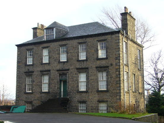
    Today is August 27th 2023. So what is special about this date? Well, it was today, 239 years ago, when the eccentric Edinburgh character of James Tytler ascended in his “Grand Edinburgh Fire Balloon” and flew the 3,000 or so feet from Comely Gardens to Restalrig on the outskirts of the city, thus making the first, manned aerial flight in the British Isles, immortalising himself in the process as Balloon Tytler.

    A rather optimistic engraving of Tytler’s balloon flight, from “The Literary World”, 25th July 1840. In reality the bird-like gondola and the stove was absent during his flight and he sat instead in a small, wicker basket

    James Tytler hailed from Fearn in Forfarshire, the son of a minister of the Kirk of modest means, who had been sent to Edinburgh to pursue and education and make a better life for himself. He was many things, but he was mainly persistently skint and in debt. Had he not been so, he may have been remember as a polymath. He had failed as a preacher, as a doctor as an apothecary and as a poet, but succeeded in scraping a living and keeping his creditors at bay as a pen for hire; he wrote much of the 2nd edition of the Encyclopædia Britannica. But we are interested in him here as an aviator.

    James Tytler, engraving of him as author of Encyclopaedia Britannica

    In September 1783, a “fire balloon1” constructed by France’s Montgolfier brothers successfully flew with a sheep, a duck and a rooster on board (the animals all survived!) In late November, Pilâtre de Rozier and the Marquis d’Arlandes were the first human passengers in one of the brothers’ machines. Tytler, reading of these endeavours in far away Edinburgh, was captivated and – like many of his contemporaries -caught the flying bug . Working on the second edition of the encyclopaedia at the time, he devoted a whole 8-page section of the Encyclopaedia to ballooning, writing “In future ages, it will be as usual to hear a man call for his wings, when he is going on a journey, as it is now for him to call for his boots“. “By this invention” he continued “the schemes of transporting people through the atmosphere, formerly thought chimerical, are realised”.

    The first flight of a Montgolfier fire balloon from Versailles in September 1783, the passengers were a sheep, duck and rooster
  • At the time, hot air balloons were known as fire balloons and hydrogen balloons as inflammable air balloons ↩︎
  • It was around this time, late in 1783 or early 1784, that Tytler took the bold step of determining that he would not just read and write about ballooning, he would also build and fly one of his own. This whole scheme may have arisen as an after-dinner wager in one of the dining rooms of enlightenment Edinburgh, as a scrap of handwritten paper was kept by Professor Dugald Stewart, in the style of a newspaper advertisement, announcing the intention:

    We have the authority to assure the Public that it is neither Mr Tytler of Woodhouselee nor Mr Frazer Tytler, Advocate and Professor of Civil History in the University of Edinburgh, that means to go up with the Air Balloon on the 7th of May, but Mr James Tytler an ingenious chemist and distant relation of the others, whose friends it is hoped will accept of this intimation of their having no intentions of going up with air balloons at present, what ever-malicious or interested persons may chuse (sic) to give out, or credulous people may believe.

    Wager or not, Tytler certainly had the brains, the self-confidence and the ambition to see this project through, but there was a big stumbling block; he had not the money. Indeed, this lack of funding would plague the project from beginning to end and seriously compromised his results. But he pressed on with planning nevertheless. On June 19th he took out a front page advert in the Edinburgh Evening Courant newspaper announcing a public demonstration of a scale model hot air balloon, both for his own testing and to try and raise precious funds by charging an admission fee:

    On Monday next, the 21st current, will be exhibited
    AT COMELEY GARDEN
    By JAMES TYTLER, CHEMIST
    A FIRE BALLOON, of 13 Feet Circumference,
    AS A MODEL OF
    THE GRAND EDINBURGH FIRE BALLOON,
    with which he intends to attempt the Navigation of the Atmosphere

    Edinburgh Evening Courant, June 19th, 1784

    Comely Gardens, if you didn’t know, was a Georgian pleasure garden between Holyrood and Abbeyhill, “a wretched imitation of Vauxhall“, where for a few pennies you could stroll the ornamental garden, take tea, and listen to whatever music or entertainment had been laid on. The gardens both offered shelter within their walls and trees, from (most of) the prevailing winds, and an ability to charge people for entry. This tethered exhibition was successful and enough money was raised to fund construction of the full-scale “Grand Edinburgh Fire Balloon

    1804 Edinburgh Town plan by John Ainslie, centred on Comely Gardens. Reproduced with the permission of the National Library of Scotland

    James got to work at once. The basic machine was quite crude – unlike the gaily decorated French contemporaries – limited both by his funds and his skills. The design was basically a 30 feet wide by 40 feet tall linen cylinder, lined with paper to make it “leak proof” and surrounded by ropes to attach a basket for the occupant and a stove to heat the air. Unfortunately, many of those gentlemen who subscribed to the scheme refused to part with their money until after the machine had flown (or at the very least risen from the ground), so he was caught in a Catch 22 situation, between having to follow through to prove himself to his sponsors, but also lacking the money or credit to actually do so.

    Engraving of Tytler’s balloon from his own promotional tickets. The characters in the balloon are well out of scale. The “wings” projecting from the car were intended to “row” and “steer” it through the air but were entirely useless.

    There was also the threat of the Edinburgh Mob, there being rumblings that they would either destroy the balloon as some sort of affront to God before it could fly or destroy it in disappointment if it failed to fly. The authorities were nervous and made it be known they might forbid the scheme entirely on public order grounds. Somehow Tytler managed to scrape together enough funds to complete the basic balloon envelope and resolved to demonstrate a public inflation of it to try and confound his doubters and convince some of the sponsors to convert their paper promises into actual money. But he needed somewhere enclosed to trial the inflation of his fragile linen and paper balloon and there was only one building big enough in town; the incomplete shell of the Register House – “the largest pigeon house in Europe“, still incomplete after 10 years of stop-start construction and a lot of finance.

    The Register House, partially complete, some time before 1787. Sketch by John Brown, Cc-by-NC National Galleries Scotland

    And so an advert was placed in the Courant on July 17th 1784, requesting the presence of “the Gentlemen who have subscribed or intended to subscribe“. The reporters from that paper and its rival The Advertiser were also invited to help publicise the scheme. This demonstration was also a success – sort of… the balloon did inflate – but the stove was inefficient and smoky, it coated the inner walls of the envelope in soot and sent up sparks and cinders which burned holes in the paper and linen, causing it to leak like the metaphorical sieve and slowly deflate. Tytler put a brave face on things, but couldn’t afford to start from scratch or buy a better stove, so resolved to patch up the leaky balloon and go for broke. The week of the Leith Races commences on 2nd August and it would provide the crowds and occasion to launch a flight.

    William Reed, the Leith Races, late 18th century or early 19th. © Edinburgh City Libraries

    There was a further reason to pick race week for the demonstration; it gave Tytler the perfect cover if things went wrong and the Mob was stirred. In this event, he could say it was the fault of the races for whipping up any trouble and not his flying machine. So the day after the test inflation at Register House he took out adverts across the local papers. In these, he announced the Edinburgh Fire Balloon would fly (tethered) after the first race, and every day thereafter, and that on the Friday it would be unleashed and might “cross the Frith (sic) of Forth”. He made yet a further appeal for financial support and made sure to note that Major Masters, commanding officer of the garrison at Edinburgh castle, had offered up his men to guard the balloon and any “Ladies and Gentlemen that may attend the different exhibitions“, lest the Mob spoil the occassion.

    Tytler’s announcement in the Caledonian Mercury, 31st July 1784

    So in amongst the drinking, the gambling, the debauchery, the freak shows and the general chaotic merriment of the Leith Races, Tytler was going to fly across the Forth! He removed the balloon back to the Comely Garden and got to work at once. For the occasion, he had tickets printed up, which he signed and numbered by hand. He also scored out the printed line “Constructed by William Brodie“, being unable to afford to pay a subcontractor he would now be doing all the work for himself.

    Ticket to the Edinburgh Fire Balloon, British Museum number C,2.11-28

    With what remained of his scant funds, he had constructed a mast 50ft tall, with a 64ft long arm at the top, to hold the envelope of the balloon as it inflated. But his relentless scrimping meant it was built too weak, and the day before race week began, Sunday 1st August, it collapsed under test. The crowd that nevertheless assembled at Comely Garden the next day to see the tethered flight was therefore denied such a spectacle. On each of the subsequent 3 days the west wind did blow – a direction from which the site was not sheltered – so disappointment prevailed again and again. Things were getting desperate for Tytler, he needed a success, and so he moved the balloon and the repaired mast to the most sheltered corner of the garden and on Friday 6th August – the date he had promised to fly across the Forth – he lit the stove and started inflating. But the wind again started to blow as the envelope filled and it strained at its mooring ropes. Tytler’s helpers struggled to contain it and it was only the ripping of the envelope and partial deflation that probably saved it from being blown clean away. The crowds left angry and dismayed. The Courant was scathing: “The Edinburgh Fire Balloon has been struggling hard to make its public appearance during the race week. Masts and yards and scaffolds and furnaces had lent their aid, but to little purpose. Its gravity and affection for the earth cannot be overcome“.

    But Tytler was irrepressible, the winds dropped and the next day he tried again. This time the balloon inflated, but as he was about to clamber aboard the basket “a gust of whirlwind, as if send by divine command to blast the hopes of this devoted projector, attacked the Balloon, drove it hither and thither and by compressing it on all sides, soon reduced it to a state of flaccidity” and it once more deflated. The Mob had finally had enough; angry scenes followed this failure and Tytler fled before he could be accosted for any refunds. When the crowd could not find him they turned instead on his balloon, detached its basket and paraded it around the local streets in triumph before throwing it on the still-glowing stove and burning it to ciders. Their anger thus sated, they drifted home. Tytler was at rock-bottom and wrote about his feelings at this time:

    I was obliged to hear my name called out wherever I went, to hear the insults of every black-guard boy, to hear myself called Cheat, Rascal, Coward and Scoundrel by those who had neither courage, honesty nor honour. I was proscribed in the newspapers and pointed out by tow of the Edinburgh News-mongers as a public enemy

    His name may have been mud with the Courant and the Advertiser, but the Caledonian Mercury was more sympathetic about the failure, giving him the benefit of the doubt – he could after all not control the weather. It also pointed out that if more of his claimed backers would pay up, he might have the funds needed to succeed.

    Perhaps encouraged by that forgiving take on events, Tytler soon slunk back to Comely Garden to examine the remains of his machine. The main flaw of his design was that it lacked a neck, so the wind easily blew or sucked the hot air out. About this he could do nothing, but he could at least try patch it up and get a new basket. The fragile paper lining was now covered in soot and full of cinder-holes and tears, so he painstakingly removed it, and instead varnished the linen to try and make it airtight. He could not afford to build a proper basket, and so one used to carry crockery was sourced as a passenger compartment. But this meant that the stove could no longer be carried. In fact this was probably a good thing as it weighed 300lbs and had a habit of mainly burning holes in the balloon. So he had to settle to try and fly without it, using only whatever hot air he could fill it with on the ground (and keep captive within it) to provide the lift for flight. His reasoning was simple, if he could make any sort of flight in the repaired machine, he should be able to raise the money for a full rebuild. In his own words it was “the resolution of a madman and which nothing but my desperate situation could excuse“.

    And so the word went out that he would try again for a flight within a fortnight. Fortunately at this time, the attention of the public and of the press was drawn to the election of a new MP for Edinburgh, giving him some breathing space from both (even if there was only one candidate and the only electors were the Town Council!) Not wanting to incur the attention of the Mob again, the next attempted inflation on Wednesday August 25th had no crowd invited. The balloon was filled for over an hour to help dry out the varnish. At about 630AM, the fire was put out and Tytler climbed into his basket. The restraining ropes were cast away, the balloon floated, and then… nothing happened! Perhaps there was not enough hot air, or the morning was too cold, but at least there had not been a disaster and he had demonstrated “the practicability of the scheme“. The previously sympathetic Caledonian Mercury was not convinced however and under the title of “The Rise and Fall of the Edinburgh Fire Balloon”, they took a satirical imagination of his first flight,with it ending with the balloon pierced by a church steeple and its occupant being cast into a duck pond.

    But success was in Tytler’s grasp and after a final few tweaks and another coat of varnish, he was ready to go again. It was Friday 27th August, 1784, 239 years ago today, it was about 5AM and the stove was once again lit beneath the envelope. An uninvited crowd had formed, either to be sure to see success or to be amused by failure. The balloon slowly filled, straining at its mooring ropes. Maybe Tytler – a deeply religious but unaligned man – said a prayer for success or salvation first, but he soon climbed into his basket again and the ropes were once more undone. And this time, to everyone’s surprise, up he went, eliciting a great cheer from them. Ascending rapidly, a loose rope caught a tree and the mooring mast, but such was the lifting force it simply snapped free of both. A height of 350ft was reached, the length of that loose rope, the crowd tried to grab it but it tore free from their grasp too. Up, up, and quite literally away he went! Carried on the western breeze, he drifted slowly eastwards and away from the city. The crowd gave chase, Tytler recalling afterwards that he was much amused by “looking at the spectators running about in confusion below“.

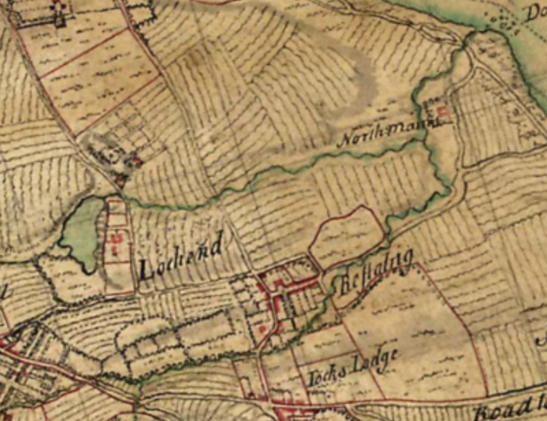
    With no stove to keep the balloon hot, it rapidly cooled and the intrepid aviator was soon drifting back to earth. He came down about half a mile distant in the village of Restalrig, possibly in the minister’s glebe (but neither in a dung heap or a duck pond as his detractors had forecast). And for once, Tytler, the crowd, his supporters, and the press were all jubilant. The downtrodden little man with a moth-eaten coat, whose shoes were falling apart and who had a hole in his hat had succeeded! The previously hostile Advertiser declared him “the first person in Great Britain to have navigated the air“. The Courant were “amazed at the boldness of the undertaking” and made something of a mealy-mouthed apology for their previous scepticism. The Caledonian Mercury called it “a decisive experiment” and that Scotland could at last “boast of its aerial navigator“.

    Filled with the confidence of success a 2nd flight – well advertised to the public – was planned for the 31st, the day of the foregone conclusion of the election of Sir Adam Fergusson as the city’s new MP. After completing the requisite formalities, the newly elected member and the Council committee hastily made their way to Comely Garden to join the assembled spectators. Once again the balloon inflated. Once again Tytler climbed bravely aboard and once again it took off. But it had been under-inflated and this time it rose to only about a hundred feet, coming down not far over the garden boundary wall. But it had still flown and it was enough to convince some of his backers to finally follow through financially and he was able to raise enough money to rebuild his basket properly and to have a new stove built for it. The clock was now ticking in the “Balloon madness” capturing the country and on September 15th Italian Vincenzo Lunardi made a balloon flight from Moorfield Barracks, in London. In Perthshire, an enterprising but unknown gentleman sent up a model balloon, 22 feet in diameter, which was seen to travel as far away as Moulin, some 25 miles, before being blown back on the wind almost to where it had lifted off.

    Lunardi makes his first balloon flight in London. Note the different balloon design to Tytler’s, but that he too carries the useless oars and rudders © The Trustees of the British Museum

    The autumn weather delayed proceedings in Edinburgh, it rained or it was too windy, or both, for weeks for any inflation or flights. But on September 29th Tytler was ready to go again. And so the balloon was hoisted on the mast and the new stove was lit beneath. A huge crowd assembled, packing out St. Ann’s Yards (now part of Holyrood Park) and the slopes of the Calton Hill. The first attempt deflated and so it was hoisted and filled again. But once again a sudden and spiteful gust of wind caught it. This time the supporting mast broke, the balloon collapsed and the whole lot came crashing down. One helper on the mast leapt for his life and landed in a tree, another was badly injured in his fall. Tytler’s luck and popularity was now trickling rapidly away from his grasp, as was the support of the press, who once again took up their sceptical stances. But he was no stranger to this and refused to give up, and went back to his repairs and planning another attempt.

    That day came on October 11th. Everything proceeded as before. When the balloon tugged at its ropes Tytler climbed aboard and cast off. Nothing happened. He climbed out again to see what was wrong and now it took off! The Courant described that the balloon “rolled about a short time like an overgrown porpoise“, reaching a height of about 300 feet before falling sideways back to the ground and landing heavily, destroying itself in the process. Excuses were made – the stove was too small, the calculations had been gotten wrong, but surely now it was all over? Indeed it was not – Tytler just would not give up. He tried to raise more money for repairs but by March 1785 he had fled to the debtors’ sanctuary of Holyroodhouse (to which he was no stranger). It may have been he was being sued by the proprietor of Comely Garden for damages caused. Amusingly, his entry in the Register of Protections in the sanctuary recorded him as “James Tytler, chemist and balloon maker“. In the sanctuary, he was safe from his creditors but could not work on his balloon, and he was not safe from the fever that incapacitated him for 6 weeks.

    The Canongate looking towards the Abbey Sanctuary, by James Skene 1820. A debtor, his coat flying behind him, is chased by his creditors and their batten-wielding henchmen © Edinburgh City Libraries

    By the time he was free of debt and fever however, ballooning had moved on and a simple half mile flight wouldn’t cut it. He would – in his own estimations – have to fly at least as far as Dundee! A date was set of July 26th. And so once more, Tytler lit his stove. And once again it began to inflate. An ominous rumble of thunder was heard in the distance, the wind suddenly got up, the balloon was torn from its moorings and upended, the stove smashed to pieces and the envelope totally destroyed. And that was that. Tytler finally admitted defeat and gave up. He was consoled by kind words in letters from none other than Vincenzo Lunardi, now a national hero. In reply, Tytler composed a sad poem, including the couplet: “Lost are my wishes, lost is all my care, And all my projects, flutter in the air“. While the two were rivals they were so on friendly terms, Tytler beat Lunardi into the air, but it was the latter who made a success of it. Edinburgh satirist John Kay captured the two of them in a caricature entitled “Fowls of a Feather, Flock Together“, Lunardi holding out a conciliatory hand.

    Lunardi, centre, holds out his hand to Tytler, 3rd left, in John Kay’s caricature of 1785, “Fowls of a Feather Flock together”

    Robert Burns corresponded with Tytler, and gives as a contemporary opinion of him:

    An obscure, tippling, but extraordinary body known by the name of Tytler, commonly known by the name of Balloon Tytler, from his having projected a balloon – a mortal, who, though he trudges about Edinburgh as a common printer, with leaky shoes, a skylighted hat and knee buckles as unlike as “George-by-the-Grace-of-God and Solomon-the-Son-of-David”, yet that same unknown drunken mortal is author and complier of three-fourths of Elliott’s pompous ‘Encyclopaedia Britannica’, which he composed at half a guinea a week.

    Robert Burns, describing James Tytler

    Tytler very soon had to flee Edinburgh, on the run yet again from his creditors, apparently a method he had devised for bleaching linen, which could have made him his fortune, had been stolen from him by unscrupulous dyers. His wife sued for divorce in 1788 on account of him having taken up with another woman with whom he fathered twins. He returned to the city in 1791 to work again on the third edition of the Encyclopædia Britannica but he did not stay long; in 1792 he wrote a seditious pamphlet calling the House of Commons “a vile junto of aristocrats” and was outlawed. In 1795 he left for America, writing a further radical pamphlet en route, “Rising the sun in the west, or the Origin and progress of liberty“. He lived out his last decade in Salem, scraping a living from his writing and selling medicines. Turning increasingly to drink as a counter his disappointments in life, he left his house one day in January 1804, inebriated, never to return. The sea washed his body up 2 days later.

    James Tytler, an 1804 portrait by American artist Hannah Crowninshield. Copy of a missing watercolour supposedly held by the Peabody Essex Museum

    James Tytler is long gone, but he’s not quite forgotten locally. On the 200th anniversary of his achievement, a hot air balloon meeting was held in Holyrood Park, over the wall from the location of Comeley Gardens, the largest balloon being decorated specially for the occassion

    James Tytler bicentennial commemorative balloon in 1984

    Two modern streets are named for him in the vicinity of where the Comeley Gardens were located, Tytler Gardens and Tytler Court and there are two murals dedicated to his aerial adventures in Abbeyhill, the most recent by the Abbeyhill Colony of Artists in 2021 at the top of Maryfield.

    The Colony of Artists mural to James Tytler at Maryfield. Note the map marks Tytler Court and Tytler Gardens.

    Note to readers: unfortunately in April 2026, a third-party plug-in more than exceeded its authority and broke many of the image links on this site. No images were lost but I will have to restore them page-by-page, which may take some time. In the meantime please bear with me while I go about rectifying this issue.

    If you have found this site useful, informative or amusing then you can help contribute towards its running costs by supporting me on ko-fi. This includes my commitment to keeping it 100% advert and AI free for all time coming, and in helping to find further unusual stories to bring you by acquiring books and paying for research.
    Or please do just share this post on social media or amongst friends and like-minded people, sites like this thrive on being shared.

    Explore Threadinburgh by map:

    Travelers' Map is loading...
    If you see this after your page is loaded completely, leafletJS files are missing.

    These threads © 2017-2026, Andy Arthur.

    NO AI TRAINING: Any use of the contents of this website to “train” generative artificial intelligence (AI) technologies to generate text is expressly prohibited. The author reserves all rights to license uses of this work for generative AI training and development of machine learning language models.

    #Lochend #Logan #Restalrig #StMargaret

    Steel Suburb: the thread about Lochend’s controvertial Steel Houses

    There’s a quiet and well-kept little corner of the Lochend Housing Scheme that is a bit different from the rest. Its houses look distinctly municipal (although they were never “council”), but they are at a lower density than other parts of the scheme; there are bungalows and there are no tenements. You wouldn’t know it to look at it, but underneath the modern external insulation and pebbledash, all of these houses are steel houses. Lets find out how these houses came to be and what sort of houses they are.

    Lochend steel houses at Findlay Gardens

    In February 1926 the Scottish National Housing Company Ltd. (SNHC) formed a new subsidiary to provide 2,000 steel houses for Scotland; the imaginatively named Second Scottish National Housing Company (Housing Trust) Ltd., (SSNHCHT). The objective of this was to quickly build new housing in areas that needed it, without either making demands on the skilled labour market or the material supply of the traditional building trade; bricks, stone, plaster and cement. By producing the houses out of prefabricated steel components, idle engineering workers could be employed; unskilled workers could quickly erect the houses on prepared sites and there would not be a significant drain on building materials. A further consideration was that there was a deep recession in the Scottish shipbuilding industry, which was projected to last for some years further. By extension, this impacted the wider engineering, steel and coal industries, and Scotland’s industrialists and a number of politicians saw steel houses as a stimulus for these sectors.

    The SNHC had been set up in September 1914 to built housing on land owned by the Admiralty adjacent to the new Rosyth Dockyard. Its stated objective was “to carry on the business of housing, town-planning and garden city making” i.e. to develop the Rosyth Garden City for let to dockyard workers. It was arranged along the lines of a public utility company, with dividend limited to 5% and a board stuffed with the worthies of local government of Scotland, including the Lord Provosts of Glasgow and Edinburgh. During the war, they would go on to build some 1,872 houses at Rosyth.

    Rosyth Garden City, cottage houses, 1920

    The capital for the SSNHCHT steel house programme of the was provided by the government – 50% from the Public Works Loan Board and 50% from the Scottish Board of Health (at a rate of 5% interest, this scheme had to pay itself back!). Its time-scales were ambitious, with only 2 years were allowed to complete and there a £40 penalty for each house that failed to meet its scheduled delivery date. To keep labour demands down, only 10% of the workforce could be from the skilled trades, with penalties for exceeding this proportion. Houses were allocated to the main centres of population, including 750 for Glasgow, 350 for Edinburgh and 300 for Dundee. Five approved types were ordered; 1,000 Weir Houses (in 3 variants), 500 Atholl Houses and 500 Cowieson Houses. The SSNHCHT had to abide by local building regulations and have their proposals approved by the Dean of Guild Courts (the equivalent then of a planning committee). Rents were set to local equivalents and factoring was handled by local agents – in Edinburgh this was Gumley & Davidson. All of the steel houses had coal fires as the only source of heating and hot water and were lit by gas; electricity was ruled out as an economy.

    Weir steel houses at Garngad in Glasgow

    Steel houses were not without controversy – indeed the government’s initial offer had been a £40 per house subsidy to local authorities that ordered and constructed their own such houses; none had taken it up, which was why they turned to the SNHC. The prime minister, Stanley Baldwin, had to intervene due to the controversy and made the provision of steel houses something of a campaign promise. Mrs Baldwin offered to personally live in one for a month to demonstrate how satisfactory they were.

    The socialist movement faced the question of whether to resist them on account of their perceived lack of quality and the labour practices involved in their manufacture versus accepting them as a cheap way to quickly provide modern new houses for slum clearance. This caused a substantial rift at the time; John Wheatley MP (who as Minister of Health had been behind the “Homes for Heroes” council houses of the 1919 programme) spoke unfavourably of them: “the people [do] not want steel houses. [I have] yet to learn that a single one of the thousands who had bought their own houses had ordered a steel house“. The building trades were unhappy that workers employed in fabrication at the factories undercut their rates and that only 10% of the labour could come from their members. Mr Hicks of the Building Trades Union condemned them as “shoddy and insanitary“. His union was in turn accused of protectionism and of trying to prevent underemployed engineering workers and casual labourers from getting steady work on fabricating the houses.

    There was also official prejudice against steel houses within Edinburgh; Baillie Mancor of the Town Council said the council wanted “real houses” and not steel houses; Councillor Mrs Eltringham Miller said that these houses were “a gift, and they were not looking forward to what they would cost after they had them.” Councillor Hardie went further and said that these were “shoddy building substitutes” and that the state was adopting a “Mussolini attitude” in forcing steel houses upon local authorities. Nevertheless, the Housing and Planning Committee approved sites in Edinburgh for the scheme on land they had already laid out for municipal housing. 250 were to go to Lochend, where 23 acres were transferred to the SSNHCHT and 100 to the Wardie district; additional land was reserved at Saughton as the Corporation desired 500 steel houses in total and was keen to encourage the SSNHCHT in any way it could.

    Work progressed quickly; in July 1926 it was reported that “satisfactory progress” was being made and that the new houses were proving popular with applicants. By August, groundworks were complete and houses were beginning to rise from the ground; many more applications for let were being received every day. Rents were set at £22 per annum for cottage flats, £28/10 for the bungalows and £34 for semi detached houses. In November 1926, The Scotsman reported that the Lochend steel houses were nearing completion, with “quite a batch of Weir houses ready now, and men at work on the gardens, shovelling a rich, dark soil, which augurs well for the gardens of the future.” The paper observed that the houses were “more than empty: they have never been inhabited” and that it was with the “coming of the people and the gardens that they will acquire a personality.”

    Lochend was allocated all 5 available types under the scheme, laid out in typical garden city style, the streets taking the name “Findlay” from John R. Findlay, Bt., chairman of the SSNHCHT (the steel houses at Wardie were given the streetnames “Fraser” from Provost Fraser of Dunfermline, who was on the board of directors).

    Housing types and distribution of the Lochend Steel Houses

    Atholl Cottage Flat

    These houses were produced by the Atholl Steel House Company and named after one of its founding partners, the Duke of Atholl, who had envisaged building a steel house in 1919 after touring the idle shipyards of the Clyde. He partnered with the industrialist William Beardmore, whose shipyard and locomotive works were desperate for work, with his steel foundry at Mossend in Lanarkshire ready to provide the plates. Also known as “4 in a block” houses, this style was very popular with the 1920s public housing schemes, offering a good balance between reducing building and population density, construction costs and giving each household its own entry door and garden.

    The Atholl Cottage Flat. The house on the right has not been rec-lad, and the steel panel lines are visible. Like the Weir Lanefield, the upper flats were accessed through the side. The narrow central upstairs window is diagnostic when comparing it with the Weir Cottage Flats.

    Atholl’s original house was to be a lodge for his own estate, and as such was designed and built to be permanent. The construction of the Atholl House was therefore more substantial than its competitors, requiring 3 to 4 times as much steel. These heavyweight steel walls were load bearing, providing rigidity to the steel framework to which they were attached and therefore no internal cross-bracing was required. The steel was coated on its inner face with granulated cork to prevent condensation and then lined with composite boards, which were painted or wallpapered, eliminating the need for plasterers. Atholl estimated the lifespan of his house to be 60 to 90 years, with that of the Weir and Cowieson being 40 years.

    The Weir Houses were produced by G. & J. Weir, engineers to the shipbuilding industry at the Holm Foundry in Cathcart in Glasgow. Weir’s chairman, Viscount Weir, had a particular interest in the idea of prefabricated houses and they would be something the company returned to on numerous occasions. Those of the 1926 scheme were of three distinct types, but all used the same basic structure, of a load bearing timber frame and floors to which a relatively thin skin of steel plates was attached as an external cladding. Their lighter construction and lower labour costs than other steel houses meant that they were the cheapest, and Weirs therefore got 50% of the total order for the scheme. A feature of all Weir houses was exposed internal copper plumbing; it could not easily be buried within the walls or their thin insulation layer, and Lord Weir felt it was better to make it accessible for repairs, so was simply clipped along the inner partitions. The Weir Paragon House of 1944 inherited this design feature.

    General construction diagram of the Weir Steel Houses; a wooden frame sitting on a concrete base, with lightweight steel panels cladding the outside.

    In 1925, Weirs built a demonstration steel bungalow in Grosvenor Square in just 10 days:

    10 days to complete a house. The Weir demonstration house in Grosvenor Square

    The Weir Houses were the most controversial of the steel houses as Weirs paid their workers at the rates of the engineering trades from which they were drawn, which were lower than those of the building trades. Weirs were accused of building “steel houses of a very inferior kind by paying low wages under sweated conditions“. In an editorial, The Scotsman called them “a pig in a poke” (an unknown entity) but that people would want to live in them anyway and prevailed upon Weirs to improve their wages. Atholl avoided this scandal by paying building trades rates to their prefabrication workers in the factories.

    Weir Eastwood Bungalow

    The correspondent from The Scotsman who was sent to review the house noted that “the Living room is a good size, and the kitchenette or scullery is larger than that of many a modern brick house. The two bedrooms are a sensible shape“. The Eastwood, like its siblings, featured lots of built-in storage cupboards and a built-in coal bunker in the kitchen. The price, excluding groundworks, was set at £365 per house.

    Weir Eastwood Bungalow at Lochend, this pair of houses were in a very original condition at the time this photograph was captured.

    Weir Douglas Semi-Detached House

    The Douglas was the largest of the Weir Houses and was a semi-detached, two-storey cottage house. The ground floor contained a sitting room with “handsome fireplace”, kitchen, larder, bathroom and – something of a novelty for the time – a large under-stairs cupboard. Upstairs were the three bedrooms, with the master bedroom running the full width of the house and having an unusually wide casement window to the front. This was the only house of the programme that had 3 bedrooms; all the other having 2. The price, excluding groundworks, was £390 per house.

    Weir Douglas Semi. The house on the right is in a very original condition, that on the left has modern windows, roof, external insulation and cladding and porch. Note the five-pane first floor window.

    Weir Blanefield Cottage Flat

    This was the cottage flat in the in the Weir range. It was basically a 2-storeyed version of the Eastwood Bungalow with the upper flats accessed by internal staircases accessed from the side. The upstairs kitchens had floors strengthened with timber laid on a damp-proof layer to protect the steel beneath from “the vigorous scrubbings” of the housewife. The price, excluding ground works, was set at £357 per house.

    Weir Blanefield Cottage Flat. In a relatively original condition excepting the modern UPVC windows in 3 of the 4 flats. The easiest way to discern this from the Atholl cottage flat is the lack of the narrow central upstairs window to the front, and the upstairs outer window is offset somewhat from that on the ground floor

    Cowieson Terraced House

    F. D. Cowieson had trained as an architect, but found success in prefabricated wood and iron buildings, with the company based in St. Rollox in Glasgow. Initially these were simple agricultural structures such as barns and sheds, but soon the company was offering halls and huts, pavilions and even cinemas. During WW1 the company turned to building bus and lorry bodies – particularly ambulances – and they would later become much better known for this side of the business. They also experimented with “brieze block” houses, a single pair of which were trialled in Edinburgh at the Riversdale Demonstration Site.

    1920s advert for Cowiesons, describing the range of prefabricated structures that the company offered.

    The Cowieson Houses built in the programme were of a four-in-a-block terrace and like the Weir Houses, used a load bearing wooden structure to which a steel cladding was applied. The roof was originally asbestos tiles.

    Cowieson Houses at Lochend the three houses on the left have been re-roofed, externally insulated and pebbledashed; that on the right has not and looks to have its original roof also.Cowieson Houses in Dundee, built under the 1926-7 scheme by the SSNHCHT. This photo has been included as the exterior is in its original condition and the light paint shows up the steel panel lines to good effect.

    In July 1927, Lochend was proudly exhibited to King George V and Queen Mary, who made a royal visit on 11th of that month. Before proceeding to Lochend, the visitors stopped at the Corporation’s newest housing scheme at Prestonfield, where the King and Queen each planted a tree to inaugurate the development. They then headed to Lochend through the Holyrood Park, with 35,000 school children turned out to line the route. Further crowds greeted them at Lochend and they made a slow drive through the new neighbourhood, guided by Lord Provost Stevenson and two councillors.

    Their majesties expressed pleasure at the fine layout of this garden city and were greatly interested in the many types of construction in evidence as well as the openness of the place and tasteful arrangement of the gardens.

    Edinburgh Evening News, 11th July 1927The Royal Party at Lochend Drive. The Queen is leading the King onto the pathway, lined with a neat picket fence.

    A halt was made at 49 Findlay Gardens, a Weir bungalow, where an inspection was made of the house occupied by the Hill family and their two young children. Mr Hill’s occupation was given as the manager of an egg merchant, T. Howden & Co., in Leith, which gives an idea of the sort of persons who were living in the houses. The residents were asked if the house had been cold in winter; yes it had been, but it was not now (it was July!). The next house to be inspected was the Atholl House of Mrs Wilson at 7 Findlay Medway, where they remarked on the sensible layout of the interior and were intrigued by a bed settee in the living room, the Queen sat on it and plumped up the cushions.

    The householders were apparently not informed in advance that they were about to receive their guests and the first thing they knew was the knock on the door from the police. One of the housewives was reputedly peeling potatoes when they arrived and said of the Queen: “She’s a verra hamely lady” and that “Ye hav’na much crack for folk o’ that kind, and ye’re a bit tongue-tacket, but she was that kind and natural, and said everything was very nice“.

    The King and Queen leaving 58 Lochend Avenue, an Airey tenement flat

    On leaving the steel houses, the royal party then proceeded to some of the Airey Duo-slab houses; Mr & Mrs Galloway at 58 Lochend Avenue and Mrs Dickson at 34 Lochend Drive.

    In the end, an additional 500 steel houses were erected by the SSNHCHT above and beyond its original target, taking the total to 2,252. All were completed by the end of 1928 and the stock, along with those at Lochend, was passed to the ownership and management of the Scottish Special Housing Agency in 1963 when it took over the assets of the Scottish National Housing companies. Although they were only given a 40-60 year lifespan by their builders, most were first refurbished between 1978 and 1983 and in 3 years time they will have their centenary. Nearly all are still standing and most have been substantially upgraded with external insulation and rendering, double glazing, central heating, new roofs etc. A handful remain in an earlier state, usually those that had been bought very early under “right to buy” legislation. The tenants of those that were not bought early campaigned to have them upgraded rather than demolished, and most of those were subsequently bought (it was not possible to buy a defective house).

    Note to readers: unfortunately in April 2026, a third-party plug-in more than exceeded its authority and broke many of the image links on this site. No images were lost but I will have to restore them page-by-page, which may take some time. In the meantime please bear with me while I go about rectifying this issue.

    If you have found this site useful, informative or amusing then you can help contribute towards its running costs by supporting me on ko-fi. This includes my commitment to keeping it 100% advert and AI free for all time coming, and in helping to find further unusual stories to bring you by acquiring books and paying for research.
    Or please do just share this post on social media or amongst friends and like-minded people, sites like this thrive on being shared.

    Explore Threadinburgh by map:

    Travelers' Map is loading...
    If you see this after your page is loaded completely, leafletJS files are missing.

    These threads © 2017-2026, Andy Arthur.

    NO AI TRAINING: Any use of the contents of this website to “train” generative artificial intelligence (AI) technologies to generate text is expressly prohibited. The author reserves all rights to license uses of this work for generative AI training and development of machine learning language models.

    #Lochend #Logan #Restalrig #StMargaret

    The thread about the East Foul Burn; profiting from sewage in the 18th century

    This thread is part one of a series; the link to the next part can be found at the bottom.

    We begin our story with the wonderfully verbose cover of a Victorian pamphlet;

    FOUL BURN AGITATION!
    STATEMENT
    Explaining
    NATURE AND HISTORY OF THE AGRICULTURAL IRRIGATION NEAR EDINBURGH;
    Containing
    A REFUTATION OF THE UNFOUNDED AND CALUMNIOUS MISREPRESENTATIONS ON THAT SUBJECT,
    In
    A PAMPHLET PUBLISHED IN THE NAME OF A COMMITTEE OF THE COMMISSIONERS OF POLICE, IN WHICH THE ANCIENT AND BEAUTIFUL CAPITAL OF SCOTLAND IS FALSELY DESCRIBED AS A RESIDENCE UNSAFE TO THE HEALTH OF ITS INHABITANTS!

    I say pamphlet, the thing is actually 166 pages long and I spent quite some time reading it (skimming much of it) so that you don’t have to. It is Victorian local politics at its best and wors, and much of it is indeed pure agitation. But it was worth ploughing my way through it as it happens to contain a complete and detailed description of Edinburgh’s largely forgotten East Foul Burn and the Irrigated Meadow systems of Craigentinny and Restalrig, their history and their method of operation.

    Anyway, what is this East Foul Burn of which I speak? Well it’s the principal watercourse that in olden times drained most of the Old Town, the Nor’ Loch and the small suburbs south of the city into the sea; rainfall, sewage and all. We can see it on the below map of 1750 by William Roy. It is the stream which flows from bottom left to top right – the stream originating in Lochend Loch in the centre left is the tail burn of that body of water.

    The East Foul Burn’s natural route to the sea via Restalrig and Fillyside (North Mains of Craigentinny). William Roy’s Lowland Map of c. 1750. Reproduced with the permission of the National Library of Scotland

    If you examine a old map of the Old Town and consider the topography, it’s obvious that gravity will carry anything liquid downhill. John Slezer’s remarkably accurate 17th century sketches of the city help us to visualise this from a contemporary point of view; any waste discharged on the north side of the ridge on which the Old Town of the city was built is obviously going to drain itself into the Nor’ Loch.

    Prospect of the Castle and City of Edinburgh from the Nor’ Loch. John Slezer, 1673, arrows indicate the steep northern slopes of the “tail” of the crag and tail geological formation on which Edinburgh’s Old Town sits

    That loch could only drain eastwards, in the direction of the sea. James Gordon of Rothiemay’s remarkable 1647 bird’s eye view of Edinburgh shows it clearly. After irrigating the pleasant-looking Physic Garden by the Trinity College Kirk, it ran off down the North Back of Canongate (what we now call Calton Road) where it was joined by any runoff from the community nestled below the crags of the Calton Hill and from the streets and closes of the north side of the Canongate itself. The stream (in reality an open sewer) passes a number of round structures; these were wells and water cistern – one of the reasons so many breweries would congregate here. 100 years later, Edgar’s map of 1765 still shows that this open sewer still ran here.

    Bird’s Eye View of Edinburgh, James Gordon of Rothiemay, 1647. Reproduced with the permission of the National Library of Scotland

    Stuart Harris, the late local historian and custodian of Edinburgh place names, refers to the wells here as being along the Tummel Burn (and you will also see it given as Tumble) which is an alternative name for the East Foul Burn, this refers to the water flow, although one imagines it wasn’t so much a pleasant babbling brook as a bubbling cauldron of filth.

    The burn worked its way down the North Back of Canongate to the Wateryett (a Scots placename meaning water gate; the word for a gate was commonly port but can occasionally be yett; the word gate or gait meant a roadway e.g. Canongate). The water part of the name refereed as much to this being the route into the Canongate for drinking water from the wells as it was from being alongside a watercourse. The yett part refers to the area at the foot of the Canongate where there was a physical gateway; not a defensive structure, but a civic boundary and customs barrier. This is confirmed by a reference from a title deed in 1635 which describes the Foul Burn as being in a gutter known as the Strand. This latter term is an old Scots word for “an artificial water-channel or gutter, a street gutter” – the Abbey Strand is the name of the old building that stands to this day at the foot of the Canongate, just before you enter the grounds of the Holyroodhouse.

    The Wateryett in 1818, a drawing by James Skene. By this time the physical gate had been replaced by a symbolic one for the toll house. © Edinburgh City Libraries

    After the Water Yett, Edgar’s 1765 map shows that the burn ran in a culvert here, but we can infer its route. This map is the extent of 18th century town plans so to follow the burn we move onto an 1804 plan by John Ainslie to pick up the trail once more. It re-surfaces around Croftangry (corrupted in modern times to the Gaelic-sounding Croft-an-Righ) before disappearing underground again in the property of the Lord Chief Baron (Sir James Montgomery, 1st Baronet Stanhope) only to re-appearing on the property boundary between him and Mr Clerk. Comley Gardens and Clock Mill on Ainslie’s map are old placenames here still recalled by modern street names. The burn here now contains almost the entirety of the effluent of the city of Edinburgh, the Canongate, the burgh of Calton and the village of Abbeyhill.

    Ainslie’s Town Plan of 1804, Reproduced with the permission of the National Library of Scotland. Orange lines show the course of the Foul Burn east

    The Comely Gardens referred to on the map above were a Tivoli Garden, a sort of Georgian amusement park where – for a fee – one could stroll the gardens and admire the roses, could take tea or coffee or fruits and entertainment such as dances and musicians may be laid on. Comely Gardens is to be forever remembered as the starting point of the Great Edinburgh Fire Balloon, the first manned aerial flight in the British Isles. In August 1784, James Tytler rode a Montgolfier-style balloon all the way to a crash-landing in Restalrig and his name is recalled in a couple of the modern street names in this area. But back to the matter in hand, following the burn east we have reached the Clock Mill, an old house named for a mill that was driven by the burn. The name came from Clokisrwne Mylne or Clocksorrow; clock is a corruption of the Scots clack, being a specific type of mill, an onomatopoeia based on the noise its mechanism made. Sorrow refers to some form of hollow in various old tongues.

    Clockmill House in 1780, from Old & New Edinburgh by James Grant. Notice the naval telegraph mast on top of Calton Hill

    In the vicinity of Clock Mill, two further open sewers joined the burn, adding yet more effluent. The came from the Pleasance (and by extension much of the Southside) and from the Cowgate to its payload. Both of these first drained into a myre just south of Holyroodhouse, marked on Kincaid’s map of 1784 as Common Sewer Kept Stagnate for Manure, i.e. the sewage solids would settle out of the slow moving water and could be collected to fertilise the city’s gardens and orchards. There was good money to be made in such “soil” or “dung”. Before the advent of early industrial fertilisers or the Kelp Boom it was one of the few copious and economical sources of fertiliser for fields and was much in demand – all you had to do was collect it (or pay someone to do this)!

    Kincaid’s Map of 1784, showing the “Common Serwer Kept Stagnate for Manure”. Reproduced with the permission of the National Library of Scotland

    After Clockmill House, which was demolished in 1859 to landscape its grounds as a military parade ground, the burn passed beneath the main road east out of the city (the London Road would not be built until 1819). The bridge here was known as the Clockmill Bridge. It is the presence of the burn that explains why significant culverts were built here under both the North British Railway and the London Road when each was constructed. Robert “Lighthouse” Stevenson, the engineer of the London Road, produced beautiful drawings for the culvert here under his road;

    Stevenson’s drawings for the London Road culvert. Reproduced with the permission of the National Library of Scotland (MS.5849, No.54 – 57)

    By the time the burn passed under this culvert, it was carrying the daily sewage of about 60-80,000 people, not to mention their animals. The Foul Burn Agitation! pamphlet describes it as “a rapid and copious stream… to which [is] added the impure waters that proceed from the houses, streets and lanes of the city“. From there, the effluent of the city should have been a relatively straightforward journey down the broad, shallow natural valley in which Restalrig sits to the sea, at Fillyside (roughly where the Matalan store now is).

    The East Foul Burn at Restalrig village, flowing along the foreground and passing under the road in a culvert. From an old post card, early 20th century.

    However it could not take this natural procession to the sea as its process was interrupted; it was industriously turned over into a series of irrigated meadows, “irrigated by the waters from the City” at Restalrig, Craigentinny and Fillyside.

    Kirkwood’s Plan of 1817 showing the irrigated meadows along the Foul Burn. Reproduced with the permission of the National Library of Scotland

    In the irrigated meadows, the Foul Burn was intersected by “principal feeders“, ditches cut along the topographic gradient. Water could be admitted to the feeders by means of sluices or damming the outflow. These feeders in turn fed further side-ditches into individual plots. The plots would be subject to controlled flooding from April to November, the fodder growing season. For two or three days a plot would be flooded, saturating the ground with sewage which would settle. The water was then allowed to run off and the plot was given three to five weeks for the grass to grow. It could then be cropped and the process could begin again. The process of flooding and cropping plots was rotated so that there were always fields ready to crop, and there was always a good supply of sewage with which to flood it. The whole object of this exercise was to provide a steady supply of food for the city’s dairy herds – this was a time when milk could not be preserved or transported any great distance, so the cattle had to be kept in and around the immediate vicinity. The system also had dedicated settling ponds where the soil could be collected and sold off by the cartload.

    Craigentinny Meadows, James Steuart, 1885. Note the sluice and ditch and the ample crops. © Edinburgh City Libraries

    The Restalrig Meadows were at the turn of the 19th century the property of the forementioned Sir James Montgomery Bt. and extended to around 30 acres. The Craigentinny and Fillyside Meadows were owned by William Henry Miller of Craigentinny and were the largest at c. 120 acres.

    Craigentinny Meadows, photograph by David Sclater, 1895. On the horizon are the “Craigentinny Marbles” (tomb of William Henry Miller) and Wheatfield House on the present day Portobello Road. © Edinburgh City Libraries

    There were further such irrigated meadows at the foot of Salisbury Crags, about 14 acres – the property of the Earl of Haddington – and near Coltbridge (modern Murrayfield) to the west, some 40-50 acres owned by Russell of Roseburn. This latter ground was fed by a much smaller foul burn – the West Foul Burn – which drained the portion of the city around Tollcross, West Port and Lauriston and the west end of the Boroughloch, making its way west via Dalry to Roseburn and then into the Water of Leith.

    While the soil of the city had been collected since time immemorial, it’s not clear when this industrial-scale meadow system evolved. The Foul Burn Agitation! recounts testimony of elderly farm workers of Restalrig that they had been in place since at least 1750. However a document from 1561 when the lands of Restalrig Kirk were confiscated during the Reformation records “of certain prebendaries yardis, in Restalrig and Chalmeris pertening to the saidis prebendaris, callit their Mansis and pece of suard Meadow” – the suard here referring to a piece of marshy or boggy ground. The pamphlet states the “practice existed from time immemorial of flooding the Meadow grounds by means of the Foul Burn“. So we can say with some certainty that it was an old and established practice, and indeed the courts agreed with this when Alexander Duncan WS of Restalrig House tried to sue his neighbouring sewage barons, Miller and Montgomery, on account of the smell from the meadows spoiling his quality of life.

    Restlarig House, c. 1883

    Indeed the legal action ended up backfiring on Duncan because in 1833 the Burgh Police Act protected the proprietors from any act “to divert or alter any stream or watercourse, or diminish the ancient and accustomed quantity of rain or other water or soil flowing therein“, guaranteeing their right to operate the meadows and collect the profits. (Side note, this was included in a Police Act because at that time in Scotland the Police had the powers and responsibilities for cleansing the burgh, distributing water and preventing disease).

    The East Foul Burn at Craigentinny, WS Reid, 1860. Looking towards Miller’s Craigentinny House. Notice the bridge across the river and that the bank is reinforced – evidence of the extensive river management. Notice that the crops on the left of the picture seem long and those on the right are short, evidence of the constant rotation of cropping in the plots. © Edinburgh City Libraries

    The other aspect of the system was the settling ponds. These are recorded as far back as 1738 when Mr Baird of Clockmill was irrigating his fields and “collecting dung“, but by the late 18th century they were beginning to be infilled and had vanished by the 1820s. These are clearly shown on Kirkwood’s 1817 town plan. Appropriately enough parts of it look like a bit like a drawing of the human digestive system! The reason for abandoning the ponds because of two problems; firstly, there was too much sandy sediment washed off the city streets into the burn, and the customers – market gardeners mainly – were loathe to pour sand onto their plots and orchards. More importantly however the sediment was found increasingly to be full of seeds. Without putrefaction (fermentation), these seeds could not be killed, and when the seed-rich manure was spread it was an instant recipe for spreading weeds.

    The soil settling ponds around Restalrig and Craigentinny. Reproduced with the permission of the National Library of Scotland

    And so the system concentrated around the production of grass for animal forage; a very productive and profitable system it was. 400 labourers were employed seasonally, and some 3,300 cattle in Edinburgh and 600 in Leith depended on it, mainly pen-fed dairy animals. Most dairies were small concerns, run by the occupation of a “cow feeder“, with 20-40 milk cows each.

    The Holyrood Dairy, c. 1830-40. Painting by William Stewart Watson. © Edinburgh Museums & Galleries

    The meadows were estimated to turn a profit for their proprietors of £5,000 per annum (about £600,000 in 2022), with William Henry Miller estimating he made £30,000 (c. £3.4 million) over 2 years. Rents were 20-30/s per acre, or up to double that for the better pasture or during times of food scarcity. Preparing a meadow cost £20-25 per acre and was a sound investment. Miller in 1821 spent £1,000 turning over 40 acres of “sandy wasteland” – the lands of Fillyside were ancient raised beaches – to meadow use. Each acre could provide up to 6 full crops per year.

    A Map of Miller’s estate at Craigentinny showing the huge network of feeders and ditches that supported the Irrigated Meadow system. This map was surveyed for Miller in 1847. Reproduced with the permission of the National Library of Scotland

    All-in-all, this was a very productive and profitable concern, so much so that in 1834 the Police Commissioners tried to extend the burgh boundary to include the irrigated meadows and to give themselves rights over them. They spent 4,000 of the city’s pounds on the scheme, which the Foul Burn Agitation! describes as “Dung Speculation“. They were unsuccessful though as the proprietors and their one-time adversary Mr Duncan fought the Commissioners off. William Henry Miller (a former MP by this point, wealthy and influential) was quick to defend his profitable scheme. In 1843 when the North British Railway proposed running their line across his meadows, Miller had them shift it about 100 feet west so that it instead skirted around his lands. He then exchanged parcels of his land on the south of the new line with his neighbours – the Dukes of Abercorn – who had parcels trapped by the railway on the north, so each could maintain a contiguous field system. Miller also made thinds hard enough for the NBR that they never built their proposed shorter branch to Leith across his land.

    The survey of Miller’s lands in 1847 show the main and sub-feeders, and the direction of flow of the water of the Foul Burn through them. Reproduced with the permission of the National Library of Scotland

    But the whole system had a number of problems facing it. Firstly, the woeful sanitation of the Old Town needed resolving – it was recognised by now that waste needed to be piped under the ground, not just run in an open sewer for the benefit of a couple of wealthy landowners. And secondly, in 1817 the Edinburgh & Leith Gas Light Company began building a gas works at New Street, crowned by its great chimney that dominated the Canongate.

    The gasworks and its chimney, with the Canongate Kirk on the left for scale.

    At this point, coal gas works had yet to begin extracting their by-products for industrial use, so you can guess where the gas works were dumping all the highly toxic waste chemicals. Coal tar, sulphur and ammonia as well as any other numbers and varieties of hydrocarbons went into the Foul Burn from New Street. The gas works “give forth an abundant stream, the odour of which is no doubt extremely offensive, being the most nauseous of all compounds… …This flows into a principal feeder of the old foul burn at the South Back of the Canongate“. To put it simply, the gas works was poisoning the burn. This was not the first time that the foul burns had been polluted by industry. In 1791, Russell of Roseburn attempted to use the courts to stop the Haig’s distillery at Lochrin from polluting his irrigated meadows at Coltbridge.

    The proprietors of the eastern irrigated meadows managed to get fines applied to the gas works, £200 per instance of pollution and £20 per day – this seemed to have the intended effect. Or perhaps the gas works just found it more profitable to begin capturing its by products for commercial gain rather than letting them run away. Whatever the reason, the Foul Burn was “cleared up” and the eastern meadows managed to carry on; the 1888 OS 6 inch Survey shows they still occupy their main extent. In 1901, an attempt was made to bury the entirety of the burn underground as a sere, but this was unsuccessful. The scheme finally commenced in 1921 as a work programme for unemployed men; a £60,000 government grant being secured to provide employment for 400 men for six months. This “draining of the swap” opened up the lands of Lochend, Restalrig and Craigentinny for public housing schemes in the 1920s and 1930s. Some of the land of the Fillyside Meadow had already been set aside as Craigentinny Golf Couse, which had been undertaken by Leith Corporation to clear golfing off of the Links. A railway yard was later also laid adjacent, appropriately it was called the Meadows Yard.

    Craigentinny Meadows, looking towards Edinburgh, 1930, in the vicinity of what is now the golf course. The dark building in the mid ground is Craigentinny House. An amazingly pastoral scene, unchanged for about 200 years, so late on. © Edinburgh City Libraries

    And what of the East Foul Burn? Well I can tell you it’s still there but just like many of Edinburgh’s old burns it’s hiding under the ground in its culvert. Very few people who live above it probably know it’s there. We get other reminders of its presence from local place names; the area name Meadowbank? that’s lifted directly off a house known as Meadow Bank, built on the southern of the meadows. And Sunnyside Bank off of Lower London Road? that’s the south-facing (therefore sunnier) bank.

    The old house of Meadowbank. An 1854 sketch by William Channing. © Edinburgh City Libraries

    This thread continues with part 2 – The thread about the problem of sewage disposal in 19th century Edinburgh and Leith; and how something ended up being done about it.

    Note to readers: unfortunately in April 2026, a third-party plug-in more than exceeded its authority and broke many of the image links on this site. No images were lost but I will have to restore them page-by-page, which may take some time. In the meantime please bear with me while I go about rectifying this issue.

    If you have found this site useful, informative or amusing then you can help contribute towards its running costs by supporting me on ko-fi. This includes my commitment to keeping it 100% advert and AI free for all time coming, and in helping to find further unusual stories to bring you by acquiring books and paying for research.
    Or please do just share this post on social media or amongst friends and like-minded people, sites like this thrive on being shared.

    Explore Threadinburgh by map:

    Travelers' Map is loading...
    If you see this after your page is loaded completely, leafletJS files are missing.

    These threads © 2017-2026, Andy Arthur.

    NO AI TRAINING: Any use of the contents of this website to “train” generative artificial intelligence (AI) technologies to generate text is expressly prohibited. The author reserves all rights to license uses of this work for generative AI training and development of machine learning language models.

    #Lochend #Logan #Restalrig #StMargaret

    The thread about Smokey Brae; how a showpiece public housing scheme became “unfit for human occupation”

    Smokey Brae. An evocative name which conjures up all sorts of nostalgia, commemorating a time gone by when Auld Reekie lived up to her nickname – but also a major public health saga that took 30 years to resolve. So why was Smokey Brae so smoky? And how did it come to be such an issue at a time when the smoke and soot from a hundred thousand open fires was an accepted part of everyday life?

    The answer to that first question is simple. Smokey Brae is immediately adjacent to and downwind of what was Scotland’s largest railway motive power depot – St. Margarets (64A for a certain type of anorak!) – where over 220 steam locomotives were based for over 100 years on a very cramped site.

    The eastern end of St. Margaret’s Depot, with the houses of Smokey Brae in the background.

    But it wasn’t always known as Smokey Brae, formally it was – and remains – Restalrig Road South. And it hadn’t always suffered from such an issue, indeed it wasn’t until the Corporation built its show-piece Piershill Housing Scheme next door from 1936-38 that the problems began to be noticed.

    Piershill Housing, Edinburgh, John Harper Campbell, 1951. © Edinburgh City Libraries

    Before the City purchased this site in 1935, it was the site of Piershill Cavalry Barracks and the relatively low and well-separated buildings on a wide open site seemed not to suffer from its railway neighbour. The 1893 OS Town Plan shows just how close the two actually were.

    1893 and 1944 OS Town Plans. Move the slider to compare. Reproduced with the permission of the National Library of Scotland

    On this site the City Architect, Ebenezer James Macrae, was balancing a client brief that desired the latest, modern, European, urban planning ideas with his own penchant for the best traditions and concepts of Scottish tenement buildings. As such, the site plan was heavily influenced by contemporary European design, but the form and finish was unmistakably Scottish vernacular in style.

    Macrae successfully lobbied to use traditional 3 and 4 storey tenements against a reluctant Department for Health (who oversaw such schemes). This allowed 342 modern flats to be incorporated onto the plot of the barracks, but retain a lot of open space and not be overly packed together. But it also meant that the tall, U-shaped blocks of Piershill Square East and West form something of a wall and obstacle to the prevailing winds. Somewhat ironically, despite being the last word in municipal housing in Scotland at the time, heating and hot water still came from coal fires and back boilers, the forest of chimney stacks required further adding to the traditional appearance of such modern houses.

    Ebenezer J. Macrae’s “Masterpiece” – Piershill Square West. CC-by-SA 2.0, Tom Parnell

    As early as 1937, the Musselburgh News reported the Lord Dean of Guild (the head of what was akin to a council planning committee in those days) as saying “the houses at Piershill had only been up a year, but one could imagine that they had been erected for the last 50 years“. The development was not even complete then, and already the pollution from St. Margaret’s Depot was posing a problem requiring official remark.

    https://www.flickr.com/photos/holycorner/8097886334/

    In May 1938, as the scheme was barely completed, the Public Health Committee of the Town Council discussed the question of the smoke emitted from St. Margaret’s with respect to Piershill. The committee heard from the Town Clerk that 40 of the houses at Piershill closest to the depot had been “rendered unfit for human occupation” on account of the soot and smoke plaguing them. A deputation was therefore sent to the London & North Eastern Railway. It was found that at the cramped, overpopulated and antiquated depot there were sheds sufficient for barely 50% of the 220+ engines stabled there: as such there was no way to contain much of the smoke and soot while the boilers were lit and it blew straight across the road to the adjacent new houses.

    Smokey Brae street sign in 2023. Photo © Self

    The Town Clerk told the committee, “I think your hands will be forced in this matter. You will have to do something“. Answering a question from the committee, he told them that the Smoke Abatement Act could force the railway to “take the best practical means” to curtail emissions. If the means weren’t practical, the railway didn’t have to take them. So nothing was done and less than a year later the Evening News and Scotsman both reported – in May 1939 – that the Public Health Committee would once again ask the railway to provide sheds for all engines. The Committee was now being directly lobbied by residents; mothers from Piershill had joined the Women’s Section of the East Edinburgh Labour Party to complain about the issue.

    The problem rumbled on in 1939. The Public Health Committee again discussed it in July, and the outbreak of war saw the metaphor of a the blackout being used by the housewives lobby group. They claimed that their health was being “seriously affected” by the smoke and soot. They wrote: “We do not know what it is to have fresh air because as soon as the windows are opened, they have to be closed again to keep out the smoke and soot. Clothing hung out to dry is black when taken in.” A reporter was shown the houses closest to the depot, barely 18 months old, which were stained black, in sharp contrast to those at the other end of the scheme.

    “Black-out” at Piershill. Housewives and the Soot Menace. Evening News, 23/10/39

    Another resident showed the reporter her house. She drew her finger over the window sill. “Look at that!” as she demonstrated a filthy finger tip. She showed the kitchen walls, the paint scrubbed back to the plaster from trying to keep the walls clean. “The soot is actually into the walls” she said: the Council had told her not to paper the walls for this reason. The smoke “ruins everything, even the blankets on the bed. You can wash them as often as you like but you cannot get the smell off them“. The reporter took a picture from her window, showing the depot breakdown crane barely yards away across Smokey Brae.

    Picture from Piershill flats towards St. Margaret’s Depot from the Evening News, 23/10/39

    Another neighbour – who suffered from asthma – complained she was tired of scrubbing the woodwork clean and that her curtains were washed barely days before and already soot stained. Referring to the back green, “If the shrubs were to be green, they would have to be painted“. Another neighbour complained that her little girl was having trouble with her chest, causing doctors bills. The doctor had said they would have to move away but they could not get another house. This was October 1939 however, and when the realities of the war hit, people were expected to keep calm, carry on, to make do and just grin and bear it. “There’s a war on, don’t you know.” So what were the specific problems that made St. Margaret’s so bad for smoke and soot? The obvious ones – alluded to already – were its cramped size, its huge allocation of engines, the topography and prevailing winds and also the lack of cover for engines.

    https://www.flickr.com/photos/holycorner/8097877667/

    But there were other issues. A kiln used for drying the sand for the locomotive’s adhesion sand boxes was coal fired. The travelling crane? Coal fired. Steam around the site was provided by condemned locos, with the fires left running as static boilers, burning anything that was handy and perpetually belching out thick black smoke.

    https://www.flickr.com/photos/paulkearley/51880896786/

    In winter, the water columns, water tanks and boiler injectors of locomotives were prone to icing up, so endless braziers of coal were lit in the sidings to prevent this happening. Every shift, some 50-60 locomotives would come in to have their fireboxes and smokeboxes cleared. This was a filthy task, where the hot ash and clinker was dropped or scraped and shovelled out the firebox into a pit between the tracks, where it cooled and smouldered. At St. Margaret’s, the ash pit sidings were as close to the Piershill houses as it was possible to get. The wind whipped up the dropped soot and ash, blowing it across the road to the houses. Firebox cleaning scraped tarry “char” out the front end. It was black and abrasive.

    B1 61404 at the St. Marharet’s ash pits, 27/3/65 . Brian J. Dickson, Steam Finale Scotland

    With the fireboxes and smokeboxes scraped clean, the fires were re-stoked and left smouldering to keep the boilers simmering, burning inefficiently and producing a lot of smoke (a steam engine running at speed and burning efficiently produces relatively little visible smoke). Worse still was that St. Margaret’s was the parent shed to a myriad network of 14 stabling points and 20 shunting yards and sidings around the district. At the end of the week, all these locos came back to the shed in a filthy condition to have their innards emptied and cleaned. Worst of all was Sundays, when the “firing up” process took place for the week. 40 engines at a time would have their fireboxes lit, using the hot embers from that smoky sand kiln. These fires too burned inefficiently, until the locos left in groups of five to wait for shifts at Craigentinny sidings. This cycle of clearing and re-firing the 220+ locos, not to mention the countless visiting engines coming up from the north east of England went on week in, week out, all of it in the open, and most of it as close to the Piershill Houses as possible.

    It was the Great Smog of 1952 that kindled a widespread public awareness and alarm at the health hazards of the smoke that had hitherto just been accepted by most as a part of city life.

    Nelson’s Column in December. Foggy Day in December 1952. CC-by-SA 2.0 N. T. Stobbs.

    Government Committees now sat up and began to take action, and in April 1954 they arrived in Edinburgh on their fact-finding mission, and the City’s Public Health Committee marched them straight down to Piershill to see for themselves.

    “To Take the Reek from Auld Reekie”. Scotsman 22/4/54

    The Evening News report of this visit is the first written reference to “Smoky Brae“. The residents had spotted the committee – headed by Sir Hugh Beaver (no sniggering at the back) – arriving and had sought out the following reporters to make their voices heard. The residents told the reporters the same stories they had done 15 years ago, they showed them the same soot and smoke stained walls, furniture, curtains and windows, and heard the same complaints of perpetually smelling of smoke, difficulty washing clothes and health worries. Mrs Jane Gray, who resided on the ground floor at no. 2, said:

    I see that they’re going to take a mobile mass X-ray machine round Pilton. They want to bring it here and X-ray every man, woman and child. What bairn can be healthy living down here? And we can’t open our windows at night

    Edinburgh Evening News, 23rd September 1954

    The Public Health Committee once again agreed to lobby the railway authorities. But by this time of course, the railway was nationalised, so it was the British Transport Commission’s Railway Executive to whom they went. The BTC was quick to point the blame at another nationalised industry – the National Coal Board. It was the low quality of post-war coal that was the problem they said, not the depot itself or its practices. There is a grain of truth that the crisis that the coal industry found itself in – and tried to dig itself out of before long term projects could start producing – caused the quality of coal to drop, but to suggest that was the problem at St. Margaret’s was pure buck passing and Mr George Hardie of New Restalrig Church was quick to denounce the BTC’s reply.

    Edinburgh Evening News, 23rd September 1954

    It was accepted that the solution Smokey Brae needed was long term, to totally phase out steam on the railways altogether. Diesel or electric were the future – and indeed the Railway’s own Modernisation Plan intended this. Mr Jamieson, of the Scottish National Congress (a socialist splinter party of the SNP) wrote to the papers to say the problem was that Scotland was getting an unfair allocation of the diesel locomotives which had already been produced by British Railways. He had calculated a Goschen Ratio (a government formula for allocating spending in Scotland compared to other parts of the UK) himself, he said, and Scotland could claim 37 diesel locomotives already, and Edinburgh at least 10 of those, and that this would improve the atmosphere at St. Margarets.

    “PROGRESS”. A poster optimistically heralding the ultimately badly flawed Modernisation Plan, with a bold new diesel locomotive replacing a rust steam engine alongside.

    The modernisation plan actually made things at St. Margaret’s worse – not better. This is because the depot was so antiquated and run down, it could not seriously handle any new diesel locomotives or multiple units, so all steam in the district was concentrated there. Haymarket would become the primary diesel depot, and Leith Central would become the depot for diesel multiple units, and the former’s steam allocation and those from other smaller sheds began to concentrate at St. Margarets. The latter’s workload concentrated on the remaining local steam services: large numbers of 0-6-0 J-type tank engines to work the docks, still plentiful traffic of the Lothians coalfields, and the steam for Waverley Route goods services.

    St Margarets Locomotive Depot, Dock Tank 8334, 13 August 1948. CC-by-SA 2.0 Ben Brooksbank

    The writing was on the wall for the depot: as its engines were replaced with diesels they would go to either Haymarket, Leith Central or the new yard at Millerhill. But the residents of Piershill had to suffer a further 13 years of smoke, soot, ash and grime. By 1965 only a handful of steam locos remained, but it was not until May 1st 1967, some 30 years after Piershill residents first started experiencing the effects of living on “Smoky Brae” that St. Margarets finally drew out the last firebox and shut its doors for good.

    J36 0-6-0 No. 65234 at St Margaret’s shed, Easter 1967 CC-by-SA 3.0 8474tim

    And in all that time, despite all the representations to the City authorities, and by them to the Railway authorities, what had actually been done about it? Nothing. It was purely the inevitability of modernisation that posed a solution.

    The houses of Smokey Brae had the carbonation sandblasted off of them in the late 1980s or early 1990s, and at some point around this time, somebody thought it would be good to informally rename the road in a manner reminiscent of an Oor Wullie cartoon. Nostalgic, yes, but also a reminder that the residents of this street probably had years shaved off their lives as a result of their proximity to unrestricted emissions of coal smoke, soot and ash.

    Stoorie Brae, a common place in the Oor Wullie universe.

    Note to readers: unfortunately in April 2026, a third-party plug-in more than exceeded its authority and broke many of the image links on this site. No images were lost but I will have to restore them page-by-page, which may take some time. In the meantime please bear with me while I go about rectifying this issue.

    If you have found this site useful, informative or amusing then you can help contribute towards its running costs by supporting me on ko-fi. This includes my commitment to keeping it 100% advert and AI free for all time coming, and in helping to find further unusual stories to bring you by acquiring books and paying for research.
    Or please do just share this post on social media or amongst friends and like-minded people, sites like this thrive on being shared.

    Explore Threadinburgh by map:

    Travelers' Map is loading...
    If you see this after your page is loaded completely, leafletJS files are missing.

    These threads © 2017-2026, Andy Arthur.

    NO AI TRAINING: Any use of the contents of this website to “train” generative artificial intelligence (AI) technologies to generate text is expressly prohibited. The author reserves all rights to license uses of this work for generative AI training and development of machine learning language models.

    #Lochend #Logan #Restalrig #StMargaret

    Corolite: the thread about a Lochend experiment in Dutch construction

    Another day. Following on from the thread about the Riversdale Demonstration Houses, here’s another bunch of inconspicuous-looking municipal houses in Edinburgh which once again pose the question of “well, what makes these so special then?”. This post will endeavour to answer that.

    Houses at Restalrig Square in Lochend

    This is just one little corner of the large Lochend housing scheme, which was developed in the mid-1920s as a big showpiece by the Edinburgh Corporation. The Corporation purchased the 170 acre Lochend estate from Morton Gray Stuart, 17th Earl of Moray, in 1923 for £37,500 (£2.9M today). Central government subsidies in place at the time encouraged the use of “non traditional construction” techniques, to try and deal with post-war shortages of skilled trades labour and an economic downturn that put many men employed on labouring out of work. Edinburgh Corporation was quick to embrace both the money and the new techniques required to access it.

    The first houses that went up at Lochend were of the Airey Duo-Slab type, a mix of pre-cast concrete slabs (which apparently made use of waste rubble from the construction of Portobello Power Station) and poured concrete.

    Airey Duo-Slab cottage flat house at Lochend.

    At a ceremony officiated over by Lord Provost Sleigh, Labour MP for South Ayrshire and Lord High Commissioner to the Church of Scotland, James Brown MP, laid a foundation stone at a Duo-Slab house on May 27th 1924 (although construction had actually started in January).

    Lord Provost Sleigh (balding, with moustache and chains of office) and James Brown MP (balding, with moustache and no chains of office) at the Lochend stone-laying ceremony in 1924

    Edinburgh Corporation ended up being very pleased with these houses and they would go on to become the prevalent type at Lochend, with something like 1,000 built (I haven’t counted them all!) There are Duo-Slab cottage flats at Restalrig Square, but those aren’t what this thread is about, there’s something else too. So if these other houses aren’t Duo-slabs then what are they? Well, one of them is a slight give-away as it’s different from the rest; strikingly so. This house is strikingly modern, with a flat roof, overhanging eaves, no ornamentation and chimney flues running up the façade.

    The unique and incongruously modernist flat-roofed Corolite house at Restalrig Square

    This house is very conspicuous – Edinburgh’s City Architects were rarely radical when it came to style and even the thoroughly modern (in construction terms) Duo-slab houses were conservatively traditional in style; they had a mock-classical porch (pre-cast concrete of course), 4-over-2 sash windows, tiled hipped roofs and traditional placement of the chimneys. No, what we are looking at here is a different, radical new construction technique, one imported from the continent. This is a Corolite House and is basically a copy of the Dutch Korrelbeton houses of the early 1920s.

    The flat-roofed Corolite House, an alternative angle

    Korrelbeton translates from Dutch as – approximately – “granular concrete”. It was a “no-fines” technique (i.e. no fine sand or ash to fill in the gaps between the aggregate) but instead of gravel as an aggregate it used crushed waste brick, clinker or slag. This made it lightweight – it was 25-50% air pockets. It was also cheap, as it was mixed in the very lean ration of 1 part Portland Cement to 9 parts aggregate (which was recycled waste materials). The end result was both well insulated and breathable, so it didn’t suffer from two of poured concrete’s biggest drawbacks when it came to house building.

    The Dutch developed Korrelbeton around 1919 and had been using it for 5 years when a visit was made by the British Housing Commission. Suitably impressed and interested, a British company was set up – the Corolite Construction Co. – in London to import this technique for housebuilding. Edinburgh’s City Architect, Adam Horsburgh Campbell, took a particular interest in what was going on in the continent regards housing and was either part of that delegation, or made a follow up visit of his own. In Jan. 1925, the Corporation accepted an offer from the Corolite Co. to built 52 experimental houses at Lochend to demonstrate the technique.

    Early Dutch Korrelbeton houses, c. 1925, note the overhanging eaves and flat roofs.

    Thirteen blocks of 4-house cottage flats (mid-density, 4-in-a-block houses, with 2 flats upstairs and 2 downstairs, all with their own external entrance doors) were to be built. Six were of the “Dutch” style, with poured Corolite flat roofs, at £420 per house. Seven were of a more traditional style with a pitched, tiled roof, costing £440 each. These houses were eligible for £9/house rent subsidy, so saved the Corporation money.

    The Lochend Corolite Houses at Restalrig Square

    The flat-roof type have overhanging eaves and the distinctive external chimney flues running up the facade. All except one of the 6 were re-roofed and reclad during the 1990s or 2000s, when rather odd-looking porticos were added. I’m not sure how one survived in its original form.

    The flat roofed Corolite House next to a modernised house of the same type (right)

    The other seven blocks were built with pitched roofs that had a reduced overhang and did not have the external flues or the central 3 windows recessed. They also got those same porticos during modernisation, so are visually quite similar – but not identical to – the refurbished flat roof houses.

    Pitched roof Corolite House, also modernised

    These were amongst the first Corolite houses completed in Britain (they may be the first completed scheme) and were certainly the first in Scotland. On a visit to Scotland in June 1926, Prime Minister Baldwin said he thought them “quite agreeable to the eye“, “quite reasonable” and “wished [we] had more of them“. Baldwin’s government had announced a £40 per-house (about 10% construction costs) subsidy for the use of Non-Traditional construction, for the first 4,000 such houses built by local authorities in Scotland. While many authorities resisted this temptation as they did not like the terms, or care for non-traditional construction, others such as Edinburgh raced to try and build such council housing under subsidy.

    In December 1925, the Edinburgh Town Council’s Housing and Town Planning Committee made a recommendation to the council that 500 further Corolite houses should be built at Lochend to capitalise on the subsidy. The Council however voted to turn down the recommendation by 35 votes to 20, after deputations from the building trade associations made representations. The £40 subsidy meant that only 10% of labour employed could be from skilled trades and the trades said it had been almost impossible to erect the Corolite houses with this workforce and keep to timescales. They also said that official figures for the number of men in the building trade that were out of work were wrong; they contended that they had better information as men out of work from one job to the next would sign on with their Union when in need of work, rather than with the Labour Exchange. Rather than being fully employed, the trades said that many men were unemployed; Edinburgh bricklayers were off working in England on public housing schemes due to the lack of work for them at home. Councillors asked about the shortage of plasterers; the plasterers’ trade representative pointed the finger at the building contractors. The trades said that building to more traditional construction practices would employ more men in the short term and the investment and would pay for itself in the long run by providing a better quality of house.

    Dundee’s Housing Committee had also been unimpressed with the progress of Corolite houses, and had made that known in the papers. The Corolite Construciton Company were aggrieved at this and made their defence known in the papers too. L. J. Pond, their general manager in Edinburgh, defended the use of wallpaper on bare concrete (rather than plaster) as being the result of the 10% skilled labour cap and having to use an unskilled wall finish. He said that it was a “sanitary, durable and pleasing finish” and should not reflect on the house itself. Corolite also said that they could build good houses faster, and cheaper, and that if Edinburgh didn’t take them up on it then someone else would get the £40 per house subsidy instead and unemployed general labourers lost the chance of steady work.

    In the end, neither Lochend nor Edinburgh (nor I believe, anywhere in Scotland) got any more Corolite houses. Airey won the contract to build lots more of their Duo-slabs at Lochend and the Second Scottish National Housing Company would build 350 steel houses for Edinburgh on Corporation land, before a return to more traditional construction for later phases. The Corolite Construction Company tried to flog their system to various other local authorities – Willesden Council in London built some at Brentfield and Manchester Corporation built a number that may total a few hundred – but overall they seem to have never found favour. The company moved on to other things and were last heard of in “Metroland”, advertising an estate of traditionally-built bungalows outside Berkhamstead in 1938.

    A 1938-built Corolite Construction Company house at Berkhamstead.

    Note to readers: unfortunately in April 2026, a third-party plug-in more than exceeded its authority and broke many of the image links on this site. No images were lost but I will have to restore them page-by-page, which may take some time. In the meantime please bear with me while I go about rectifying this issue.

    If you have found this site useful, informative or amusing then you can help contribute towards its running costs by supporting me on ko-fi. This includes my commitment to keeping it 100% advert and AI free for all time coming, and in helping to find further unusual stories to bring you by acquiring books and paying for research.
    Or please do just share this post on social media or amongst friends and like-minded people, sites like this thrive on being shared.

    Explore Threadinburgh by map:

    Travelers' Map is loading...
    If you see this after your page is loaded completely, leafletJS files are missing.

    These threads © 2017-2026, Andy Arthur.

    NO AI TRAINING: Any use of the contents of this website to “train” generative artificial intelligence (AI) technologies to generate text is expressly prohibited. The author reserves all rights to license uses of this work for generative AI training and development of machine learning language models.

    #Lochend #Logan #Restalrig #StMargaret