Gestern herausgefunden das #nominatim gar nicht das ist, was ich brauche, sondern #overpass-api na dann bauen wir das doch mal auf. Mal sehen wie lange es dauert.
#openstreetmap
#openstreetmap
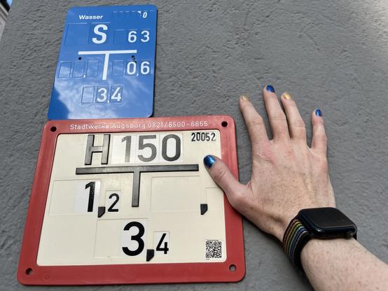
Das ist heute sicher der 50. #Hydrant, den ich in die #OpenStreetMap eintrage...
Man kann doch sicher eine #Overpass Query bauen, die alle Hydranten in Augsburg auflistet, die ich gemappt habe, oder?
Muss ich definitiv mal machen!
New Artist announced for Into The Great Wide Open Festival 2025: 🔥 Overpass 🔥
🎶 Listen to the current LineUp on YouTube and Spotify: https://fyrefestivals.co
🎟️ Get your Tickets now: https://prf.hn/l/EJnYMdO
#Into_The_Great_Wide_Open_Festival_2025 #Overpass #fyre_festivals #livemusic #youtube #spotify #music #musicfestivals #playlist #tickets #announcement
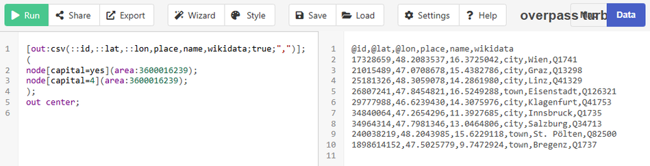
Today I learned that you can export CSV directly from Overpass, *and* you can query features that are within a given polygon relation (not just bounding box).
So my multi-step process to extract cities in Austria from OSM just got reduced to a single #Overpass query 🎉
Tiens j'apprends qu'à #Paris on aurait entreprit de virer des répétiteurs de feux tricolores pour améliorer le respect des sas vélos. Les grands esprits se rencontrent et on peut facilement localiser les lieux avec feux et aménagement cyclable via #Overpass et #OpenStreetMap
{{geocodeArea:Paris}}->.searchArea;
(
way(area.searchArea)[~"^cycleway.*$"~"."];
> -> .cyclable;
);
node.cyclable["highway"="traffic_signals"];
out geom;

Vive les écosystèmes libres et ouverts !
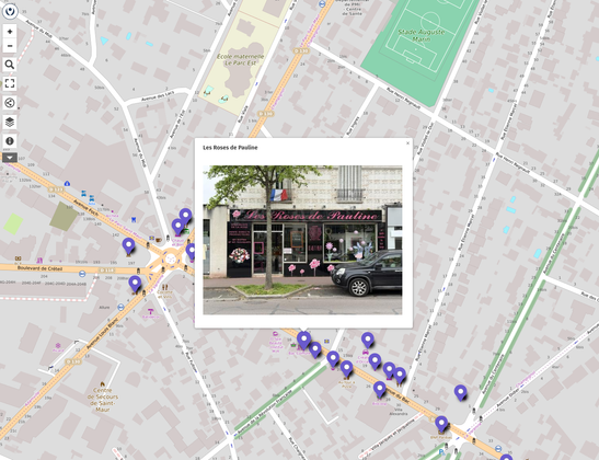
@MapComplete permet de relier @osm_fr et @panoramax très facilement.
On sélectionne un objet présent dans #OpenStreetMap qu'on peut compléter entre autre en lui ajoutant une photo.
Cette photo est partagée directement sur #Panoramax et un tag panoramax=* est ajouté sur l'objet OSM pour faire le lien.
La carte ci-dessous est faite sur @umap et utilise #Overpass pour afficher les objets OSM avec leur photo associée. #NoCode
https://umap.openstreetmap.fr/fr/map/poc-integration-osm-panoramax_928955#18/48.79688/2.50524
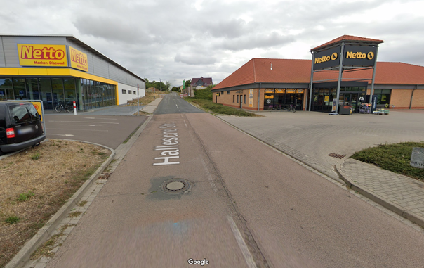
By popular demand, here's a map showing the Netto Marken-Discount / Netto distribution within Germany.
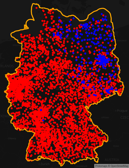
Was bored on my way to #eh22 and made a map showing the ALDI Nord / ALDI Süd distribution within Germany using Overpass-Ultra and #OpenStreetMap data.
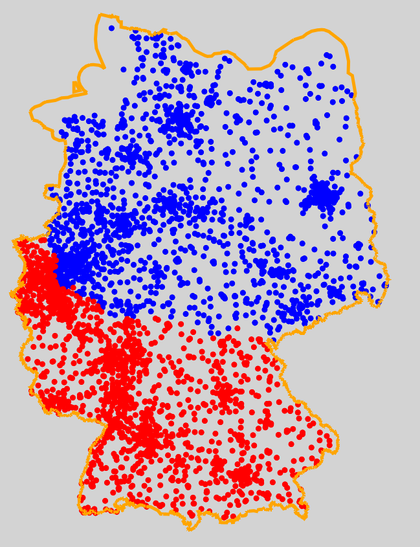

By popular demand, here's a map showing the Netto Marken-Discount / Netto distribution within Germany.