THE WILD…
A walk on kunanyi-Mt Wellington's southern flank takes us high above a river to follow the route of Hobart's water supply to its source. An easy and popular walk, the Pipeline Track takes you through cool temperate rainforest.

READ THE STORY HERE…
https://medium.com/pacificedge/along-the-pipeline-7c1743bd79a1?source=friends_link&sk=c86630663615a0cbe9bfa879795542ae

#bushwalking #bushwalkingaustralia #hiking #tasmania #MtWellington #PipelineTrack

THE WILD…
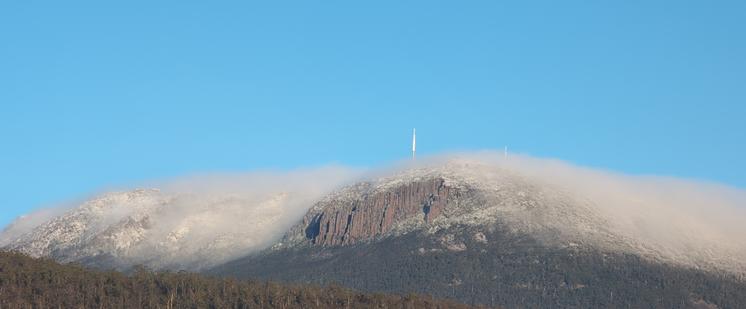
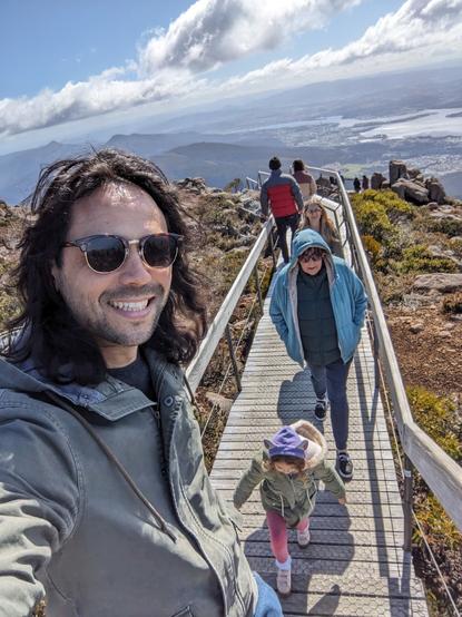
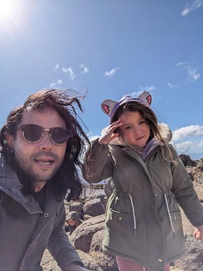
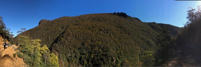
We made the walk to Mt Connection on a fine day in March, no wind, clear blue sky and excellent views across the landscape.

At 1132m high and with a prominence of 134 metres above the range (height of the summit relative to the lowest contour line encircling it), like the rest of the Wellington Range Mt Connection is composed of the igneous rock, dolerite, formed during the Middle Jurassic period around 175 million years ago.

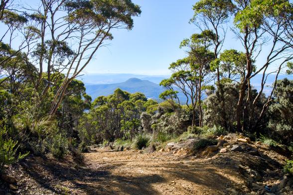
The trail tracks through the range’s subalpine zone and is exposed to sun, wind and weather for most of its length so a hat, wind/waterproof jacket, water, food and sturdy hiking shoes or boots are advisable. It can be snowy in winter and powerful, cold winds can blow in from the southwest at any time of year.

Marcus Aurelius advises us that ‘The impediment to action advances action. What stands in the way becomes the way’. In other words, ‘the problem is the solution’. But, not on this mild day when we walked the track. We encountered no problems and the exertion of the descents and ascents offered no impediment.

This is an in-and-out route of approximately 12km with excellent views into the Derwent Valley to the east and into Southwest Tasmania in the other direction. On a clear day, Precipitous Bluff, far away on the southern coast of Tasmania, is visible on the horizon.

READ THE STORY HERE:
https://medium.com/pacificedge/on-foot-to-mt-connection-de3274e50332?source=friends_link&sssssk=31e494e00f7f0e5eb1c64ef67e570b1423042

#bushwalking #hiking #MtWellington #MtConnection #Tasmania #mountains

On foot to Mt Connection - PacificEdge - Medium

A bushwalk to Mt Connection on Tasmania's Wellington Range reminds us that walking in wild country brings us the freedom of the hills…

PacificEdge
Mountain's looking majestic this morning
#hobart #kunanyi #mtwellington

We went up the mountain this morning 🗻

#kunanyi #MtWellington #hobart #tasmania

Could somebody confirm that...umm...is this a wallaby or similar marsupial on the Kunanyi/Mt Wellington pinnacle? seen in a timelapse I made

#kunanyi #tasmania #hobart #tasmania #mtwellington

On Saturday I got to share my favourite place with a group of tourists. From the top of kunanyi / Mount Wellington, we look over nipaluna / Hobart towards Port Arthur and beyond.

After a hot hot hot day on Friday, it was 9°C and felt like 0°C with wind chill. Let's call that refreshing.

#tasmania #hobart #TourGuiding #kunanyi #mtwellington #landscape #photography #QuickSnap

Near the summit of kunanyi /Mt Wellington (elevation 1271 meters) looking southwest over alpine heath towards a dolerite rock formation on a summer afternoon, Dec 2017. Pretty sure that's a cluster of mountain spice (ozothamnus ledifolius) in the foreground.

#photography #landscape #mountain #outdoors #alpine #Hobart #Tasmania #Australia #kunanyi #MtWellington

This Panorama doesn't even remotely do justice to Betts Hill, Cathedral Rock and Montague Thumbs. Just a hill of forest looked vast and stunning, Especially with the wattle in blossom.

#hobart #CathedralRock #Tasmania #australia #MtWellington