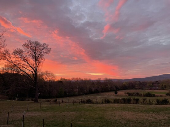
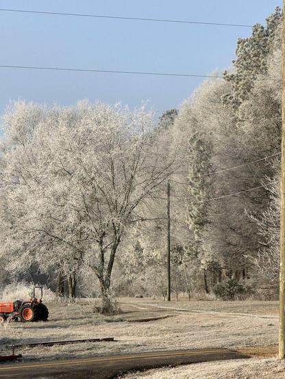
RT @lydawgcha: The product of freezing fog this morning. #gawx #tnwx #alwx #CHAwx #HUNwx @NWSAtlanta https://t.co/XK1zzONtUg https://x.com/lydawgcha/status/1878440745545138493
Lyerly NWGA Storm Dawg (@lydawgcha) on X

The product of freezing fog this morning. #gawx #tnwx #alwx #CHAwx #HUNwx @NWSAtlanta

X (formerly Twitter)
Snow is letting up in the Huntsville area. I went out and measured a 100 mm or just a little under 4 inches in my back yard in Ryland. My neighbor measured 4 1/2 inches. #alwx #hunwx #valleywx
@NWSHuntsville: RT by @NWSAtlanta: 🧏 Weather Safety Workshops for the #Deaf & #HardofHearing ! 👉Fully accessible w/ #ASL & CC #2 🗓️October 21st in Huntsville General inquiries about tours at @NWSHuntsville, call our office. #HUNwx 🧵3/3 https://twitter.com/NWSHuntsville/status/1845531687234719916
NWS Huntsville (@NWSHuntsville) on X

🧏 Weather Safety Workshops for the #Deaf & #HardofHearing ! 👉Fully accessible w/ #ASL & CC #2 🗓️October 21st in Huntsville General inquiries about tours at @NWSHuntsville, call our office. #HUNwx 🧵3/3

X (formerly Twitter)

@WDEFNews12 -- The Fort Payne #NOAAWeatherRadio WWF-44, on a frequency 162.500 MHz, is off the air at this time.

During the Outage Tune to:
Winchester WNG-554 (162.525 MHz) or Arab WNG-642 (162.525 MHz) to get your latest weather information.

We apologize for any inconvenience. #HUNwx
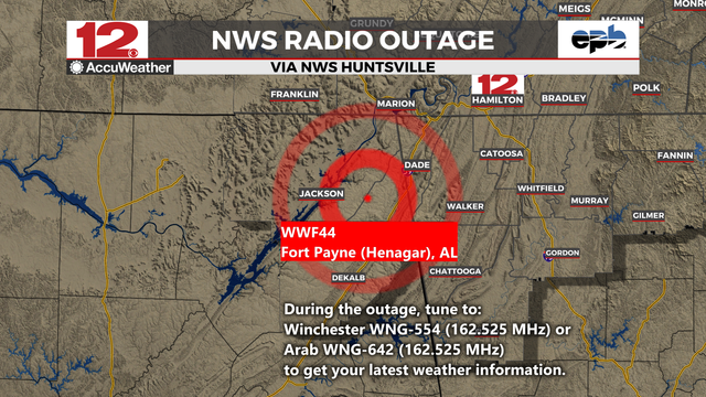
NWS (bot) (@[email protected])

We're repeating @NWSHuntsville to have a plan in place and have multiple ways to get warnings during this severe weather event! nitter.net/NWSHuntsville/status/1641940413430001664#m

AI6YR's Mastodon
Another beautiful sunrise in Ryland! #alwx #valleywx #hunwx
Looks like the SCAN weather station on the @aamu@twitter campus recorded a 80.6 mph wind gust in the 11:00 am report https://wx.aamu.edu/daydat.php?2057+2023+03+03 #HUNwx #valleywx
AAMU Campus - Climate Data for March 03 2023

FROM NWS Huntsville - “7:50 PM: An area of showers with a few thunderstorms will overspread the TN Valley tonight. Main threats tonight will be heavy downpours and gusty winds with a low threat for severe weather. Tomorrow still looks like a severe day, so have multiple ways to receive warnings! #HUNwx #ALwx
Moderate snow falling in Moontown. 35F. Doesn’t square with Special Weather Statement just issued by NWS HSV. #HUNwx
FROM NWS HUNTSVILLE - Remaining chilly through Monday with a slight warming trend in store. Then, truly arctic air moves into the area
towards the end of the week, possibly producing some wintery precipitation. #HUNwx