Rapid Response Seafloor Seismology [USGS]
--
https://www.usgs.gov/news/featured-story/rapid-response-seafloor-seismology <-- shared technical article
--
#GIS #spatial #mapping #geology #earthquakes #monitoring #remotesensing #geohazards #marine #massmovement #geology #engineeringgeology #tsunami #volcano #risk #hazard #forecasting #seafloor #seismology #hazardmaps #models #modeling #mitigation #seismograph #seismicwaves #instrumentation #underwater #remote #tectonics
@USGS
--
https://www.usgs.gov/news/featured-story/rapid-response-seafloor-seismology <-- shared technical article
--
#GIS #spatial #mapping #geology #earthquakes #monitoring #remotesensing #geohazards #marine #massmovement #geology #engineeringgeology #tsunami #volcano #risk #hazard #forecasting #seafloor #seismology #hazardmaps #models #modeling #mitigation #seismograph #seismicwaves #instrumentation #underwater #remote #tectonics
@USGS

Rapid Response Seafloor Seismology | U.S. Geological Survey
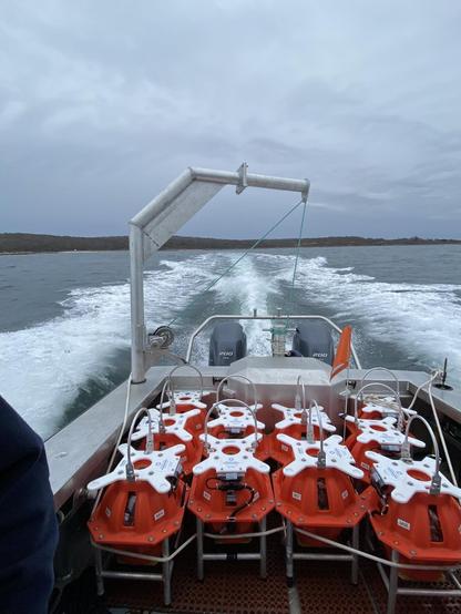
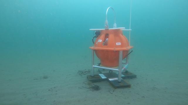
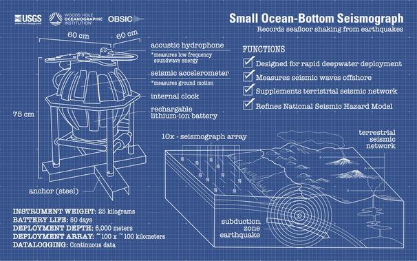
Ocean-bottom seismographs are valuable tools for studying marine geohazards like subduction zone earthquakes. The USGS has partnered with the Woods Hole Oceanographic Institution to operate a small fleet of highly mobile instruments to deploy during periods of seismic unrest.