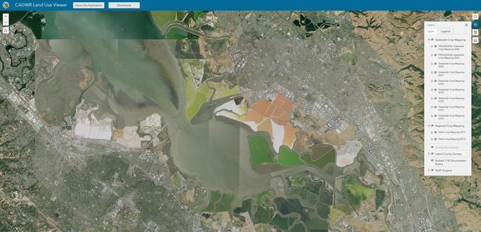
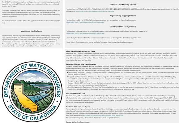
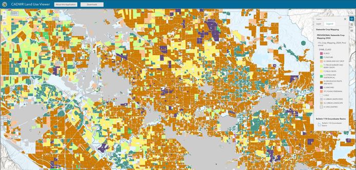
Provisional Land Use Data From Water Year 2024 Is Now Available On [CA]DWR Atlas, CNRA Open Data, And SGMA Data Viewer For Public Use
--
https://gis.water.ca.gov/app/CADWRLandUseViewer/?page=home <-- shared web-based CDWR datasets / map
--
“The collected data is used by various federal, state, and local agencies, academic researchers and private consultants , and can help estimate the amount of water available for agriculture. Using this information, farmers can adapt and make decisions to better manage scarce water supplies more effectively.”
#GIS #spatial #mapping #California #download #opendata #water #hydrology #datause #datasharing #download #landuse #spatialanalysis #spatiotemporal #wateryear #DWRAtlas #statewide #CNRA #SGMA #publicdata #publicgood #usecase #crops #croplands #cropmapping #counties #countysurvey #CADWR #DWR #groundwater #irrigation #wateruse #watermanagement #federal #state #local #webmapping #agriculture #watersecurity #foodsecurity #watersupply
#CaliforniaDepartmentOfWaterResources
--
https://gis.water.ca.gov/app/CADWRLandUseViewer/?page=home <-- shared web-based CDWR datasets / map
--
“The collected data is used by various federal, state, and local agencies, academic researchers and private consultants , and can help estimate the amount of water available for agriculture. Using this information, farmers can adapt and make decisions to better manage scarce water supplies more effectively.”
#GIS #spatial #mapping #California #download #opendata #water #hydrology #datause #datasharing #download #landuse #spatialanalysis #spatiotemporal #wateryear #DWRAtlas #statewide #CNRA #SGMA #publicdata #publicgood #usecase #crops #croplands #cropmapping #counties #countysurvey #CADWR #DWR #groundwater #irrigation #wateruse #watermanagement #federal #state #local #webmapping #agriculture #watersecurity #foodsecurity #watersupply
#CaliforniaDepartmentOfWaterResources