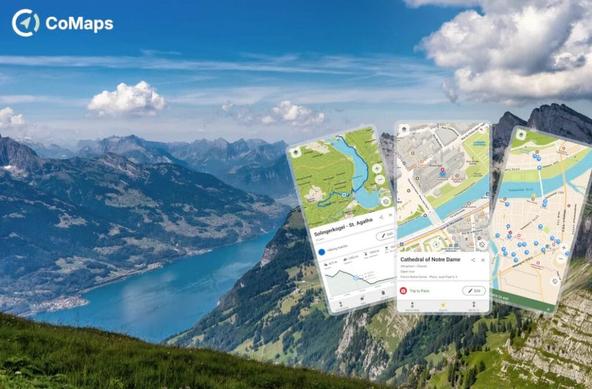
meine Packliste für #fossgis2026
#OSMAnd und #CoMaps aktualisiert
✅ passbook in PassDroid importiert
✅ FahrplanApp installiert https://t1p.de/mi1o
✅ QFieldApp installiert https://onelink.to/fossgis-2026
✅ Teilnahmehinweise gelesen https://pretix.eu/fossgis/2026/page/teilnahme-an-fossgis-konferenz-2026/
✅ fediwall getestet https://gislars.github.io/fediwall/
✅ letzte Änderungen für Abfahrtplan https://gislars.github.io/fossgis-fahrplan-druck/events/fossgis2026/?columns=mobile
□ irgendwas vergessen?

#fossgis #OpenStreetMap

so frustrating

just a mild rant:

#CoMaps is nice
am happy with it
really.

None of these #openstreetmap mobile app tools that I have thusfar been able to find

have a grid overlay

Why?
For The Love of all the Godz!

Why?

On holiday in Brazil and the small town I'm staying in has almost nothing mapped. A couple key POIs are mapped, but, I still was able to add 20 new POIs to the "city centre". A 360 camera would have been a massive help, maybe next time.
@CoMaps,
@everydoor & @streetcomplete have been massive help with getting things added quickly!

#OpenStreetMap #brasil #streetcomplete #EveryDoor #CoMaps

For some upcoming outdoor adventures I'm currently looking for a map solution with some special requirements that seem rather rare or not existent at all:

– Download (complete) OSM data for small area, let's say 4 to 9 km². I understand that's difficult because of how OSM data downloads are bundled, but I don't mind downloading the entire region, as long as the data is "complete" (not stripped of information that some provider deemed unimportant - CoMaps map downloads for example apparently don't include structures outside of cities).

– Download satellite imagery tiles for the given area for offline use. That's probably difficult cause providers want money for their satellite stuff, however OSMAnd for example can display Microsoft Earth imagery as over/underlay for free, so I guess those should be cacheable somehow. As mentioned above it's be for a rather small predefined area.

– Display both OSM map and satellite imagery at the same time like OSMAnd does with the over/underlay, with configurable opacity for the layers.

– This one's tricky: possiblity to (freehand) draw on the map (and obviously having my sketches pan/zoom along with the map when moving around).

– Put markers on the map with notes and have the notes displayed on the map itself, not just the marker that you gotta tap to have the note pop up.

OSMAnd comes pretty close, but doesn't download/cache satellite imagery for offline use, markers are a bit cumbersome for a quick note and it doesn't support drawing on the map.

I'm mostly looking for an Android app, however I'm not opposed to buying a dedicated GPS device if it does everything above. Right now the best solution I can think of is configuring an OSM map with all the desired information, print it out and just draw on the paper map, with the obvious downside that it doesn't show my position and also doesn't zoom well.

Any suggestions welcome!

#android #maps #outdoor #openstreetmap #osm #osmand #comaps

Routes from Cartes.app to CoMaps

https://sopuli.xyz/post/42726571

Routes from Cartes.app to CoMaps - Sopuli

Did you know, if you are using @[email protected] [/u/[email protected]] as a web-based map on your phone, you can now also move your route planning from there right into CoMaps: https://amicale.net/@cartes_app/116138981582214264 [https://amicale.net/@cartes_app/116138981582214264] And, if you’re not francophone: the team has started to improve its support for more languages recently!

Tour Aufzeichnung mit #coMaps #osm

Bei zwei Standorten 📍 stimmen die Höhenangaben nicht .. was könnte das sein ?

Heut die Route 📍mit @[email protected] aufgezeichnet .. mich interessieren die Höhenangaben 🚵‍♀️ der Tour. 2 Vergleiche. Kaiser-Rudolf-Platz • 920 hm / coMaps - 964 hm Hierholzer Weiher • 900 hm / coMaps - 962 hm #osm 📍 #coMaps #Navigation #dachsberg #südschwarzwald

@CoMaps

Just wondering why there is no way to stop downloading maps on Linux.

Erroneously double-clicked the top most 'countries' and now I need to download, what 90GB maps, only to delete them again. 🤦

Or is the cancel button hidden somewhere?

#CoMaps

@maglab Danke noch mal für den tollen Abend gestern, die guten Gespräche im Nachgang und natürlich für das Hosting 🤗

Kurze Zusammenfassung: Es ging größtenteils um

#OSMand #CoMaps #EveryDoor #MapComplete #MapRoulette #iD

Danke auch an @hedgedoc . Der Präsentationsmodus ist wirklich super 💪

#Fulda #MagratheaLaboratories #ccc #OpenStreetMap

@thibaultmol isn't the second best enough? 😉😂

But now tbh.
I am waiting for the public transport support in #CoMaps, since this is my favorite navigation tool. They are working on that. Not sure when it will be done.
I assume #Osmand can do it. Maybe you need a subscription for it.