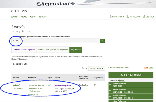
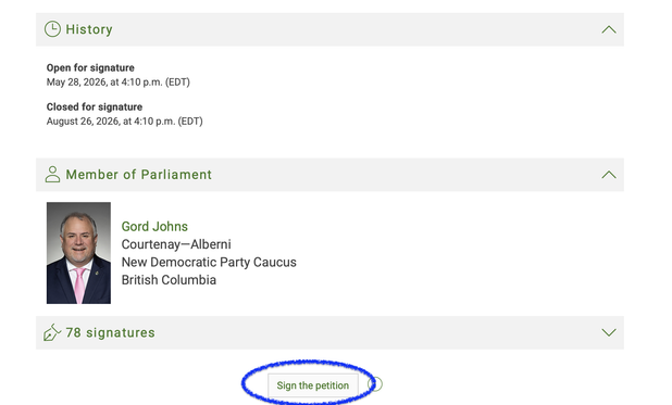
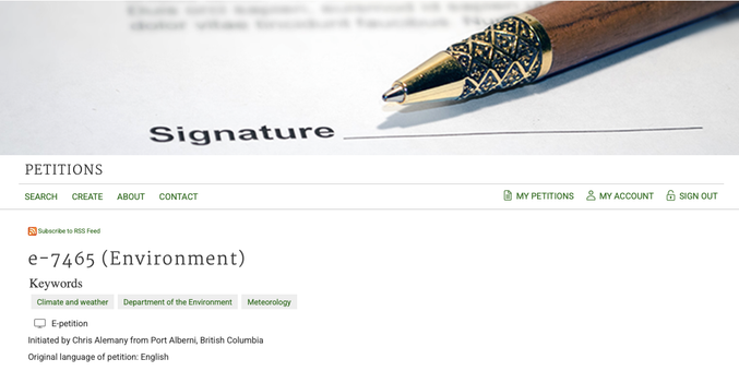
If you are concerned about weather and climate in Canada please sign this e-petition!
https://www.ourcommons.ca/petitions/en/Petition/Details?Petition=e-7465
The Carney Government has decimated many ECCC services at a time when extreme weather and climate change are hitting Canadians harder than ever.
Boost, Like and write a post of your own and share the petition!
If you are on FB or other platforms please share there too!
thank you! 🙏 ❤️ 🇨🇦
Full text below the hashtags.
#carneyrestoreeccc #e7465
#canpoli #cdnpoli #weather #bcstorm #climateChange #ClimateEmergency #science #pleaseBoost #austerity #Canada
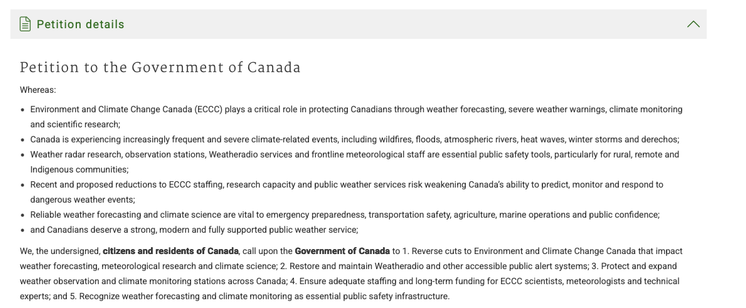
Petition to the Government of Canada
Whereas:
Environment and Climate Change Canada (ECCC) plays a critical role in protecting Canadians through weather forecasting, severe weather warnings, climate monitoring and scientific research;
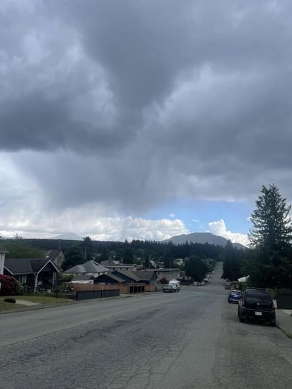
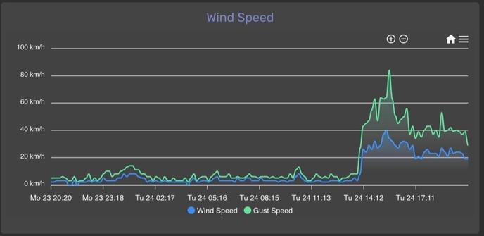
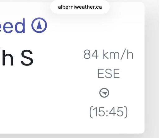
Canada is experiencing increasingly frequent and severe weather and climate related events, including wildfires, floods, atmospheric rivers, hurricanes, heat waves, winter storms and derechos;
Weather radar research, observation stations, Weatheradio services and frontline meteorological staff are essential public safety tools, particularly for rural, remote and Indigenous communities;
Recent and proposed reductions to ECCC staffing, research capacity, and public weather services risk weakening Canada’s ability to predict, monitor, and respond to dangerous weather events;
Reliable weather forecasting and climate science are vital to emergency preparedness, transportation safety, agriculture, marine operations and public confidence; and
Canadians deserve a strong, modern and fully supported public weather service.
We, the undersigned, citizens and residents of Canada, call upon the Government of Canada to
1. Reverse cuts to Environment and Climate Change Canada that impact weather forecasting, meteorological research and climate science;
2. Restore and maintain Weatheradio and other accessible public alert systems;
3. Protect and expand weather observation and climate monitoring stations across Canada;
4. Ensure adequate staffing and long-term funding for ECCC programs, scientists, meteorologists and technical experts; and
5. Recognize weather forecasting and climate monitoring as essential public safety infrastructure.