 S&A
S&ADiscoVereto, al via i primi scavi sistematici nell’antica città messapica del Capo di Leuca
S&ANel Capo di Leuca prende forma un progetto destinato a diffondere la conoscenza della storia preromana del Salento. A Patù, in provincia di Lecce, è iniziata infatti la prima campagna sistematica di scavi archeologici nell’antica città messapica di Vereto, uno dei centri più importanti dell’estremo sud della Puglia antica.
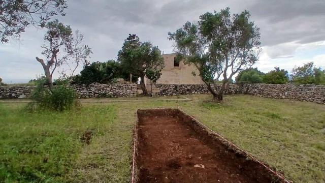
Area di scavo Grotta SudaL’iniziativa, denominata “DiscoVereto”, è promossa dall’Università degli Studi di Napoli “L’Orientale” sotto la direzione scientifica dell’archeologo Valentino Nizzo, con concessione del Ministero della Cultura e in collaborazione con enti territoriali, istituzioni culturali e realtà scientifiche nazionali.
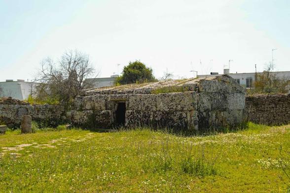
Centopietre_Vereto_PatùL’obiettivo del progetto è ricostruire la storia delle reti di scambio, delle identità culturali e delle trasformazioni sociali del Capo di Leuca tra la fine dell’età del Bronzo e la fase della romanizzazione.
Vereto, la grande città messapica del Salento antico
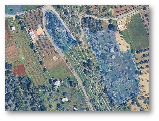
L’antica Vereto occupava una posizione strategica nel Mediterraneo antico. Il centro messapico si estendeva originariamente per oltre 40 ettari ed era protetto da una poderosa cinta muraria. Il suo controllo su due approdi fondamentali, Leuca e San Gregorio, ne faceva uno snodo cruciale per le rotte marittime tra Adriatico, Ionio e Tirreno.
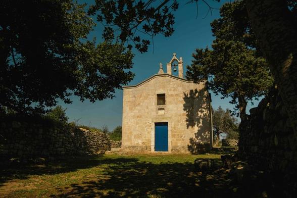
Chiesa Madonna di Vereto_ph. Noemi De VitisSecondo gli studiosi, proprio questa collocazione geografica avrebbe trasformato Vereto in un crocevia di popoli, merci e culture fin dalla protostoria. Nonostante l’importanza storica del sito, l’area non era mai stata oggetto di una campagna di scavo sistematica. La nuova missione rappresenta quindi il primo grande progetto organico di ricerca archeologica dedicato alla città.
Il progetto “Leucantica” e le nuove tecnologie applicate all’archeologia
La campagna di scavo rientra nel più ampio progetto “Leucantica”, ideato da Valentino Nizzo insieme all’archeologa Daniela Ventrelli di Puglia Culture. Il programma combina archeologia tradizionale, tecnologie digitali e valorizzazione del patrimonio culturale.
Area di scavo Acropoli di VeretoLa ricerca sul campo, concentrata su alcune aree di proprietà comunale e messe a disposizione gratuitamente dai proprietari, mira sin da questa prima missione a integrare lo scavo stratigrafico tradizionale con l’analisi delle fonti letterarie e antiquarie, lo studio dei materiali già rinvenuti (editi e inediti) e la ricognizione topografica supportata da tecnologie digitali avanzate come la mappatura 3D, il telerilevamento LIDAR e i Sistemi Informativi Geografici (GIS) per l’analisi del paesaggio, coniugate con prospezioni geofisiche non invasive realizzate in collaborazione con l’Istituto Nazionale di Geofisica e Vulcanologia (INGV).
DiscoVereto_area di scavo Grotta SudaArcheologia partecipata e coinvolgimento della comunità
Uno degli aspetti più innovativi di DiscoVereto riguarda il forte coinvolgimento della cittadinanza attraverso pratiche di archeologia partecipata. Il progetto punta infatti a trasformare il patrimonio archeologico in una risorsa condivisa per il territorio, in linea con i principi della Convenzione di Faro.
Grotta Suda_ph. Alessandro RizzoSono previsti laboratori didattici aperti al pubblico, seminari e conferenze, attività di citizen science, percorsi educativi, esposizioni temporanee e incontri divulgativi presso il Museo Archeologico di Vereto.
Le attività verranno inoltre documentate attraverso la realizzazione di un documentario dedicato all’esperienza di scavo e al rapporto tra archeologia e comunità locale.
Un progetto culturale per contrastare lo spopolamento
“DiscoVereto” è una delle iniziative inserite nel programma “Storie Meridiane”, progetto di rigenerazione culturale e sociale promosso dai Comuni di Patù e Morciano di Leuca.
L’iniziativa è finanziata attraverso il PNRR Cultura – Missione 1 Componente 3 Investimento 2.1 “Attrattività dei borghi”, sostenuto dall’Unione Europea – NextGenerationEU e dal Ministero della Cultura.
L’obiettivo è utilizzare la cultura come leva concreta di sviluppo economico, turistico e occupazionale per contrastare il fenomeno dello spopolamento nei piccoli centri del Sud Italia.
Valentino Nizzo: “Vereto è una memoria collettiva da riscoprire”
Il direttore scientifico del progetto, Valentino Nizzo, ha sottolineato il valore culturale e sociale dell’iniziativa:
“Con DiscoVereto vogliamo fare dell’archeologia uno strumento di partecipazione, capace di coinvolgere la comunità nella riscoperta del passato e nella costruzione del presente”.
Nizzo ha inoltre evidenziato l’importanza della collaborazione tra università, istituzioni e realtà locali per valorizzare uno dei paesaggi storici più significativi del Mediterraneo.
Il sindaco di Patù: “Un appuntamento con la Storia”
Grande entusiasmo anche da parte dell’amministrazione comunale.
Il sindaco di Patù, Gabriele Abaterusso, ha definito l’avvio degli scavi:
“Un appuntamento con la Storia, un avvenimento sensazionale che tutta la comunità aspettava da anni”.
Secondo il primo cittadino, Vereto rappresenta un luogo identitario per il territorio del Capo di Leuca, uno spazio simbolico dove memoria, storia e appartenenza collettiva si intrecciano profondamente.
Un nuovo capitolo per l’archeologia del Salento
La campagna di scavo, che proseguirà fino al 19 giugno, potrebbe fornire dati fondamentali sulla frequentazione del Capo di Leuca tra età protostorica e romanizzazione.
L’integrazione tra ricerca scientifica, tecnologie avanzate e partecipazione pubblica rende DiscoVereto uno dei progetti archeologici più interessanti attualmente in corso nel Mezzogiorno.
Se i risultati confermeranno le aspettative, Vereto potrebbe diventare un nuovo punto di riferimento per gli studi sull’Italia preromana e per la valorizzazione culturale del Salento.
Per informazioni e per rimanere aggiornati sullo scavo e sulle iniziative ad esso collegate: www.leucantica.it
📘 Notizia verificata ✅
- 📄 Fonte: DiscoVereto ✅
 Mauro Bortone
 Central & Western Archive/GLAM