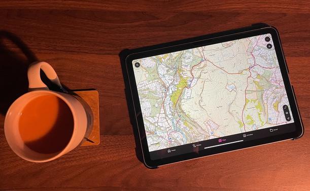
In anticipation of apple maps starting ads, I am going to give OSMAnd maps a try. Directions, searching, transit..let’s see how it does.

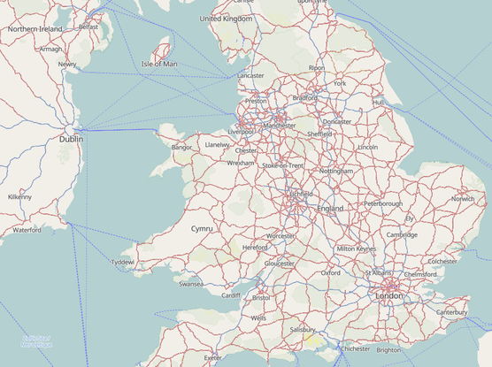
It is, if anything, too much info. It has individual park benches. You may call that good, but it makes the map so busy. Also no street view, but I can fall back to Apple maps if needs must.

Still, let’s give it a whirl.
#OSMaps #osmandapp

Speeding up access to vector tiles

Ive been creating and serving web-based maps such as this one for some time. Thats based on raster tiles, and an osm2pgsql database is used to store the data that the tiles are created from, on demand as a request to view a tile is made.

OpenStreetMap
My Android OS maps app thinks I am following a route in Dolgellau (where I was last weekend but am not now). Zero distance has been recorded, the "Finish" button does nothing and I cannot find a cancel button to escape from the route. Has anyone encountered this and found a way to stop the route? Without driving back to Dolgellau and completing the route! Seems like a bug πŸ€”#OsMaps
Weekend planning with OS Maps and Yorkshire Tea πŸ₯Ύβ˜•️ #OrdnanceSurvey #OSMaps #Hiking #Cartography

For all interested in or studying the more recent past ...

Post-war OS maps as single sheets, overlay, or side-by-side for the period 1944-1973 are now available from the National Library of Scotland website:
https://maps.nls.uk/os/national-grid/

A great deal of information on post-war rebuilding and expansion can now be seen for free, as detailed as 1:1250.

A wonderful site just got even better. Well done to all involved. πŸ‘πŸΌ

#OSmaps #History #Maps #PostWW2 #NationalLibraryOfScotland

Ordnance Survey National Grid maps, 1944-1973 - National Library of Scotland

One for UK #walking fedifolk..

Is anyone using the OSMaps App having trouble with it saving activity? The last two routes I walked did not save, despite me recording them, nor was there a prompt to save after I hit finish. Many thanks.

Edit: is anyone using it and not having problems? Wondering if it’s something in settings. Thanks again!

#OSMaps

Does nobody at #OSMaps ever zoom out?
Perhaps not a widespread issue but do I know of others affected: The Ordnance Survey maps app has been misbehaving for eons, taking an age to render even offline maps. My subscription renewing reminded me to complain and in troubleshooting I deleted and reinstalled the app. And it's now appears to be completely new app that seems to work just fine. I routinely update apps so I'm not sure what's gone on, but if the #OSMaps app map view looks like the first image, it's out of date. #MapGeek

To commemorate the amazing work that everyone does in Mountain Rescue England and Wales, Ordnance Survey has created this data visualisation using call-out data from 2019-2023, showing the most common areas that Mountain Rescue attend to.

Thank you to all team members who are on call 24 hours a day 365 days a year.

#OSMaps #UKHikes #HikingKit #WinterHiking #AdventureSmart

I was thinking about which Ordnance Survey map was my favourite just now. Really tricky as it does change but this year at least, it's 44. A lot of good days out in that square. Long weekend coming up (local holiday on Monday) so hoping the weather is nice, though the plan is to maybe head into 37. Forecast looking OK so far.

#OSMaps