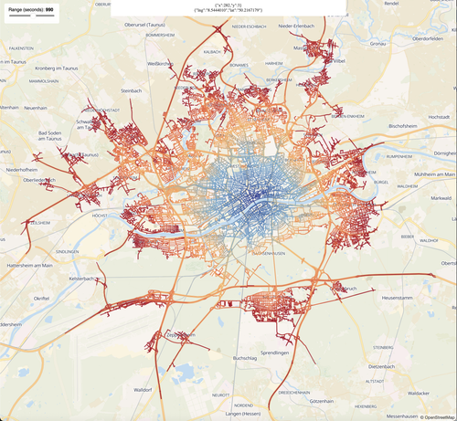
【個人開発】最寄り駅から徒歩X分以内の物件を地図上に列挙できるアプリを作ってみた【React,TS,supabase,leaflet】
https://qiita.com/nu197ma/items/bc9aee9c5951e01ad13b?utm_campaign=popular_items&utm_medium=feed&utm_source=popular_items

#qiita #leaflet #React #osrm

【個人開発】最寄り駅から徒歩X分以内の物件を地図上に列挙できるアプリを作ってみた【React,TS,supabase,leaflet】 - Qiita

はじめに 個人開発で、supabaseとReactを使ったアプリケーションを作成している。 解決したかった問題 賃貸物件を探す際、「駅から近い物件」、あるいは「駅から遠くてもいいので家賃が安い物件」などを調べたいことがよくある。 既存の賃貸サイトでは、「駅からX分...

Qiita

Drive around in Paris and avoid ways named after men!

My route planner now has a Parisian edition:
https://osrm.findvej.dk/paris/

E.g.:
https://osrm.findvej.dk/paris/?z=12&center=48.842722%2C2.372320&loc=48.823939%2C2.330303&loc=48.819228%2C2.329402&hl=fr&alt=0

Data is based on #OpenStreetMap extract for Paris where every street with the tag "name:etymology:wikidata" is compared to the corresponding item in Wikidata which has gender specified. Streets named after men are marked il the extract.

Finally a custom #OSRM plan is created that ignores these roads.

#rstats osrm.backend 0.2 is out.

I fixed a bug that might have caused lockup if you tried to calculate too large origin-destination matrices. Should work just fine now! (though there is a limit of course, as it works over REST API, but parallel requests are your friend).

osrm.backend::osrm_start("data_folder")

- router is installed automagically on all OS
- graph prep control from R

📘 Quick Start: https://www.ekotov.pro/osrm.backend/articles/osrm-backend.html
🗂️ Repo: https://github.com/e-kotov/osrm.backend
#OSRM #routing #gischat

First time trying #OSRM for routing, as my previous OSMNx + Pandana setup was failing at building a road network for all of Australia.

Jeez it was a PITA to set up but so fast once you get there! National SA2 OD matrix ran in a few seconds.

Entschuldigung, aber #OSRM hat ja wohl nen Knall. Wenn ich mit dem Fahrrad von #Köln Nippes in die Südstadt will, soll ich zweimal über den Rhein fahren?! 🤦‍♀️

@UteBorsch

Wenn du Zeit, Lust, Laune und etwas Hardware hast: #nextcloud mit Maps App und dann noch #osrm - läuft dann mit Material von osm und routed aid deinem device...

🗺️ Building routes with 𝐑 + 𝐎𝐒𝐑𝐌 on 𝐎𝐩𝐞𝐧𝐒𝐭𝐫𝐞𝐞𝐭𝐌𝐚𝐩 data and tired of switching to terminal and breaking the workflow?

Just use osrm.backend::osrm_start("your_data_folder")

• No need to pre-install 𝐃𝐨𝐜𝐤𝐞𝐫 or 𝐨𝐬𝐫𝐦-𝐛𝐚𝐜𝐤𝐞𝐧𝐝 native app — it’s handled for you on macOS, Windows, and Linux automagically

• No manual graph prep (though you can, see options for advanced users)

📘 Get started: https://www.ekotov.pro/osrm.backend/articles/osrm-backend.html
🗂️ Repo: https://github.com/e-kotov/osrm.backend

#rstats #OSRM #routing #gischat

Så er min ruteplanlægger, der nægter at køre på veje opkaldt efter mænd, opdateret med frisk data.

Siden maj 2025 har jeg og andre frivillige fået markeret 10 % yderligere veje opkaldt efter mænd.

Eksempel i Hjørring:
https://osrm.findvej.dk/nomales/?z=14&center=57.468716%2C10.003695&loc=57.470551%2C9.988933&loc=57.461411%2C10.017514&hl=da&alt=0

#OSRM #OSM

Ruteplanlægger, der nægter at køre på veje opkaldt efter mænd - Open Source Routing Machine

Midterm Update: Temporary Road Closures Database and API - GSOC 2025

Im excited to share the midterm progress on my Google Summer of Code 2025 project: Temporary Road Closures Database and API for OpenStreetMap. This project aims to create a centralized platform where users can submit and retrieve real-time information about temporary road closures, enabling OSM-based navigation apps to provide better routing around construction, accidents, and other events.

OpenStreetMap

Newest test case for route planner: A planner that tells you what the streets are named after in Denmark.

I have "simply" updated the street names with the description from Wikidata and OpenStreetMap. Perhaps I'll style it a bit, but the OSRM part is pretty default otherwise.

The descriptions is in Danish.

https://osrm.findvej.dk/etymology/?z=13&center=55.681504%2C12.606983&loc=55.649384%2C12.618806&loc=55.689294%2C12.526131&hl=da&alt=0

#OSM #OpenStreetMap #OSRM