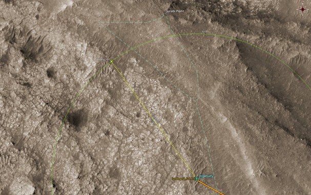
#Perseverance moved further SW on Sol 1002, to RMC 48.0690. At this new location it is just 28m NW of where #Ingenuity had landed after #Flight60 and #Flight61

The animation shows approx. where the #MarsHelicopter had been from Sol 924 to Sol 940. A map follows.

Processed, undistorted, leveled, cropped NAVCAM_RIGHT
looking SSE (153ยฐ) from RMC 48.0690
Sol 1002, LMST: 13:04:29

Original: https://mars.nasa.gov/mars2020-raw-images/pub/ods/surface/sol/01002/ids/edr/browse/ncam/NRF_1002_0755894622_425ECM_N0480690NCAM03002_01_195J01.png
Credit: #NASA/JPL-Caltech/65dBnoise

#Mars2020 #Solarocks #Space

Interestingly, the center part of the MastcamZ image above coincides with that peculiar "dent" in the flight path of the #MarsHelicopter during #Flight60 : https://mastodon.social/@65dBnoise/111204174578916160

Detail of map showing the visible part of the area around the "dent".

#Ingenuity #Perseverance #Mars2020 #NASA #Solarocks #Space #QGIS

More RTE images from #Ingenuity's #Flight60; this one just before the beginning of that dent mentioned above.

Updated map.

Image captured from RMC 60.0001/0
Sol 924, LMST: 11:06:00

Quickly processed, undistorted, leveled HELI_RTE
Original: https://mars.nasa.gov/mars2020-raw-images/pub/ods/surface/sol/00924/ids/edr/browse/heli/HSF_0924_0748962903_074ECM_N0600001HELI00000_000085J01.png
Credit: #NASA/JPL-Caltech/65dBnoise

#MarsHelicopter #Perseverance #Mars2020 #Solarocks #Space

Map showing location and field-of-view of #Ingenuity's RTE camera when the images in the thread above were captured, during #Flight60

Drawn with #QGIS and #MMGIS data, on #USGS (#HiRISE) imagery.

#MarsHelicopter #Mars2020 #NASA #Solarocks #Space

Remember that dent in #Ingenuity's flight path during #Flight60, which we noticed the other day? https://mastodon.social/@65dBnoise/111143393069401062
Here is the view to NW from that point.

Map follows.

Image captured from RMC 60.0001/1
Sol 924, LMST: 11:06:07

Quickly processed (today in Technicolor ๐Ÿ˜€), undistorted HELI_RTE
Original: https://mars.nasa.gov/mars2020-raw-images/pub/ods/surface/sol/00924/ids/edr/browse/heli/HSF_0924_0748962910_975ECM_N0600001HELI00001_000085J01.png
Credit: #NASA/JPL-Caltech/65dBnoise

#Mars2020 #Solarocks #Space

While the dust from #Ingenuity's #Flight60 has not yet settled on the ground, #Flight61 comes tosol to break one more record: fly as high as 24m!

Apparently the #MarsHelicopter team's plan is to take advantage of every available opportunity and gather as much new data as possible, before facing again survival conditions, next winter.

https://mars.nasa.gov/technology/helicopter/status/485/flight-61-preview-by-the-numbers/

#Mars2020 #NASA #Solarocks #Space

Flight 61 Preview โ€“ By the Numbers - NASA

Flight 61 Preview

#Ingenuity stopped at about 1/3 of the way in #Flight60 to take a look at something interesting ๐Ÿค“

Animated zoom

From the updated flight path on the #MMGIS map:
https://mars.nasa.gov/maps/?mission=M20

#MarsHelicopter #Mars2020 #NASA #Solarocks #Space #QGIS #USGS #HiRISE

MMGIS

A web-based mapping and localization solution for science operation on planetary missions.

And here is the estimated landing location of #Ingenuity's #Flight60. The straight part of the flight path is guessed, but the last part before landing, and the landing should be close to reality.

#MarsHelicopter #Mars2020 #NASA #Solarocks #Space #localization #QGIS #USGS #HiRSE #MMGIS

#Ingenuity's flew its 60th flight on Sol 924, as planned.

The animation shows the last part of #Flight60 just before landing, and is rotated to approx. north up.

10 processed, stabilized HELI_NAV images played at 4 fps
Sol: 924, RMC: 60.0001, LMST: 11:07:34
Original: https://mars.nasa.gov/mars2020-raw-images/pub/ods/surface/sol/00924/ids/edr/browse/heli/HNM_0924_0748963000_017ECM_N0600001HELI04456_0000A0J01.png
Credit: #NASA/JPL-Caltech/65dBnoise

#MarsHelicopter #Perseverance #Mars2020 #Solarocks #Space

And so we've reached #Flight60 ๐Ÿš !

#Ingenuity will fly again on Monday, Sept 25, 2023, to the northern part of the rocky area where Mandu Wall lies, about 160m WSW of Jurabi Point, as seen on the map. And will do so in a record breaking speed of 8 m/s!

Flight announcement: https://mars.nasa.gov/technology/helicopter/status/483/flight-60-preview-by-the-numbers/

The flight path and landing shown on the map are guesses.

#MarsHelicopter #Mars2020 #NASA #Solarocks #Space #IngenuityFlightPrediction

Flight 60 Preview โ€“ By the Numbers - NASA

Flight 60 Preview