Running #EverySingleStreet: The Project of a Lunatic or Highly Motivating Gamification? I’ve just published a blog post about finding out!
https://www.teesche.com/everysinglestreet
https://www.teesche.com/everysinglestreet
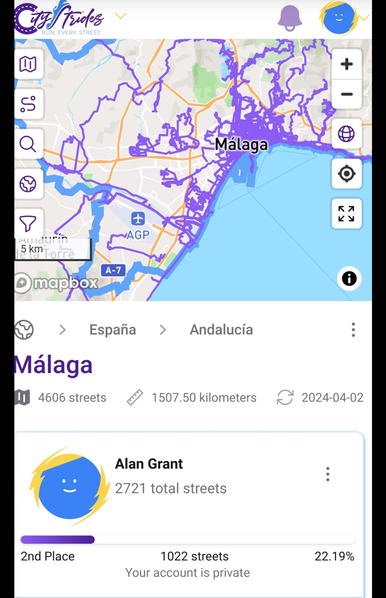
Today I broke through 1000 named streets completed (walked or run) in the city of Málaga, as measured by CityStrides.
Only another 3600 to go. The first 1000 took me more than 10 years, so....
As an OpenStreetMap contributor, there is a nice feedback loop using tools like this that are based entirely on OSM data. Streets that should be tagged as private become obvious. And I've found many residential streets that should be tagged as steps.
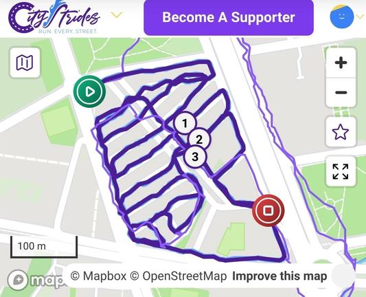
The Finca La Palma barrio in Malaga is perfect for racking up the street count for any kind of EverySingleStreet tracking. I added 19 streets to my total in 20 minutes, but still somehow managed to miss one!
I also confirmed all the sidewalks and pedestrian crossings with StreetComplete, and took a few notes to be added to OSM later.
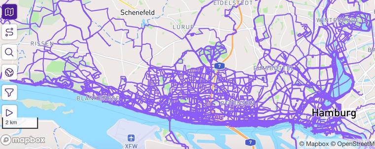
Anyone else here combining mapping with EverySingleStreet apps like #CityStrides, #StreetFerret, or #Wandrer.earth?
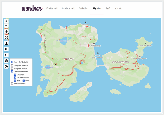
Tuttu joka juoksee kaikkia H:gin katuja #everysinglestreet:issä ja on jo varsin viimeisillään, oli just käynyt hakemassa Vallisaaren pois
Aika paloissa huonosti on Vallisaaren reitit Wandrer kartassa