It’s a common claim by paranormalists that there are special places on earth where “energy” whirls are responsible for strange phenomena reported at those locations. They are called paranormal or energy “vortex” areas. The crystallization of the “vortex” idea in this context began with a popular proponent of mysterious subjects who identified twelve equidistant areas around the globe with peculiar characteristics. Since then, the idea of a paranormal vortex has evolved. The term became flexible enough to be employed as the cause of localized anomalies, to “explain” areas of unusual natural or historical features, and to label places heavily laden with reports of “high strangeness”.
If you look up the word “vortex” in the metaphysical context (that is, not the actual scientific definition based on fluid dynamics), you will find it used in association with places like Sedona, Arizona, and areas where there is a concentration of reports of paranormal phenomena. These vortices (or vortexes) can be considered good or bad but the premise is that the vortex area is unusual in some way – it is a location of exceptional “energy” drawn from the earth. Some writers will go so far as to say these are areas where “known laws of physics don’t apply” or where the connection to the spirit world or other dimensions can be accessed.
In a scientific framework, such areas of unusual energy could be measured and documented. But it is not so at these energy vortex locations. The effect is measured only in subjective human feelings or interpretation of observations, making the case for paranormal vortex areas entirely unscientific. The upwards or downwards swirling “energy” can be felt or used as a convenient ploy to explain areas of transcendence or high strangeness.
Ivan T. Sanderson’s Vile Vortices
The origin of paranormal vortex areas was not exactly scientific, but it was made to appear so. It was fortuitous and coincidental and then fitted to look precise. In 1968, Ivan T. Sanderson, a popular and influential writer about mysterious phenomena proposed the idea that there were 12 tilted oval areas located equidistantly around the globe – ten of which were along defined latitudes north and south of the equator and an additional two at the poles. The locations corresponded to points of the earth’s surface on a grid. The vortex areas were located on the vertices of an icosahedron (a 20-faced polyhedron). Therefore, we find a tie-in with the concept of sacred geometry of the earth – a mathematical means of showing design in the earth’s features. (That’s a tangent to be examined at another time.)
Originally labeled as areas of collected anomalies, Sanderson called these twelve spots “Vile Vortices”. The impetus for the mapping of these areas, according to Sanderson, was his research into what he believed were unexplained plane and ship disappearances in the Bermuda Triangle in the Atlantic and the “Devil’s Sea” area in the Pacific. Both areas fell along the 36 deg north latitude.
Vile vortex speculative locationsSanderson seemed to have some help in further examination of these latitudes that resulted in identifying other sites where “funny things happen”. The oval shapes or “lozenges” trended southwest-northeast at exactly 72 degrees apart latitudinally (5 steps of 72 degrees = 360). That seemed like a pretty spooky fit! With the help of other researchers who did things like stick skewers through a model globe, Sanderson, et al. identified a band in the southern hemisphere at 36 degrees south latitude where notable locations also appeared 72 degrees apart, but on a 23.5-degree latitude shift. These other areas in the Southern Hemisphere included Easter Islands and the South Atlantic Anomaly.
Sanderson played up his evidence in a television appearance and in articles and books, continuing to update the idea for several years. The vile vortices concept was connected to dangerous, perplexing powers of the earth that manifested in precise locations.
Critical problems surfaced immediately with Sanderson’s idea. Firstly, the locations on the mathematically tidy map didn’t line up with the perceived anomalies that supposedly defined them. The locations of these vile vortices eventually meandered and became less exact. Later, some paranormalists asserted that the perimeters of the spooky areas would wax and wane, and maybe even wander, under the influence of ambiguous forces. Secondly, with only moderate effort, one can discover that there is nothing particularly unusual about these places and that the mysteries were enhanced or outright manufactured.
Sanderson even admitted that the effect in the Bermuda Triangle, his key vortex feature, was “weak” because many planes and ships pass through daily without incident. Fishing boats in both the Bermuda and Dragon’s Triangle – the dramatic name for the Devil’s Sea area off the coast of Japan – certainly experienced occasional and unsurprising trouble due to mechanical failure, waves, and storms, just like sea-going vessels everywhere, but those mundane causes were downplayed or ignored.
Any weirdness that was rumored to be caused by vile vortex energy in the mid to late 20th century dissolved when more rational investigation and statistics were applied. Notably, the mysterious hazards supposedly apparent around the devil’s triangles of the Atlantic and Pacific were never acknowledged by the officials from either the US or Japan.
Grid of proposed vortex areasLey lines
Related, but somewhat separate from an earth grid is the idea of lines of energy lines called “leys”. (See Leylines: From the Old Straight Track to the Ghostbuster Vortex for a background on leys.) If one accepts that leys exist and that mysterious earth energy flows through them, it seems reasonable to subsequently conclude that where ley lines intersected (a “node”), some “funny things” might happen. The energy could, supposedly, amplify and swirl into a vortex. Following the maxims of pop cultural exchange, it’s unsurprising that paranormalists would find the mysterious energy vortices interesting. Leys became associated with providing energy for paranormal manifestation of all kinds – ghosts, sacred areas, healing places, UFO highways, etc. Because leys weren’t limited to certain nexus points on a grid, they could be “discovered” everywhere. And wherever these lines crossed, that area might be deemed a vortex.
Sounds Sciencey
Describing the cause of strange phenomena as an energy vortex sounded very “sciencey”. Terms like magnetism and electromagnetic energy were used to define the forces. The term “energy” is widely misused by paranormalists because it sounds impressive. Vortex areas are said to “hold more energy” or have an “upward flow of energy”. With the exception of areas of natural geomagnetic or gravity anomalies that could be readily explained, vortex proponents downplayed the fact that there were no documented anomalous measurements in vortex areas. The lack of evidence and measurements undermined the acceptance of vile vortices from the start. This supposedly dangerous force affecting planes, boats, and the atmosphere has only been quantified by speculative and subjective means.
When it became obvious that physical energy (in the form of measurable flowing electrons) wasn’t noticeably different in these areas, vortex claimants pivoted to calling the effect “spiritual” or psychic “energy” – a term for something that is not scientifically defined or measurable. That makes definitively documenting vortices conveniently impossible.
According to a website called “Vortex Hunters”, a vortex will cause normal devices to not register correctly:
“Traditional test equipment devices can be ineffective in sensing the unknown energies claimed to be present at some vortexes. Often, the best evidence of a vortex is how people feel when they are in one.”
VortexHunters.comA critical component of scientific investigation is to minimize personal bias and subjectivity. How one “feels” is the least reliable method of measurement. The admission that vortices cannot be objectively detected is a giveaway that they are more imaginary than real.
Continuing on this theme of detectably-undetectable energy, you can discover magical vortex areas by using magical tools like pendulums or dowsing rods. Or, as some vortex hunters claim, a person will sense tingling or an electrical feeling when in a vortex area. The vortex energy, some dauntless paranormalists state, may open a portal to another dimension. The portal conveniently allows spirits, aliens, or unusual creatures to appear and disappear without a trace.
A few self-proclaimed “vortex scientists” describe some huge energy vortexes hundreds of miles across and part of a larger Fibonacci spiral thousands of miles across connecting important features. This is similar to ley lines but in circular and “quantum” terms. Appealing to quantum physics is a common and practical way of sounding sciencey to a non-scientist audience because the jargon sounds impressive but is nonsense. Quantum energy has nothing to do with the way people feel at vortex locations. The construction of complex, speculative concepts to explain mystery areas is effective in making the public believe that something extraordinary and real is occurring at that place. A critical evaluation of vortex areas reveals that they are designated based on pattern-seeking. If a location was famous for its strangeness, it can be labeled by someone as a vortex just by declaring it to be so. Eventually, many areas worldwide were called vortices as the use of term “vortex” expanded.
It’s in the rock
Many places around the world that are noted to be “energy vortexes” are also striking geological features (Sedona, Ibiza, Mt. Shasta, Haleakala, Uluru) or man-made stone structures (Stonehenge, Machu Picchu, Glastonbury Tor, Pyramid of Giza). So, vortex promoters say there is something about the rock.
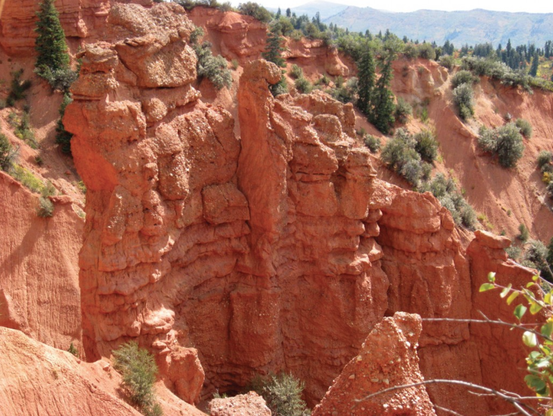
Citing the bedrock composition as a key to vortex energy sounds legitimate and scientific. It’s not difficult to find many ghost hunters or UFO seekers citing the presence of limestone or quartz (and sometimes iron or gold) in the underlying rock as the catalyst that amplifies the earth’s energy to power paranormal activity. Their vague reasoning asserts that limestone or quartz more effectively channels or concentrates the energy. This may sound technical, but it’s science fiction to geologists. Limestone and quartz-containing bedrock (commonly, sandstone or granite) are ubiquitous in the crust and have been widely evaluated for their physical properties for all sorts of uses. There is nothing inherent in these rock types linked to the generation or focusing of physical or mystical energy. (Concepts of piezoelectricity, telluric currents, or conductivity are regularly abused for this purpose.) Tellingly, most paranormalists who proclaim this bedrock connection never check their local geological map. Sometimes neither limestone nor quartz is present. (To wit: shale and basalt are also ubiquitous.)
Another geological claim is that magnetic or gravitational anomalies in the crust fuel the energy vortex. There are maps of such anomalies around the globe. Magnetic anomalies are local variations in the earth’s magnetic field on the surface caused by differences in chemistry and magnetism of materials under the surface. Gravity anomalies are differences between the locally observed and the theoretically calculated value of gravity that reflects local variations in the density of the underlying rocks. These features are dictated by geological structure. For example, anomalies will appear in areas where the bedrock deviates from average density or composition because of ore bodies, or tectonic features. It’s just not mysterious. Such anomalies do not cause a human physiological response, regardless of the claims. This is well-established; to claim otherwise is delusory.
Popular paranormal vortices
Let’s take a look at a few common locations said to be paranormal vortices. These include so-called “mystery spots”, a few other designated triangular areas, and zones of “high strangeness” where all kinds of weird observations are reported.
Oregon Vortex: The location of the House of Mystery in Gold Hill, Oregon. Opened to the public as a tourist attraction in 1930, the location is advertised as an area of unique phenomena where “everyday physical facts are reversed” because of a spherical force field. It was the nation’s first “mystery spot” roadside attraction typically consisting of crooked buildings that create optical illusions against the landscape. Though there are self-published research findings for the Oregon Vortex, none of it is solid and the work is considered to be pseudoscience.
House of Mystery at the Oregon VortexSanta Cruz Mystery spot: A tourist attraction near Santa Cruz, California since 1939 featuring a tilted house enhanced by sloped land. The original owner was inspired by the Oregon Vortex attraction. The site has accumulated legends and exaggerated stories about the disconcerting effects. Many other similar tourist spots like this have been built around the country after the initial mystery spots gained attention from traveling families. While it is true that the site can be disorienting, the cause is not paranormal energy.
Sedona, AZ: Likely the most famous area of “energy vortexes” in the world. Several “positive” vortex areas are said to exist around Sedona that supposedly promote a sense of well-being, healing, high emotion, spiritual awareness, feeling of connection to the universe, and sometimes even visions. The energy is also said to manifest in signs such as twisted trees and light anomalies. The town is blessed with amazing climate and incredible erosional features carved into the red rock formations. The Oak Creek Canyon leading to Sedona is one of the few stream valleys in Arizona that flows all year. The location always served as a draw for artists, retirees and people seeking quiet and natural scenic beauty. The focus on spirituality began in the 1940s. By the 1960s, new age religious leaders were capitalizing on the location, seeking special cosmic energy there. The first use of the term “vortex” in reference to Sedona may have been around 1980. Sedona as a “vortex energy center” culminated in 1987 when thousands came for the harmonic convergence of the planets. Since then, the town jumped onboard the “vortex” theme. Several commercial ventures, from stores, resorts, and guided tours capitalize on exposing tourists to the vortex locations. There is no doubt that there is something “special” about this place – it’s jaw-droppingly gorgeous. It feels sacred and magical for very non-paranormal reasons. As with other vortex areas, there is no unique “energy” measurement that can be demonstrated here. Any unusual observation, however, is gleefully claimed to be the result of a vortex.
Gallery: Infamous Bell Rock in Sedona (top left). Next (middle left) is a camera light anomaly captured by the author but what some would call a “light vortex”. The Sedona Crystal Vortex (lower left) is one of the many New Age shops in Downtown Sedona that capitalized on its mystical reputation. A twisted desert juniper tree near the base of Bell Rock (right). All photos by S. Hill.
Glastonbury, UK: A town in Somerset, England that has evidence of occupation for thousands of years and has accumulated extensive colorful legends. Glastonbury is recognized as a key location for the development of “New Age” beliefs. The place is said to be sacred and magical. Some reasoned that its specialness comes from the vortex energy derived from the intersection of ley lines that occurs here.
Bermuda Triangle: The first recognized “vortex”. The mysterious phenomenon of the location is still hyped by paranormal writers who erroneously claim that disappearances of ships and planes must have a more dramatic cause other than mechanical troubles, human error, or rough seas and storms.
Dragon’s Triangle: Said to be a “twin” area of the Bermuda Triangle off the coast of Japan where vessels disappear. In 1953, the research ship No. 5 Kaiyo Maru was sunk in the “Devil’s Sea” area after encountering an erupting undersea volcano. While this was undoubtedly an unusual incident, it was not mysterious. The remains of the ship were positively identified in the area where the submarine volcano exploded. The claims about missing boats or aircraft were real, but exaggerated by mystery mongers like author Charles Berlitz who wrote about both triangle areas and other paranormal subjects. Not everyone looked at the statistics and facts, certainly not Berliz who cherry-picked and inflated certain events to bolster the mystery.
For a time, the Great Lakes (Lake Michigan) Triangle was also considered an especially dangerous area for ships. But, as with other deep water areas, the disappearance of vessels might be immediately undetermined but usually not so mysterious.
Paranormal Triangles: Drawing triangles is easy; you simply need three points of reference. Paranormalists who conclude that certain areas have more than the usual number of weird experiences and phenomena sometimes refer to locations as areas of “high strangeness”. If a triangle can be drawn, a catchy name can be given and the weird stories multiply. “Weird” areas with a concentration of reports of UFOs, monsters, ghosts, demonic activity, anomalous atmospheric events, strange behavior of living things, disorientation, illness, compass anomalies, deaths, and disappearances are frequently referred to as “paranormal vortex” areas. These areas may be large or localized. Famous land triangle areas include the Bridgewater Triangle in Massachusetts and the Bennington Triangle in Vermont. These are associated with disappearances, suicides, murders, earth lights, mystery aircraft sightings, the appearance of strange creatures, time slips, hauntings, and almost any other kind of creepy tale you can think of.
The trend to label areas of high strangeness and popularize them in the media is growing. Calling an area a “paranormal vortex” suggest that some mysterious and unidentified “energy” is behind the myriad of strange goings on. It enhances their reputation and makes people far more curious about them. Examples include Skinwalker Ranch and the greater Uinta basin in Utah, San Luis Valley, California, Mt Shasta, California, and Dulce, New Mexico.
Places that seem even a bit unusual or have a mysterious history – such as Ringing Rocks in Pennsylvania, the Hudson River Valley of New York, and the Superstition Mountains of Arizona – are also called vortex areas by some paranormal enthusiasts. The application of the term “vortex” to describe areas of paranormal activity is vague and inconsistent because there is no concrete phenomenon to pin down. Ghost hunters will invoke the term to describe any localized incident where they felt strange, had equipment malfunction or recorded environmental anomalies. For a few years, paranormal investigators who took flash photographs with cameras would catch illuminated swirls and call them “vortexes” of paranormal energy.
Conclusion on the paranormal vortex
The concept of vortex areas as zones of paranormal or spiritual energy forces remains popular today even though the evidence points strongly to the vortices being imaginary constructs developed and propagated by creative people. Vile vortices ended up being a debased device to explain everything paranormal but nothing verifiable in a particular location. Mathematic and geometric attempts to quantify a paranormal area failed because the earth is not based on a design – its near-surface is complex and heterogeneous, and the subjective data didn’t stand up to scrutiny.
Humans are fantastic at identifying patterns in occurrences and making spurious correlations that aren’t connected to the real cause, especially if those means result in media attention or attract tourist dollars. Paranormalists rely on vague, subjective feelings, weak data, speculation, and dramatic scary stories to convince an audience of their claims, all of which have been used to promote vortex areas. The energy or paranormal vortex is a handy way to combine odd experiences into a location and attempt to explain them. Inventive writers and businesspeople played up spiritual and sciencey themes to enhance mystery and magic in the world.
As great as it would be to discover an energy vortex and pin down the cause of so-called paranormal activity, the evidence supporting vortices as a particular, genuine feature of earth fizzled out.
Bibliography
In addition to the inline reference links above, the following sources were used.
Dunning, Brian Skeptoid Podcast “The Bermuda Triangle and the Devil’s Sea.” 20 Nov 2012. https://skeptoid.com/episodes/4337
Dunning, Brian Skeptoid Podcast “The Sedona Energy Vortex.” 11 Jun 2013. https://skeptoid.com/episodes/4366.
Kusche, Larry. The Bermuda Triangle Mystery Solved. 1995.
Litster, John. The Oregon Vortex. 1960.
Sanderson, Ivan T. “The 12 Devil’s Graveyards Around The World” Reprint from SAGA UFO report Special 1973.
“Sedona History” https://www.sedonaaz.gov/home/showdocument?id=34040
“Vile Vortices” from The Paranormal Encyclopedia https://www.paranormal-encyclopedia.com/v/vile-vortices/
#BermudaTriangle #DevilPlaces #DevilSSea #DragonTriangle #energyVortex #highStrangeness #leyLines #limestone #mysteriousPlaces #Paranormal #paranormalPlaces #paranormalVortex #quartz #SpookyGeology #vileVortices https://sharonahill.com/?p=7351