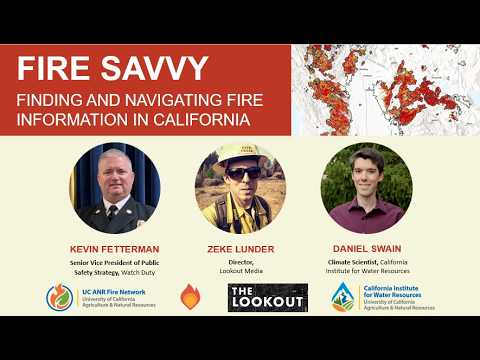
Fire Savvy: Finding And Navigating Fire Information in California Webinar
#Wildfire #Wildfires #California #CAWildfire #cawildfires www.youtube.com/watch?v=Nsul...
Fire Savvy: Finding And Naviga...
Fire Savvy: Finding And Naviga...
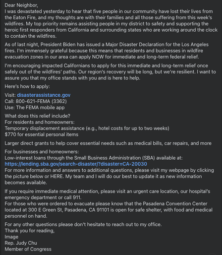
From congressional rep Judy Chu encouraging #CAWildfire victims to apply for this immediate and long-term relief once safely out of the wildfires’ paths.
Visit: disasterassistance.gov
Call: 800-621-FEMA (3362)
Use: The FEMA mobile app
What does this relief include?
For residents and homeowners:
Temporary displacement assistance (e.g., hotel costs for up to two weeks)
$770 for essential personal items
Larger direct grants to help cover essential needs such as medical bills, car repairs, and more
For businesses and homeowners:
Low-interest loans through the Small Business Administration (SBA) available at: https://lending.sba.gov/search-disaster/?disaster=CA-20030
There is now some MODIS/VIIRS heat detection data for the #MountainFire, Ventura County, CA. However, the fire is moving fast and the fire front has moved *much* further SW'ly than that satellite data.
So right now there is no reason to post a MODIS/VIIRS map and doing so might mislead people as to the fire's location and danger people in that area might be in.
#CAfire #CAwildfire #CAwx
Umm. Hi.
Been away a minute.
Is #cawildfire / #wildfire / #cawx stuff happening here anymore?
Was out at the #SitesFire today for #abc10.
The people in Leesville, #California - a rural community of ranchers- were spared the loss of their homes.
Our story from #ColusaCounty today: https://youtu.be/Fnkl6hudkc4?si=Euo8as6NFf0BJnMS

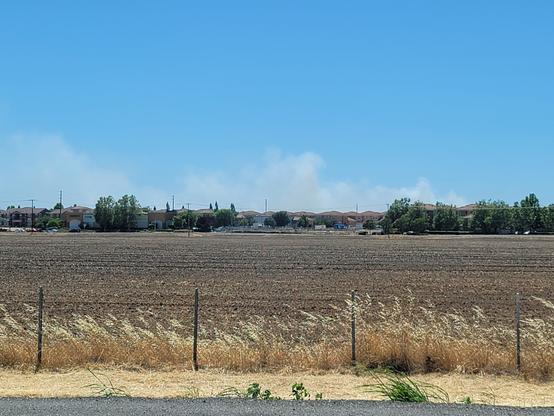
Huh. Driving slow bc traffuck sb on I5 into Sacramento, looking west towards the Bay just south of the curve in the road after the airport, and saw this.
Not the right placement for the fire near Tracy I dont think, so I think uh. New start? Doesn't look right for a building fire. Have seen at least three fire vehicles go howling up NB. #fire #wildfire #cawildfire #cafire @ai6yr (location when pic taken approx just after I5 & 99 join thru Sacramento.)
#SchoolFire near #Maricopa in Kern County. approx 100 acres, moving fast. Requesting 2 Air Tankers and 2 additional copters - Per IC.
Incident Command has requested Evacuation Warnings for Zones 289 and 291
July 15 6pm PDT. Interactive #GIS map.
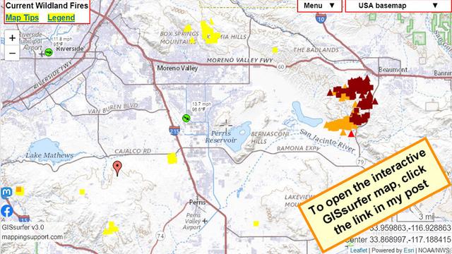
Dark red symbols are latest MODIS/VIIRS satellite *heat* detection for #RabbitFire Riverside County, CA.
Red marker is general location of #GavilanFire. Too new to show up in the MODIS/VIIRS data.
Green symbol (clickable) near map center has some near real time weather data.
#CAfire #CAwx #CAwildfire #Geospatial #Maps #Mapping #Leaflet #ArcGIS #WebMap
Open #GISsurfer map:
https://mappingsupport.com/p2/gissurfer.php?center=33.850801,-117.191162&zoom=11&basemap=USA_basemap&overlay=State_boundary,MODIS_7_day,VIIRS_7_day,Forecast_discussion,Wind_temperature_and_more...&data=https://mappingsupport.com/p2/special_maps/disaster/USA_wildland_fire.txt||33.811674,-117.339477
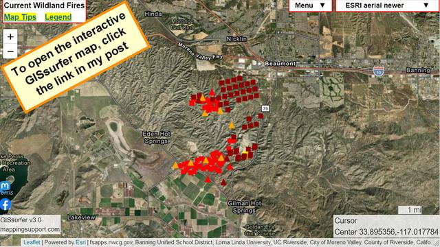
July 15 1:38pm PDT. Interactive #GIS map shows latest MODIS/VIIRS satellite *heat* detection for #RabbitFire Riverside County, CA. The uniform pattern suggests that some of this data may (or may not) be "false positive".
The map has a lot of fire related layers you can turn on. Need help? Click “Map tips” upper left corner.
#CAfire #CAwx #CAwildfire #Geospatial #Maps #Mapping #Leaflet #ArcGIS #WebMap
Open #GISsurfer map:
https://mappingsupport.com/p2/gissurfer.php?center=33.895356,-117.017784&zoom=12&basemap=ESRI_aerial_newer&overlay=VIIRS_7_day,MODIS_7_day,Wildland_fire_name,Fire_perimeter_NIFC&data=https://mappingsupport.com/p2/special_maps/disaster/USA_wildland_fire.txt