Beautiful weather for takeoff from Arad International airport (Romania) “LRAR 130730Z 19006KT CAVOK 10/04 Q1021” : See what it means on https://www.bigorre.org/aero/meteo/lrar/en #aradinternationalairport #airport #arad #romania #lrar #arw #metar #aviation #aviationweather #avgeek vl
Beautiful weather for takeoff from Arad International airport (Romania) “LRAR 121000Z 17012KT CAVOK 12/05 Q0990” : See what it means on https://www.bigorre.org/aero/meteo/lrar/en #aradinternationalairport #airport #arad #romania #lrar #arw #metar #aviation #aviationweather #avgeek vl
Aviation weather for Arad International airport (Romania) is “LRAR 310900Z 22003KT 160V270 9999 FEW040 21/11 Q1022” : See what it means on https://www.bigorre.org/aero/meteo/lrar/en #arad #romania #aradinternationalairport #lrar #arw #metar #aviation #aviationweather #avgeek #airport vl
#EAS #WEA for Baxter, #AR; #Izard, #AR; #Searcy, #AR; #Stone, #AR; #Van Buren, #AR: National Weather Service: #TORNADO WARNING in this area until 9:45 PM CDT. Take shelter now in a basement or an interior room on the lowest floor of a sturdy building. If you are outdoors, in a mobile home, or in a vehicle, move to the closest substantial shelter and protect yourself from flying debris. Check media. Source: NWS Little Rock AR #Baxter, #AR; #Izard, #AR; #Searcy, #AR; #Stone, #AR; #Van Buren, #ARw
@Teknovis Lose the triple lock, massively boost spending on personnel and equipment e.g.
* Primary Radar
* Navy
* #jas39gripen fighters (better suited to our needs then the F35s)
* Nurture and support the #ARW Army Ranger Wing, since they are already hugely capable
* Primary Radar
* Navy
* #jas39gripen fighters (better suited to our needs then the F35s)
* Nurture and support the #ARW Army Ranger Wing, since they are already hugely capable
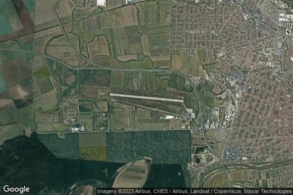
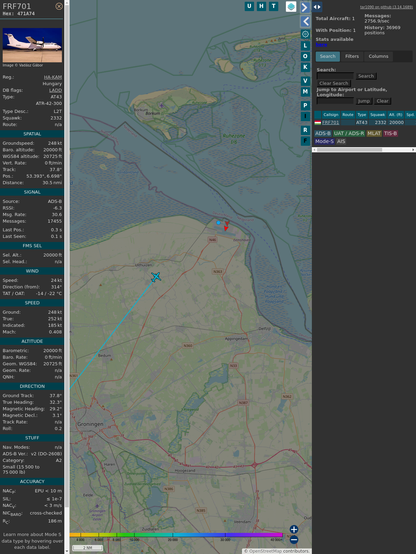
ICAO: 471A74
Flt: FRF701 #FLEETAIRINTERNATIONAL #ARW-#KTW
First seen: 2024/11/29 10:04:02
Min Alt: 6086 m AGL
Min Dist: 24.29 km
https://globe.adsbexchange.com/?icao=471a74&lat=52.836697&lon=5.830209&zoom=12&showTrace=2024-11-29
#adsb #aboveFRL #EHLW
BULLETIN - IMMEDIATE BROADCAST REQUESTED
NWS Little Rock AR
855 AM CDT Fri Jul 21 2023
* Severe Thunderstorm Warning for...
West central Lonoke County AR
N Grant County AR
NW Jefferson County AR
SE Saline County AR
SE Pulaski County AT
* Until 945 AM CDT.
* At 855 AM CDT, severe thunderstorms were located along a line
extending from Little Rock to Southwest Little Rock to near Bryant
to near Benton, moving southeast at 20 mph.
Special Weather Statement
National Weather Service Little Rock AR
603 PM CDT Thu Apr 20 2023
ARZ004-005-113-313-202345-
Baxter AR-Marion AR-
Eastern, Central, and Southern Searcy County Higher Elevations AR-
Searcy County Lower Elevations AR-
603 PM CDT Thu Apr 20 2023
...Strong thunderstorms will impact portions of northern Searcy,
southeastern Marion and central Baxter Counties through 645 PM CDT...
Screen shot of Fox Weather severe weather potential.

FOX Weather Live: Expert Analysis, Accurate Forecasts, and Real-Time Updates
#Weather #SevereWeather #Arkansas #ARWeather #ARw #Mississippi #MSWeather #MSwx #Tennessee #TNWeather #TNwx #NWS
H/T @nwswpc_bot https://m.ai6yr.org/@nws_bot/110120599273752688

NWS (bot) (@[email protected])
The tornado threat increasing over the next few hours for central Arkansas, far northwestern Mississippi, and far southeastern Tennessee. nitter.net/NWSSPC/status/1641947505381474304#m