426 Followers
248 Following
142 Posts
UW Madison Geography, opinions are mine. Geomorphology, soils, dunes, loess, in the Midwest, Great Plains, northern China. Living on Ho-Chunk lands
Websitehttps://joseph.a.mason.github.io
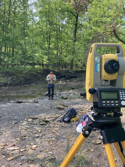
Surveying stream beds (and trash) earlier this week. I can’t wait to see how the surveys compare to the ones we did last summer, because my eyes tell me there were some changes at most of our sites. #FieldWorkFriday #FieldPhotoFriday #urbanStream #TrashyStreams
Zooming in to show the dune forms that appear at different scales.
Sand drifting toward the Atlantic in beautiful, complex dunes, past the Richat Structure. Mauretania and Western Sahara. #Sentinel2, Feb 25, 2023
Same perspective on the same landscape, but with stream network generated by DepressionBreach and StreamExtract in #Whitebox Tools, virtually identical the r.watershed result. Part of an effort to characterize drainage networks on these landscapes and compare them to results of landscape evolution modeling
Perspective view of a loess landscape in central Nebraska, with large closed wind-eroded depressions surrounded by stream-dissected terrain. Topography from 1 m #lidar DEM. Blue lines are the stream network generated by the r.watershed tool in GRASS GIS, not entirely realistic but better than many other algorithms for this, it seems. Note effects of road embankments, ditches, and field terraces, all captured by lidar data.
Thick loess southwest of Broken Bow, Nebraska, sculpted by wind erosion and dissected by streams. Previous research shows coarse late Pleistocene loess in this region can be directly entrained by winds below the threshold for aeolian sand mobility. Troughs and narrow ridges are oriented NW-SE, typical of all large-scale deflation features in Central Plains loess. 3D perspectives created with #rayshader
Sediment plume from the Russian River, northern California, January 9, 2023. Sentinel 2 image.
@Brad_Rosenheim 2100 by 1340 meters (2 m DEM)
Taking a careful look at a small loess table, in the Loess Canyons area of southwest Nebraska. #rayshader
Same area and images, zoomed out. A swath of fully active dunes is south of the river, with vegetation-stabilized dunes on either side.