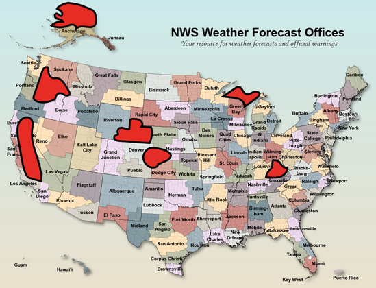
This map now includes much of California's (quite flammable) foothill & mountain areas ringing Central Valley (including Sierra Nevada west slope plus Coast Range east slopes/Shasta), a good chunk of Tornado Alley during tornado season, & most of Alaska's vast North Slope region.
I am certain that NWS meteorologists, hydrologists, and technicians from adjacent offices (many of which are now also understaffed) will (frantically and exhaustedly, especially during stressful extreme events) will do their very best to gap fill.
But that simply isn't going to cut it during a major extreme weather/wildfire event. Anyone arguing that NWS services in these regions (& likely others) are not already degraded is kidding themselves; present situation is one where lives could genuinely be lost due to these cuts.
@weatherwest The cuts will probably lead to fatalities: every so often, an unusual weather pattern brings intense storms originating from hurricanes off the coast of Mexico and going up the east side of the Sierra Nevada. Without advanced warning, some hikers/backpackers without adequate rain gear and counting on the typical nice weather inevitably get caught in it an perish due to hypothermia.
