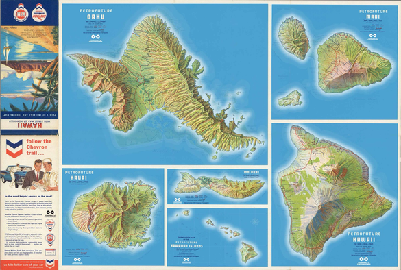
Across half the Pacific to Hawaii…the #Petrofuture maps. 
66m sea level rise — melted ice caps on a vintage Chevron gas station map. 

Higher-res images:
https://conspiracyofcartographers.com

#climateChange #maps #cartography #climateCrisis #greenWashing #Hawaii #Kauai #Maui #worldBuilding #Oahu #Molokai #HawaiianIslands #Chevron
Conspiracy of Cartographers

@ConspiracyOfCartographers this is really cool
@oceaniceternity Not so cool for those of us that will have our houses under water.
@ConspiracyOfCartographers oooops. The house I’m sitting in right now would be under water.

@ConspiracyOfCartographers Here are some more tools to visualize sea level rise:
https://freegeographytools.com/2007/animated-flooding-maps-storm-surge-sea-level-rise-and-river-flooding

Maybe a bit dated, but might not be, also.

Animated Flooding Maps – Storm Surge, Sea Level Rise And River Flooding