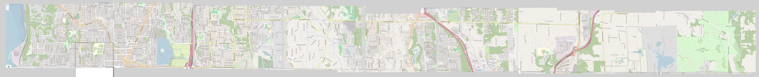
Yes, we've had _one_ Megamap, but what about ULTRA Megamap?
#BikeMap #BikeTooter #SnohomishCounty #MountlakeTerrace #Edmonds #Lynnwood #Everett #Seattle #Northshore #Seattle
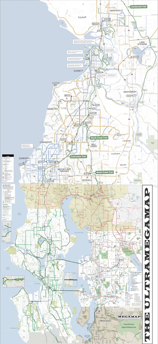
Yes, we've had _one_ Megamap, but what about ULTRA Megamap?
#BikeMap #BikeTooter #SnohomishCounty #MountlakeTerrace #Edmonds #Lynnwood #Everett #Seattle #Northshore #Seattle
I do have a point with this and it's that filling in northshore / northwest King County lets you connect a LOT of maps together and that _kinda matters_.
In social media terms, it's called the "network effect." But yes, it also applies to maps - and biking.
#BikeMap #BikeTooter #SnohomishCounty #MountlakeTerrace #Edmonds #Lynnwood #Everett #Seattle #Northshore #Seattle
I might drop a "Version 0.1 EXPERIMENTAL" of this and might not.
And I might just grab like 5-6cm of southern Snohomish and add it to the top of Greater Northshore and/or MEGAMAP, and plot my own damn infrastructure using my own legend instead.
Because I think it's valid and important to show that you _can_ get to places in Snohomish County.
But a lot of these line markers are _bullshit_. They're more about speed limits that infrastructure at best, and they make no division between "an actual attempt" and "yeah there's a parking strip" and I'm not here for that.
My map tells you what's there.
Community Transit's map says "here's where you should look to see what might be here, but also might not."
Here's what I mean. Check out this shit. Same marking, but in one place, there are bike lanes, on the other, FUCKING NOTHING except a weak-ass sidewalk.
That's _bad mapmaking_.
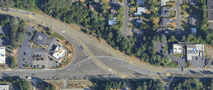
And I didn't even bother mentioning that the thin gold line east of Aurora includes a section which is LITERALLY IMPASSIBLE TO BIKES on the Snohomish County side. Absolutely impassible. (Well, unless you feel like biking on a four-lane highway that has a complex multi-crossing intersection as it diverges north.) WHY IS THAT ON THE MAP?
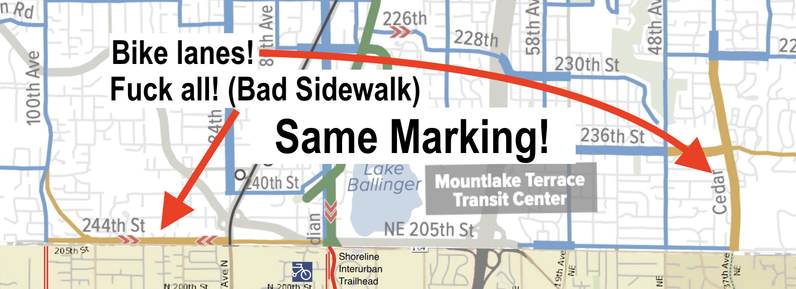
ALSO also: that green stripe between Shoreline Interurban Trailhead and Interurban North?
That's a short section of sharerow followed by honestly decent bike lanes.
WHICH ISN'T WHAT GREEN MEANS IN THEIR OWN LEGEND.
Green bar means "Biking / walking trail," not "sharerow and bike lanes."
Anybody up there want to get on Community Transit about all this because holy crow I don't think I can use this as much as I honestly do kinda want to.
This is the thing I was calling impassible. If you're on the Snohomish County side of this line, you're on the north, which is up in this image.
yeah. that's bikeable.
OKAY FINE I'LL MAKE MY OWN MAP
WITH SNOGIS
AND SCREENCAPS
AND BEING FASTER THAN THEIR MASKING SOFTWARE THAT TRIES TO SCREW UP MY SCREENCAPS