Pick A Lane
Description: Where The 23 meets The 101, you need to pick a lane.
Location: Ventura County, California, USA, North America
Photograph copyright Peter West Carey. All rights reserved
https://thecareyadventures.com/blog/pick-a-lane/
#California #Featured #NorthAmerica #PhotoOfTheDay #USA #aerial #AerialPhotography #California #freeway #highway #Highway101 #mountains #PhotoOfTheDay #Photography #The101 #The23 #ThousandOaks #travel


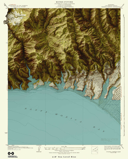
Not to be outdone by the previous map to the east, here's the 1952 #USGS #Goleta quad, just west of Santa Barbara.
A different kind of flooding...66m of sea level rise—if all the world’s ice caps melted.
#santabarbara #montecito #ucsb #pch #the101 #santaynezmountains #vintagemaps #oldmaps #retrofuture #steampunk #solarpunk #shadedrelief #searisemaps #sealevelrise #sealevelrisemaps #climatechange #climatechangemaps #maps #cartography #speculativecartography #conspiracyofcartographers

A different kind of flooding...Santa Barbara retrofuture…this is a USGS quad from 1952, with 218’ of sea level rise—if all the world’s ice caps melted.
#santabarbara #montecito #ucsb #pch #the101 #lamesa #santaynezmountains #vintagemaps #coolmaps #oldmaps #retrofuture #steampunk #3dterrain #shadedrelief
#searise #searisemaps #sealevelrise #sealevelrisemaps #climatechange #climatechangemaps #maps #cartography #speculativecartography #speculativemaps #conspiracyofcartographers

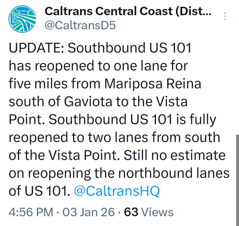
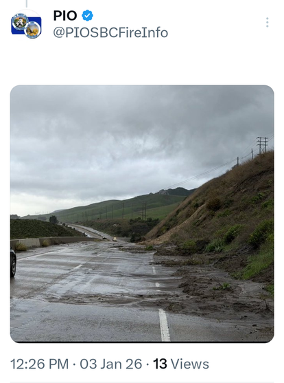
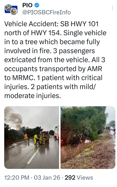
Today was a bad day to drive 250 miles down #the101 with the family in a rented car, from #MLA23 to Santa Barbara. We made it home all right, but lots of flooding, exit closures, and cautious maneuvers. A midway rest at the unique/bizarre #MadonnaInn in #SanLuisObispo proved vital.
Los Angeles Retrofuture... 1920s Topanga Canyon USGS Quad with 66m of sea level rise.
https://conspiracyofcartographers.com/retrofuture-gallery/
1/6
#losangeles #pacificpalisades #topangacanyon #topangabeach #santamonica #pch #the101 #101 #palisadesbeach #malibu #vintagemaps #coolmaps #oldmaps #retrofuture #steampunk #3dterrain #shadedrelief
#searise #searisemaps #sealevelrise #sealevelrisemaps #climatechange #climatechangemaps #maps #cartography #speculativecartography #speculativemaps #conspiracyofcartographers