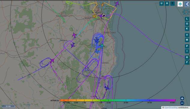
Hey #plane bubble, is there any existing solution to store #ADSB using #tar1090 toolchain for longtime playback of all the surrounding plane movements? And to query it to get all flights within certain height, time patterns, ...? Preferably something to feed trajectories into #QGIS or #movingpandas ?
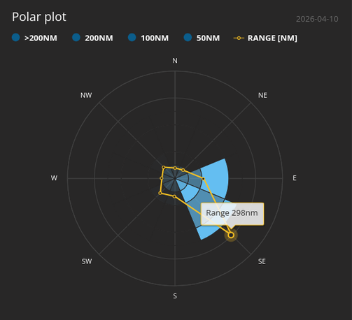
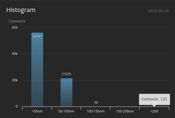
There were further contacts and the range went out to 298nm yesterday evening. I've added the range at 40000ft to my map and I don't have anywhere near that with line of sight to the SE.
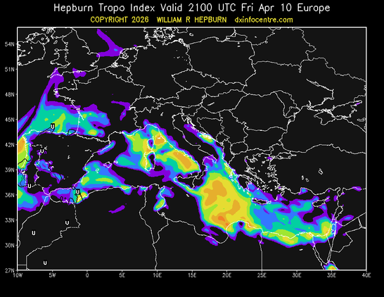
So I'm thinking misconfiguration or tropospheric ducting. Forecasts suggest the latter was marginal to fair to the SE of me yesterday evening.
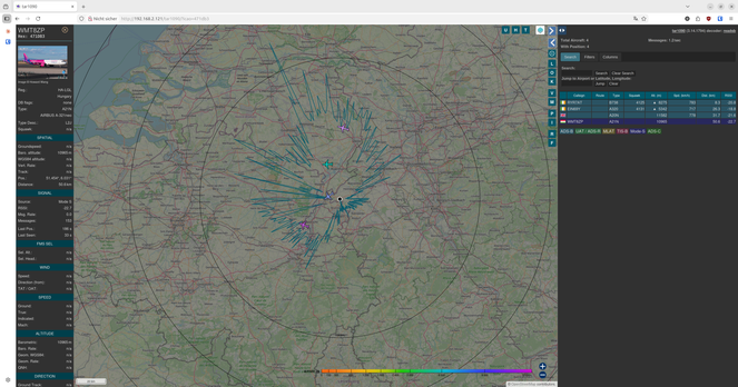
I've turned on #tar1090 on my laptop and increased the history to 24 hours, just in case it happens again, I can identify the plane. #adsb ✈️ 📡 🤷♂️