RE: https://mapstodon.space/@kylebarron/116579175217460870
Again, fantastic work from @kylebarron and @developmentseed. Cant wait to get my hands dirty and make this available for #rstats #rspatial
RE: https://mapstodon.space/@kylebarron/116579175217460870
Again, fantastic work from @kylebarron and @developmentseed. Cant wait to get my hands dirty and make this available for #rstats #rspatial
Kyle Walker: “Lots of new features landing in R's mapgl package as it approaches an 0.5.0 release. Today's drop:
- An interactive color ramp picker for your legends
- Native bivariate choropleth mapping”
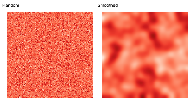
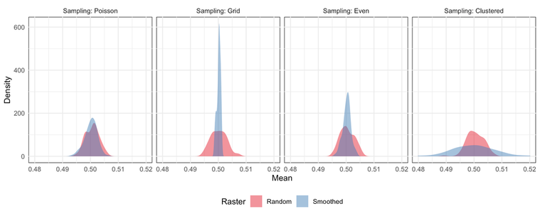
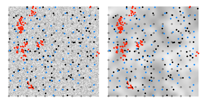
David O’Sullivan shows how spatial autocorrelation makes sampling fundamentally important: even when two surfaces contain the same values, their spatial arrangement means different sampling schemes can “see” very different patterns 🗺️
URL: https://geospatialstuff.com/posts/2025/11/14/gia-chapter-2A-spatial-autocorrelation/index.html
The new version of the terra package is now available on CRAN! It includes several notable new features:
- tool for parallelize functions on a raster: `tile_apply()`,
- smooth blending between overlapping rasters: `mosaic(fun = "blend")`,
- hexagonal and rectangular grids: `tessellate()`,
- custom CRS transformation pipelines in `project()`,
- and fixes for many long-standing issues!
Read the full changelog here: https://rspatial.github.io/terra/news/index.html#version-19-24
R package gdalraster has been updated on CRAN. The package provides comprehensive API bindings to GDAL. v2.6.0 is a feature release with full changelog at:
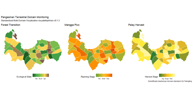
Sharing #Philippines beauty via my latest package {palettephines} on CRAN. These palettes anchor to BBCH & Reef Health standards.
3 years in public office taught me that viz must be both statistically and culturally relevant to my people.
Not a replacement for LISA/Moran’s I in EDA, but a domain-specific layer.
Vignette: https://pinasr.r-universe.dev/articles/palettephines/palettephines-intro.html
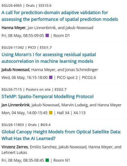
🚂 Looking forward to attending #EGU26 next week and contributing several works on spatial prediction and machine learning.
If you are attending, I would be glad to connect and discuss related work -- feel free to reach out.