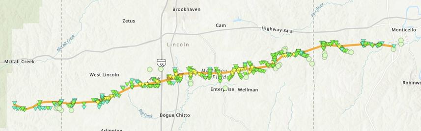
#NWS #flood #nwsflashflood #FlashFloodWarning Flash Flood Warning for Walthall, MS #MSwx
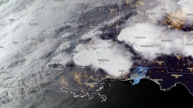
At 721 AM CDT, Doppler radar and automated rain gauges indicated
thunderstorms producing heavy rain across the warned area. Between 2
and 3 inches of rain have fallen. Additional rainfall amounts up to
1 inch are possible in the warned area. Flash flooding is ongoing or
expected to begin shortly.

HAZARD...Flash flooding caused by thunderstorms.

SOURCE...Radar and automated gauges.

IMPACT...Flash flooding of small creeks and streams, urban areas,
highways, streets and underpasses as well as other poor
drainage and low-lying areas.

Some locations that will experience flash flooding include...
Dexter.

#NWS #flood #nwsflashflood #FlashFloodWarning Flash Flood Warning for Amite, MS; Pike, MS; Walthall, MS; Wilkinson, MS #MSwx
At 633 AM CDT, Doppler radar and automated rain gauges indicated
thunderstorms producing heavy rain across the warned area. Between 2
and 3 inches of rain have fallen. Additional rainfall amounts up to
1 inch are possible in the warned area. Flash flooding is ongoing or
expected to begin shortly.

HAZARD...Flash flooding caused by thunderstorms.

SOURCE...Radar and automated gauges.

IMPACT...Flash flooding of small creeks and streams, urban areas,
highways, streets and underpasses as well as other poor
drainage and low-lying areas.

Some locations that will experience flash flooding include...
Liberty, Magnolia, Centreville, Tylertown, Gillsburg and Dexter.

This includes the following Interstate...
Interstate 55 in Mississippi between mile markers 2 and 11.

#NWS #flood #nwsflashflood #FlashFloodWarning Flash Flood Warning for Amite, MS; Pike, MS; Walthall, MS; Wilkinson, MS #MSwx
FFWLIX

The National Weather Service in New Orleans has issued a

* Flash Flood Warning for...
Amite County in southern Mississippi...
Pike County in southern Mississippi...
Walthall County in southern Mississippi...
Eastern Wilkinson County in southern Mississippi...

* Until 945 AM CDT.

* At 541 AM CDT, Doppler radar and automated rain gauges indicated
thunderstorms producing heavy rain across the warned area. Between
2 and 3 inches of rain have fallen. Additional rainfall amounts of
1 to 2 inches are possible in the warned area. Flash flooding is
ongoing or expected to begin shortly.

HAZARD...Flash flooding caused by thunderstorms.

SOURCE...Radar and automated gauges.

IMPACT...Flash flooding of small creeks and streams, urban
areas, highways, streets and underpasses as well as
other poor drainage and low-lying areas.

* Some locations that will experience flash flooding include...
Mccomb, Liberty, Magnolia, Summit, Centreville, Tylertown,
Woodville, Gloster, Gillsburg, Smithdale, Salem, Dexter, Crosby
and Mccomb Airport.

This includes the following Interstate...
Interstate 55 in Mississippi between mile markers 2 and 24.

RT: @JordanHallWX A VERY detailed damage track from the Brookhaven, MS Tornado Emergency EF-3
#mswx #wxtwitter

RT from Jordan Hall (@JordanHallWX)

A VERY detailed damage track from the Brookhaven, MS Tornado Emergency EF-3
#mswx #wxtwitter

Violent tornadoes spatter debris across Mississippi

Multiple homes have been destroyed and injuries reported as at least two violent, destructive tornadoes tore through parts of Mississippi on Wednesday, prompting rare “particularly dangerous situation” tornado emergency warnings and search and rescue efforts in some of the hardest-hit areas. #weather #tornado #MSwx
https://www.cnn.com/2026/05/07/weather/video/brookhaven-mississippi-tornado-hnk-digvid

Debris blocks parts of highway after violent tornado | CNN

Video shows several trees toppled and blocking parts of a highway near the intersection of US 84 and Interstate 55 in Brookhaven, after a violent tornado tore through southwest Mississippi.

CNN

@ai6yr For info.

Tornado Emergency issued as large tornado hits Brookhaven area, Mississippi

A large, destructive tornado moved through the Brookhaven area of southern Mississippi during the evening of May 6, 2026, after the National Weather Service in Jackson issued a Tornado Emergency for communities including Brookhaven and Bogue Chitto. The event developed within an SPC Enhanced Risk severe weather setup and produced repeated radar-confirmed Tornado Debris Signatures as the storm moved from Franklin County into Lincoln County and toward Lawrence County. #weather #tornado #MSwx
https://watchers.news/2026/05/07/tornado-emergency-issued-tornado-brookhaven-mississippi-may-6-2026/

Tornado Emergency issued as large tornado hits Brookhaven area, Mississippi

A large, destructive tornado moved through the Brookhaven area of southern Mississippi during the evening of May 6, 2026, after the National Weather Service in Jackson issued a Tornado Emergency for…

The Watchers

#NWS #flood #nwsflashflood #FlashFloodWarning Flash Flood Warning for Covington, MS; Jones, MS #MSwx
FFWJAN

The National Weather Service in Jackson has extended the

* Flash Flood Warning for...
Northeastern Covington County in southeastern Mississippi...
Northern Jones County in southeastern Mississippi...

* Until 230 AM CDT.

* At 1202 AM CDT, Doppler radar indicated thunderstorms producing
heavy rain across the warned area. Between 3 and 6 inches of rain
have fallen. Additional rainfall amounts of 1 to 2 inches are
possible in the warned area. Flash flooding is ongoing or expected
to begin shortly.

HAZARD...Flash flooding caused by thunderstorms.

SOURCE...Radar.

IMPACT...Flash flooding of small creeks and streams, urban
areas, highways, streets and underpasses as well as
other poor drainage and low-lying areas.

* Some locations that will experience flash flooding include...
Laurel, Sandersville, Soso, Hebron and Mill Creek.

#NWS #flood #nwsflashflood #FlashFloodWarning Flash Flood Warning for Franklin, MS; Lawrence, MS; Lincoln, MS #MSwx
FFWJAN

The National Weather Service in Jackson has extended the

* Flash Flood Warning for...
Northwestern Lawrence County in south central Mississippi...
Central Lincoln County in south central Mississippi...
Northeastern Franklin County in southwestern Mississippi...

* Until 230 AM CDT.

* At 1203 AM CDT, Doppler radar indicated thunderstorms producing
heavy rain across the warned area. Between 3 and 5 inches of rain
have fallen. Additional rainfall amounts of 1 to 2 inches are
possible in the warned area. Flash flooding is ongoing or expected
to begin shortly.

HAZARD...Flash flooding caused by thunderstorms.

SOURCE...Radar.

IMPACT...Flash flooding of small creeks and streams, urban
areas, highways, streets and underpasses as well as
other poor drainage and low-lying areas.

* Some locations that will experience flash flooding include...
Brookhaven, Monticello, Enterprise, East Lincoln, Loyd Star,
Vaughn, West Lincoln, Sontag, Mccall Creek and Wanilla.

#NWS #flood #nwsflashflood #FlashFloodWarning Flash Flood Warning for Covington, MS; Jefferson Davis, MS; Lawrence, MS #MSwx
FFWJAN

The National Weather Service in Jackson has issued a

* Flash Flood Warning for...
Northwestern Jefferson Davis County in south central Mississippi...
Northeastern Lawrence County in south central Mississippi...
Northwestern Covington County in southeastern Mississippi...

* Until 230 AM CDT.

* At 1138 PM CDT, trained weather spotters reported thunderstorms
producing heavy rain across the warned area. Between 3 and 6
inches of rain have fallen. Additional rainfall amounts of 1 to 2
inches are possible in the warned area. Flash flooding is ongoing
or expected to begin shortly.

HAZARD...Flash flooding caused by thunderstorms.

SOURCE...Trained spotters reported. Flash flooding was reported
along Highway 49 south of Mount Olive.

IMPACT...Flash flooding of small creeks and streams, urban
areas, highways, streets and underpasses as well as
other poor drainage and low-lying areas.

* Some locations that will experience flash flooding include...
Collins, Prentiss, Mount Olive, Silver Creek, Clem, Lone Star,
Progress and Arm.