It's #MapMonday !

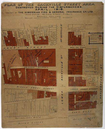
This is a map of the #GPO and surrounding area issued by Hibernian Fire and General Insurance Co. Ltd, showing buildings that were destroyed or damaged by fire during Easter Week 1916.

From the Inspiring Ireland 1916 project, deposited in the DRI by the National Museum of Ireland: https://doi.org/10.7486/DRI.w089fr674

This week marks 110 years since the Easter Rising, which took place between 24 and 29 April 1916.

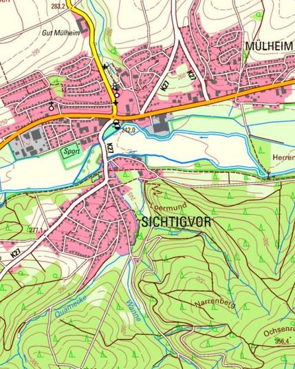
📍 Der #MapMonday führt uns nach Sichtigvor im Sauerland. Klingt ungewöhnlich, ist aber ganz bodenständig:

🏘️ 1656 gegründet, benannt nach dem „siegde Four“ 🐎, einem Fahrweg an einer seichten (niedrigen) Stelle.

#LustigeOrtsnamen #WirGebenOrientierung

Happy #MapMonday !
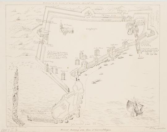
This drawing of the town of Carrickfergus is an annotated plan showing town walls, dwellings, church, and monuments. The drawing was copied from the engraving published by the Society of Antiquaries, April 23rd 1838.

From the Ordnance Survey Memoir Drawings collection, deposited in the DRI by the Royal Irish Academy as part of the 'OS200: Digitally Re-mapping Ireland’s Ordnance Survey Heritage' project.

Explore the collection: https://doi.org/10.7486/DRI.ks65x655z

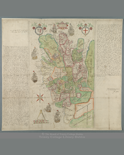
For this week's #MapMonday we're delving back into the colourful Hardiman Atlas collection with this map of the province of Munster. The map is inscribed to Lord Burleigh by Francis Jobson on 30 May 1589.
Deposited in the DRI by Trinity College Dublin.

Explore the collection: https://doi.org/10.7486/DRI.rb69b272p

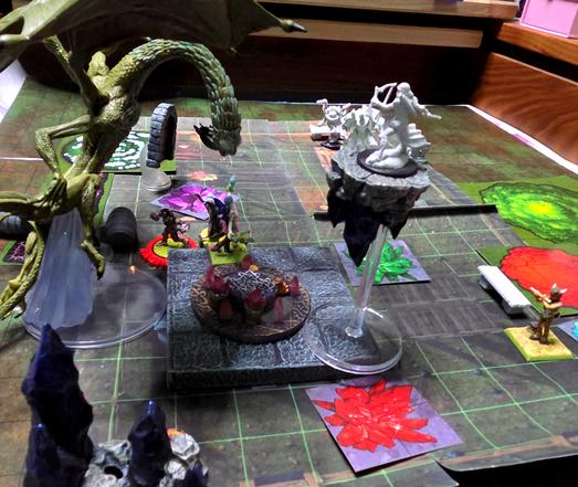
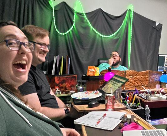
Guess which Strix U girlies had to face a horrific jabberwock.....if you dont know...might I recommend an actual play podcast for you?
#ttrpg #mapmonday #podcast

https://youtu.be/7-saCw8zEqE

It's #MapMonday !
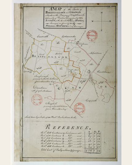
This map from the Dublin City Surveyors Maps 1695-1827 collection was created in 1780 and depicts lands at Ballycullane and Grange, in 6 numbered lots, with acreage given in a separate reference table.

The Dublin City Surveyors Maps, 1695-1827 collection documents the development of the Dublin City Estate within the original walled city.
🔎💫Explore the collection: https://doi.org/10.7486/DRI.1g05tw11q-1

#Maps #Mapping #DigiPres #DublinCity #UrbanMaps

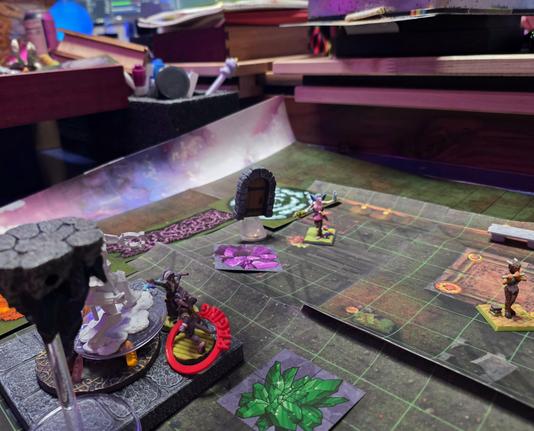
Our hive mind had so much fun playing our Strixhaven campaign yesterday!!!! There was awesome loot, scary time monsters, and really intense eye contact!

You can find all the Strix U fun wherever you listen to podcasts! #DnD #ttrpg #tabletop #dicerolling #gaming #podcasts #MapMonday

https://youtu.be/R4afNtJtCZA

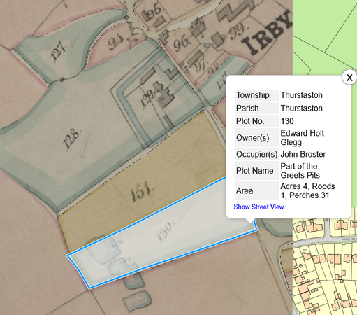
@aroundthehills The 1849 tithe map shows common ownership between 1+ of the pits and Irby Hall (NB actual moat though only 2 sides). Known as Greets Pits. Archaic "Greet" means weeping, perhaps as in spring or their overflow feeding the brook? #MapMonday

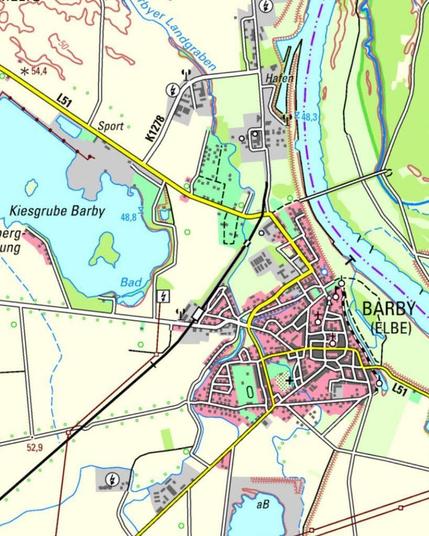
Heute am #MapMonday feiern wir Barbies Geburtstag! Und wo geht das besser, als in Barby an der Elbe? 💕

Während #Barbie Party macht, fehlt noch jemand… Wo ist Ken? 🤔 Vielleicht an der Kiesgrube. 🌊 Denn Beach kann er. 🏄‍♂️⛱️

#BarbiesBirthday #LustigeOrtsnamen

Happy #MapMonday!
This colour map of Waterford City from 1830 shows the city's parish boundaries. An index lists the street names as numbered on the map and also includes significant buildings such as the Town Hall; Cathedral; Old Courthouse; Female Blue School and others: https://doi.org/10.7486/DRI.jq08k912p