It's #MapMonday !
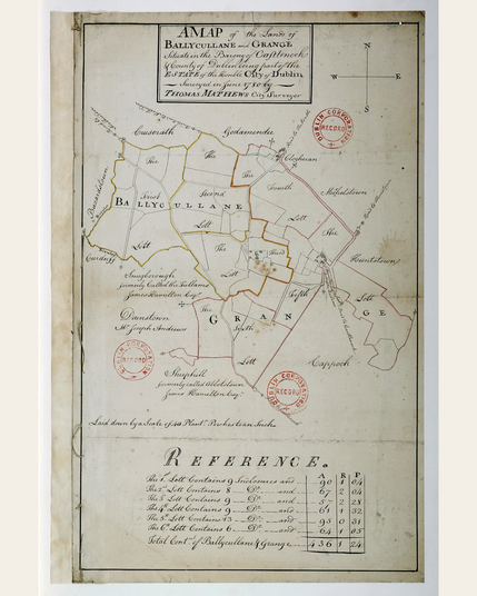
This map from the Dublin City Surveyors Maps 1695-1827 collection was created in 1780 and depicts lands at Ballycullane and Grange, in 6 numbered lots, with acreage given in a separate reference table.
The Dublin City Surveyors Maps, 1695-1827 collection documents the development of the Dublin City Estate within the original walled city.
🔎💫Explore the collection: https://doi.org/10.7486/DRI.1g05tw11q-1