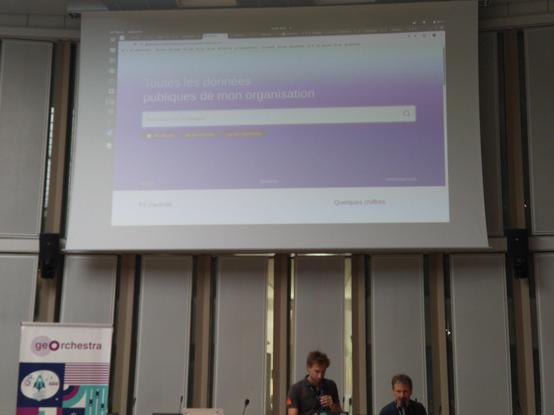
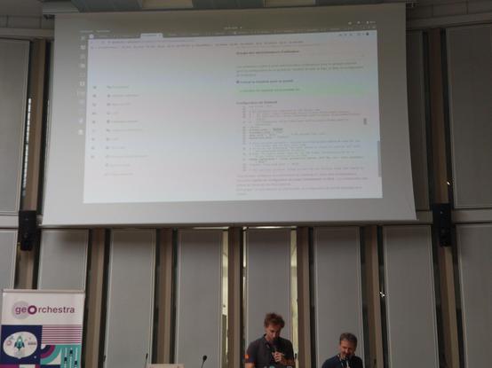
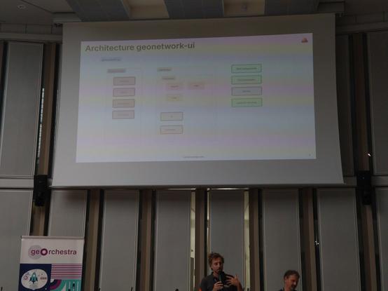
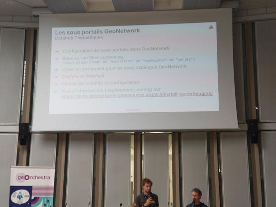
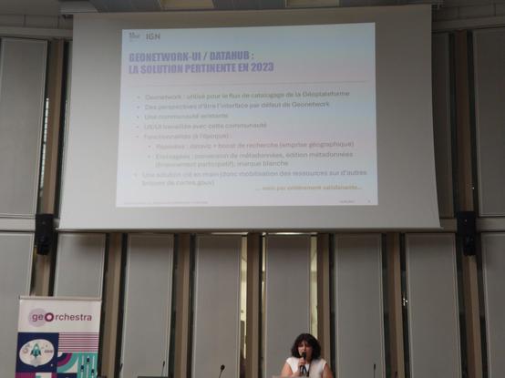
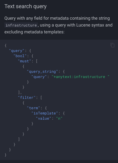
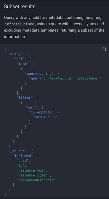
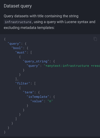
#geOcom2025 Florent Gravin et François Van Der Biest de @camptocamp font le point sur état actuel de #Datahub par sous-portails #GeoNetwork. Reste à résoudre l’utilisation de URL propre à l’instance #geOrchestra avant d'avoir des sous-portails en marque blanche.
#geOcom2025 Melodia Mohad de @ignfrance explique le choix de #Géoplateforme d'utiliser #GeoNetwork-UI / #Datahub de #geOrchestra pour l'interface de catalogue de cartes.gouv.fr.
GeoNetwork 4.4.7 Released

Here is a small demo from testing the datahub plugin: Downloading gn-datahub-integration-4.4.7-0.zip Install instructions in README.html Copy the lib folder jar files into to {GEONETWORK_DIR}/WEB-INF/lib folder. shutdown.sh cd webapps/geonetwork/WEB-INF/lib cp ~/Downloads/gn-datahub-integration-4.4.7-0/lib/*.jar . startup.sh Following instructions to configure The datahub UI appears (and includes the banner from previous demo)

OSGeo Discourse
FOSS4G 2024

GeoCat was happy to attend FOSS4G 2024 in Belém Brazil and help support the open source community in this outreach event.

GeoCat bv

@pokateo The change from mailing-lists to discourse has been slow and then sudden with @osgeo committees and projects starting to make the switch.

You are welcome to drop-in http://discourse.osgeo.org and check it out.

#osgeo #foss4g #geoserver #GeoNetwork #gischat

OSGeo Discourse

A place to discuss OSGeo projects

OSGeo Discourse

Au sein du CRAIG, la description des données est une priorité constante. C'est pourquoi nous mettons à votre disposition deux interfaces pour explorer notre catalogue de jeux de données. Choisissez celle qui correspond le mieux à vos besoins. #geonetwork #datahub

Version complète : https://ids.craig.fr/geocat/

Version simplifiée : https://ids.craig.fr/datahub/

CRAIG

Helpful #geonetwork examples of how to use Elasticsearch with record data https://docs.geonetwork-opensource.org/4.2/api/search/

Thanks to Jose from @geocat for these examples :)

(helpful for those updating scripts from GeoNetwork 3.12 which reaches end-of-life soon).

Search Service - GeoNetwork opensource (EN)

GeoNetwork catalogue for listing, searching and reviewing records.

@osgeo #geonetwork upgrade guidance - PR now merged and docs are available: https://docs.geonetwork-opensource.org/4.4/maintainer-guide/updating/

Although GeoNetwork 4 has been out for some time it was a lot of work to determine which:
1. Web services had migrated to Elasticserach
2. Web Services had been dropped (but could be migrated)
3. Services had been dropped forever (depended on Lucene engine)

Also the #mkdocs_material documentation looks good with version selector for 4.4 latest / 4.2 stable

Updating the application - GeoNetwork opensource (EN)

GeoNetwork catalogue for listing, searching and reviewing records.

Trying for one @osgeo thing a week this year:

Week 1: CRA statement
Week 2: Sponsorship statement
Week 3: #GeoNetwork 3 --> 4 Upgrade Guidance

https://github.com/geonetwork/core-geonetwork/pull/7644

Upgrade guidance for geonetwork 3 users by jodygarnett · Pull Request #7644 · geonetwork/core-geonetwork

Including mitigation guidance for removed services. This is an action item from PSC meeting documenting the information from #4727 in the user manual. I personally have questions after writing this...

GitHub

@jcarlson If using #geonetwork set up "harvest" on a daily or weekly schedule to check your webservices and manage layers added/removed.

As I understand it #STAC is halfway between a catalogue and a web feature service; which each record capturing quite detailed information about an individual image (time, sensor, angle, etc...)