Just ordered two external 8 TB drives so that I can take out my street-level imagery data from Mapillary, just in case.
Inspired by some discussions at #SOTMUS2026
Inspired by some discussions at #SOTMUS2026


I'm not a conference person. But I really, really enjoyed #SOTMUS2026
These are my people! Thanks to the @OpenStreetMapUS team for all the work that went into making it a great experience! (and the sponsors who paid for it)

RE: https://fosstodon.org/@haraldkliems/116731510618010707
Our talk today went well, and I had a lot of great conversations with other attendees! I'm loving my first #SOTMUS2026 conference. I'm pretty exhausted, but tomorrow is another day (and I'll have my second talk, on street-level imagery).
@benvarick If you can't make it: These are our slides https://haraldkliems-sotmus-2026.share.connect.posit.cloud/#/title-slide
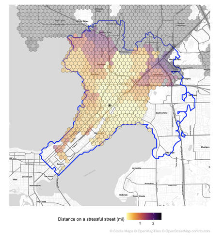
#SOTMUS2026 starts today and I'm excited. I'll meet with my co-presenter @benvarick shortly to finalize our talk. If you're interested in how we use OSM data and a variety of open source tools to create measures of bikeability of schools, join our talk tomorrow (Friday) at 1:15pm.
Oopsie, I just found out today that one of the #SOTMUS2026 talks I was co-presenting on doesn't have its main presenter anymore. Well, that's a good opportunity to pivot a little and talk about efforts to get #Panoramax off the ground in the US!