#CTP #PAwx 948
CDUS41 KCTP 042118
CLIIPT
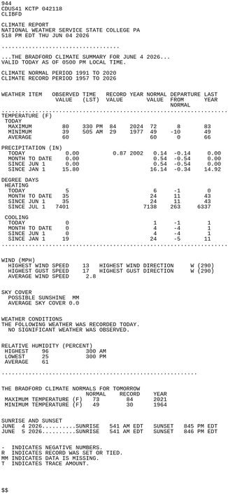
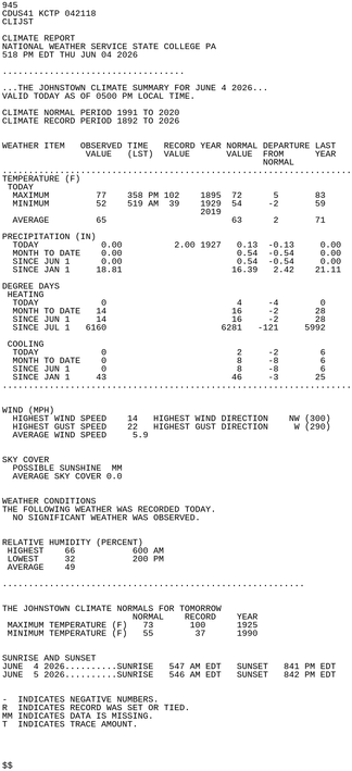
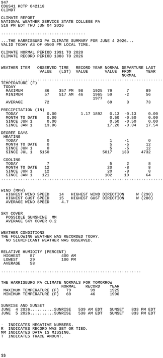
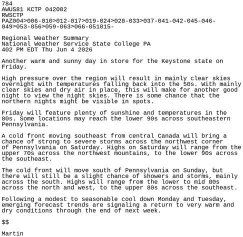
CLIMATE REPORT
NATIONAL WEATHER SERVICE STATE COLLEGE PA
518 PM EDT THU JUN 04 2026
...................................
...THE WILLIAMSPORT PA CLIMATE SUMMARY FOR JUNE 4 2026...
VALID TODAY AS OF 0500 PM LOCAL TIME.
CLIMATE NORMAL PERIOD 1991 TO 2020
CLIMATE RECORD PERIOD 1895 TO 2026
WEATHER ITEM OBSERVED TIME RECORD YEAR NORMAL DEPARTURE LAST
VALUE (LST) VALUE VALUE FROM YEAR https://mesonet.agron.iastate.edu/p.php?pid=202606042118-KCTP-CDUS41-CLIIPT