@organicmaps is it possible to create route link that starts at the current location?

I tried om://route, but it requires `sll` and sll=0,0 is taken literally.
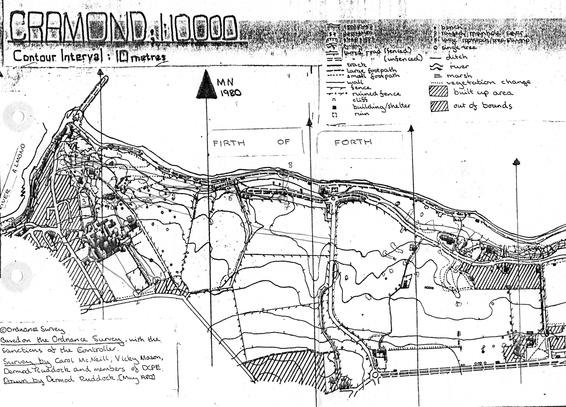
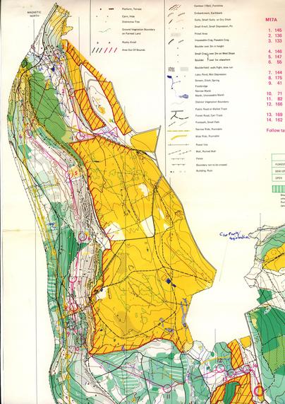
#gis #omaps #organicmaps #askfedi

Cramond, 1980 Cramond to Silverknowes with a photocopied map for an evening event. Mapped by Carol McNeil and others from Dunfermline College, the big black buildings on the west of the area (now houses). #OldOrienteeringMaps #OMaps #Orienteering #ESOC
www.geograph.org.uk/photo/10101
The very much missed Twenty Shilling Wood 1979, Comrie, #Perthshire. Used in the second 6 days. #OldOrienteeringMaps #Omaps #ForthValleyOrienteers #TaysideOrienteers
Moseley Green 1988 #BOK #ForestOfDean. The eastern part was covered by the 1973 Oakenhill Wood map of variable scale infamy. #OldOrienteeringMaps #OMaps #Orienteering

Wharncliffe 1978
#JK individual with M17 course. Lots of rock features in an area often wheeled out by #SYO for big events. #OldOrienteeringMaps #OMaps #Orienteering
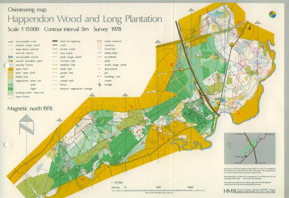
2022 version:
www.syo.routegadget.co.uk/rg2/#233

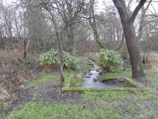
www.geograph.org.uk/photo/3813501

Happendon Wood 🎨 Harvey Map Service 1978. This map was often displayed by Harveys at events and is beautifully scribed. Since use, the M74 was built through the area and the Douglas (west) part of the area fell out of use. Happendon is still used.
#Lanarkshire #OldOrienteeringMaps #OMaps #OrienteeringMap
Newcastleton Forest. F Jolly and Heriot-Watt University Orienteering Club 1980. HWUOC liked Sitka plantations, they mapped Blairadam a year later - I would love to see that map.
Newcastleton has had some changes since - the yellow was planted with trees soon after the event and there is a #7Stanes trail centre there now. #OldOrienteeringMaps #OMaps #Orienteering #MTB
Drumore Wood 1975 - a bit of surviving rainforest in the midst of the Loch Ard Forest, Aberfoyle. Physical!
#OldOrienteeringMaps #OMaps
It's #Scottish6Days Week, so here is Culbin from the World Championships in 1976 and the first ever 6 Days. #Orienteering #OldOrienteeringMaps #OMaps