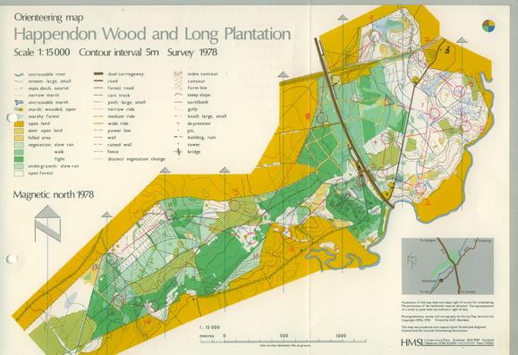
Happendon Wood 🎨 Harvey Map Service 1978. This map was often displayed by Harveys at events and is beautifully scribed. Since use, the M74 was built through the area and the Douglas (west) part of the area fell out of use. Happendon is still used.
#Lanarkshire #OldOrienteeringMaps #OMaps #OrienteeringMap
#Lanarkshire #OldOrienteeringMaps #OMaps #OrienteeringMap