We have ported Nik4, the Python utility to render map images using #Mapnik by @zverik, to C++ and called it Nik5. #OpenStreetMap
https://blog.geofabrik.de/index.php/2026/01/13/nik5-a-c-port-of-nik4/
We have ported Nik4, the Python utility to render map images using #Mapnik by @zverik, to C++ and called it Nik5. #OpenStreetMap
https://blog.geofabrik.de/index.php/2026/01/13/nik5-a-c-port-of-nik4/
I am hacking carto stylesheets and postgres magics to make pretty useful maps...
And I've had an afternoon coffee... Yum.
This may all work out, or may fall apart at the last moment into a pile of snotters and pee. Hmm.
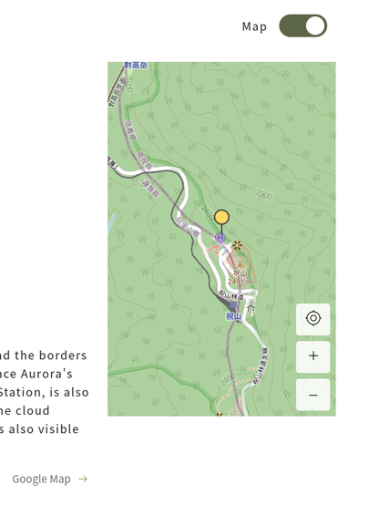
While reviewing plans for a hiking trip, this agency's website described a feature map as "Google Map".
Clicking on the label takes you to GMaps, but the embedded map itself, which you can browse freely, is obviously made with @OpenStreeetMap, specifically the #Mapnik layer. 
OK, so #mapnik is not the best right now for me. What other #OpenStreetMap to #raster tiles are there? Specially if it has a text based style language. I could even try to write a compiler from osm-carto to that.
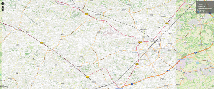
Wer kennt sich mit #openstreetmap aus?
https://openstreetmap.de/karte/
Bei gewissen Zoom-Stufen sehe ich Fehler bei Gütersloh.
Wo kann ich das melden?
Mittlerweile habe ich die Karte von Geofabrik in ein .img schreiben können - die sieht aber unter Garmin seltsam aus 😕
Anscheinend kann man über Styles die Karte anpassen: https://github.com/ligfietser/mkgmap-style-sheets/tree/master
Die Frage ist nur: WIE genau?
Was muss ich wie einstellen, dass? 🤔

This project aims to improve the vector maps for Garmin GPS created with the mkgmap compiler from http://OpenStreetMap.org data for the world routable maps at http://garmin.openstreetmap.nl - ligfi...
