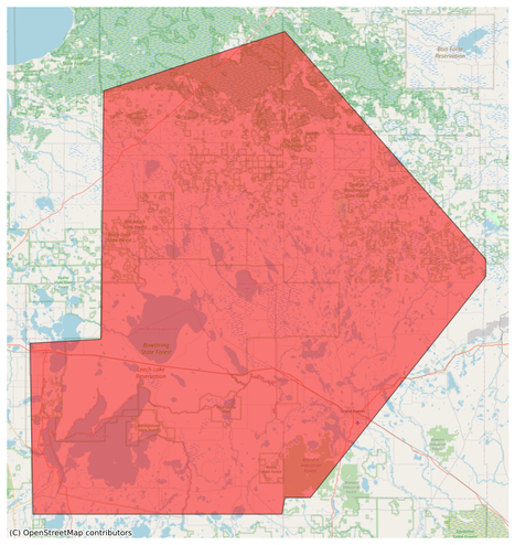
8 P.M. RADAR UPDATE:

There is a line of #thunderstorms just to the west/northwest of the #Northland that has led to a #tornado.

Tornado Watch is still in effect for #Itasca and #Koochiching counties until 10. Be prepared for possible strong/#severe #storms over the next few hours.

#wxtooter #weather #wx #MNwx

SEVERE WEATHER THREAT:

A #Severe #Thunderstorm Warning is in effect for northern #Koochiching County until 4 p.m. Greatest threat from this #storm will be large #hail & strong #winds.

A #Tornado Watch is in effect for #Itasca and Koochiching counties until 10 p.m. today. The severe #weather threat does extend east over more of the #Northland tonight.

#wxtooter #weather #wx #MNwx #WIwx #UPwx

#EAS #WEA for Itasca, #MN; #Koochiching, #MN: National Weather Service: #TORNADO WARNING in this area until 1:45 AM CDT. Take shelter now in a basement or an interior room on the lowest floor of a sturdy building. If you are outdoors, in a mobile home, or in a vehicle, move to the closest substantial shelter and protect yourself from flying debris. Check media. Source: NWS Duluth MN ** DO NOT RELY ON THIS FEED FOR LIFE SAFETY, SEEK OUT OFFICIAL SOURCES ***
#EAS #WEA for Cass, #MN; #Itasca, #MN; #Koochiching, #MN: National Weather Service: SEVERE THUNDERSTORM WARNING in effect for this area until 1:30 AM CDT for DESTRUCTIVE 90 mph winds. Take shelter in a sturdy building, away from windows. Flying debris may be deadly to those caught without shelter. Source: NWS Duluth MN ** DO NOT RELY ON THIS FEED FOR LIFE SAFETY, SEEK OUT OFFICIAL SOURCES ***
#EAS #WEA for Cass, #MN; #Itasca, #MN; #Koochiching, #MN: National Weather Service: SEVERE THUNDERSTORM WARNING in effect for this area until 2:00 AM CDT for DESTRUCTIVE 90 mph winds. Take shelter in a sturdy building, away from windows. Flying debris may be deadly to those caught without shelter. Source: NWS Duluth MN ** DO NOT RELY ON THIS FEED FOR LIFE SAFETY, SEEK OUT OFFICIAL SOURCES ***

#SEVERE #THUNDERSTORM #WARNING:

A #thunderstorm passing through the Rainy River region will continue east into northwest #Koochiching County through 4:30 p.m.

The threat is for #hail up to 1-inch in diameter and #winds up to 60 mph.

Take shelter if you are in this area.

#wxtooter #weather #MNwx

As a line of #showers and #thunderstorms continues to move slowly south, a few will be strong.

One of those is in #Koochiching County south of #InternationalFalls. Expect #winds up to 40 mph and small #hail, along with heavy #rain and #lightning.

#wxtooter #weather #Northland #MNwx

A heads up for people driving along Highway 71 in #Itasca and #Koochiching counties over the next hour.

A #thunderstorm will bring heavy #rain and #hail, possibly just under 1" in diameter. Strong #winds are also likely.

A similar strong thunderstorm is also passing through southwest Itasca County, but the hail is smaller.

#wxtooter #weather #MNwx