#BackToSchool #EasternBush

This is the start of our "Back to School" series which will feature schools from Waiau, Murihiku:

According to FWG Millers history, Eastern Bush School was not opened until 1 January 1892 and previously the school children had been taught in the Scobie’s woolshed on the Accommodation House/Hotel property. We have a list of early teachers and students. What we are missing is more photos. Can you help with this? Thanks!

Visit link below:
https://ehive.com/collections/202139/objects/1565173

The word for Day 27 in English then Māori of #Museum30 #Plan #Hoahoa

There must have been a plan or hoahoa for the builders of this Eastern Bush Church from 1914. See more about this building in our Central and Western Murihiku Southland Archive here: https://ehive.com/collections/202139/objects/1564914/eastern-bush-district-presbyterian-church-history-foundation-stone-laying

#History #Heritage #Aotearoa #NZ #GLAM #Museums #Archives #digipres #Ōtautau #Murihiku #Southland #EasternBush
#Waiau #Presbyterian #Churches
#CommunityCollaboration #FarmingFamilies #Clifden
#CentralAndWesternArchive

Eastern Bush District - Presbyterian Church History, Foundation Stone Laying: ... on eHive

Sepia photo of foundation stone laying & letter of names of those present: The story of the Presbyterian Church at Eastern Bush from the start to finish... The foundation stone was laid 10 June 1914 and the church had its sad demise not even 100 years late, when it fell down in April 2003. There was no church in Eastern Bush until 1914, a range of photos of it are in this archive online – from its construction until it’s demise. If you are interested in this, please look for the other entries. I have recently been given the names of those involved in the Foundation Stone laying photo shown above. In a letter written to "Lincoln & Ann (Moffat) signed, "God Bless from Daphne & Don", it states the following: "A copy of the stone laying at Eastern Bush. I think this was from Aunty Ina (Pearce) as it's her handwriting. The names I found on the back of the photo are from left to right: 1. WJ Darley 2. Donald McLaren 3. Rev Lopdell 4. JG Craig 5. Rev A MacDonald 6. - 7. J McCall 8. D Young 9. Malcolm Mouat 10. Thomson, MP for Wallace 11. A Snowball I have also included a copy of this letter in this entry for anyone to see who is interested. And please, keep the information coming, so it can be added for everyone else to enjoy, both now and in the future. Prior to the opening, according to the history of the Otago Presbyterian Church, the minister in charge of the Ōtautau Parish had to minister to congregants across the district nearly all the way to Blackmount! The Rev A McDonald or ‘Sandy’ as he was most affectionately known, had oversight of all the following districts: Clifden, Eastern Bush, Bellmount, Nightcaps and Wairio. As FWG Miller points out in his history, 'West to the Fiords', the area covered “all the country north-west of Ōtautau.” The Reverend would arrive at Bellmont by horse on a Saturday, having had communion with adherents on the way, then on Sundays, a service was held in the Wairaki Woolshed men’s quarters at 11am, at Eastern Bush at Scobie’s Woolshed at 3pm, and then he would return the 40 odd miles back to Ōtautau to hold his last service there at 7pm. This route was done every month, with other trips to other districts taken on the alternative weekends. As Miller also notes, the early settlers held Rev. McDonald in high regard, as he had taken such care to minister to them, labouring hard and long in difficult conditions. It is likely these hardships led to his later ill health and demise. The Presbyterian Church history also notes the sacrifices and commitment made by him. NOTE: Both the Mouat and Moffat families have a long-standing history at Eastern Bush. Their contributions to the photographs and history of the Eastern Bush Church, which was a Presbyterian entity, is noted. It was the original Mouat, Malcolm Snr., whose wife Anna Bella (née Scobie), who gifted the 1 acre of land that the church originally sat on, to the Otago Presbytery for this cause. And it was the Moffat family, I believe mostly Lincoln (the last of his name on the land there), who has been largely responsible for collating, researching and passing on the building's history. Hopefully this entry will be added to as more information comes to hand. If you or anyone you know has any more information or photos to share or accounts of the Eastern Bush Church during the years, please do share in the comments section. You can do this by making a comment in the space provided under the image page.

eHive

The word for Day 22 in English then Māori of #Museum30 #Orange #Pākākā

The diggers in this group of photos are orange or pākākā coloured. See our Central and Western Districts Archive for more information on this machinery and this job, here: https://ehive.com/collections/202139/objects/1565822/mararoa-river-willow-clearance

#History #Heritage #Aotearoa #NZ #GLAM #Clifden #Museums #Archives #digipres #Mararoa
#EasternBush #Waiau #Ōtautau #Murihiku #Southland #Farming
#CommunityCollaboration #RuralNZ #AgricultureHistory
#CentralAndWesternArchive

Mararoa River, Willow Clearance ; Mouat, Stewart; 1970-1980; CWA.042.86.12 on eHive

This collection of photos is labelled "Mararoa River Willow Clearance" but no exact date was given. The donors believed it could have been from the early 2000's, but were unsure. However, I noted the name 'Carran Scott Contracting' on the diggers, and they say they started business in 1998, so I have contacted them for more information on this job, and I also saw there was a ute in the forefront of one of the photos with the company logo of Landward Management and their website claims, "Ray Macleod, the Manager of Landward founded the company fourteen years ago," so this would mean that this river clearance was completed sometime after 2008. On further discussions with Ray Macleod of Landward, who has been extremely helpful and interested in this historical archive project, he informs us that, “Graeme Franklyn was working on that project and that was his car at the time. He thinks it was around 2007 and that was an open day, part of a wider inspection/familiarisation tour organised by Southland Regional Council. We were representing Land Information New Zealand, which also had staff present.” He goes on to say, “In 1975 I was a young engineer working for New Zealand Electricity and I was allocated the project clear the river of willows. To do with the Manapouri scheme and river flow being impacted by willows and riverbed gradient changes. Anyway, I left that year and didn't do the work.” But thanks to Ray for updating us with more information on the story. And on even further looking into river willow clearances in Murihiku Southland, an Environment Southland report from 2 August 2013, tells us that these river willow clearances had been completed by 2011, with the following information: "The Mararoa River is a medium-sized river with a confined single braid and open semi-braided channel form that flows into the Waiau River immediately upstream of the Manapouri Lake control structure. The section river below Weir Road has been highly modified as part of control of Lake Manapouri for hydroelectric generation. Above Weir Road the river has been the subject of a major willow clearance project that extends to the SH 94 Key Bridge. Since completion of the clearance project in 2011, dynamic river processes are occurring as the river re-establishes a natural intactness.” Title of report quoted is: Managing Unwanted Vegetation in Southland Rivers - https://www.es.govt.nz › about-us › documents On another note, it was claimed in 2017 in a Stuff article, by the NZ Federation of Freshwater Anglers, that the willow clearances have led to a decline in trout numbers, as this removed the shading of the trees for the fish. They said: "Agriculture was not only culprit identified by the federation. Removal of willow trees shading was blamed for decline in fisheries values in the Upukerora and Whitestone rivers near Te Anau." So it seems the willow clearances have had both a positive effect on the one hand, with a more detrimental effect for some on the other hand. If you or anyone you know has any more photos, information or accounts of the Mararoa Willow Clearances during the years, please do share these in the comments section. You can do this by making a comment in the space provided under the image page. And please let us know if you have more records to add, they will add the history. Similarly if you were there when these photos were taken and can add more to the story contained above, please let us know, thank you!

eHive

The word for Day 21 in English then Māori of #Museum30 #View #Tirohanga

The view or tirohanga of the landscape surrounding the removal of the Eastern Bush hall is spectacular. See our Central and Western Districts Archive for more information on this here: https://ehive.com/collections/202139/objects/1565760/eastern-bush-district-old-hall

#History #Heritage #Aotearoa #NZ #GLAM #Clifden #Museums #Archives #digipres
#EasternBush #Waiau #Ōtautau #Murihiku #Southland #Farming
#CommunityCollaboration #Ōrawia #RuralNZ #AgHistory
#CentralAndWesternArchive

Eastern Bush District - Old Hall ; Mouat, Stewart; 1970-1980; CWA.004.42.5 on eHive

The first mention I have found of the earliest Eastern Bush Hall, was in reference to Henry Moffat and his son Norman (a long-standing family name in the district), receiving a timber order for building a hall, in 1898. I am not at this point sure what happened to the said hall, but will do some more research. Te Hikoi Museum has a fabulous photo in their collection, also on eHive, of an event at the early hall, around 1900 which is recorded as a Jubliee, so maybe there was an even earlier hall? The photo above, which has been labelled as: "Eastern Bush Public Hall, 1970's, before being shifted to Blackmount." The hall was cut in half so it could be transported, as shown in the photo, so it must have been a reasonable size. But it also appears as if this could be a later hall than the one referred to from the Moffat records, but someone else may know more. The Community Centre is now the old (third) school building and district activities including a Playgroup are held there on a regular basis. Lincoln Moffat, (a grandson of Norman mentioned above who was the supplier of timber to build the hall in 1898), recounts how his father Charlie was very sad about the end of the hall, as to quote him, "it held so many memories. As a young serviceman leaving for a war there would have been a sendoff. Dances, meetings, 21st birthday parties, farewells and welcomes. It also meant the end of dances which had been such a part of the rural social life. The district was offered the closed Eastern Bush school building which was modern and low maintenance so it was a no brainer." Thanks Lincoln for adding more personal history to the story. If you or anyone you know has any more photos, information or accounts of the Eastern Bush Hall during the years, please do share these in the comments section. You can do this by making a comment in the space provided under the image page. Please let us know if you have more records to add, they will add the heritage records of this very old property.

eHive

The word for Day 20 in English then Māori of #Museum30 #Bookshelves #PaePukapuka

Two of the bookshelves or pae pukapuka of our new community archive project for the Central and Western Districts of Murihiku Southland in Aotearoa NZ. To view the archive see: https://ehive.com/collections/202139/central-western-murihiku-southland-archive

#History #Heritage #Aotearoa #NZ #GLAM #Clifden #Museums #Archives #digipres
#EasternBush #Waiau #Ōtautau #Murihiku #Southland #Farming
#CommunityCollaboration #Ōrawia #RuralNZ #AgHistory
#CentralAndWesternArchive

Central & Western Murihiku Southland Archive on eHive

The Central & Western Murihiku Southland Archive has been set up as a community archive project, to digitally gather, store, preserve, record and share our district history. It is especially important for those local communities who have no history repository locally, to have a place to keep a copy of their local heritage safe and to promote the history of their communities and those who settled them. But all district histories are welcome here. So, if your district, town, farm, business or family are within our area and you would like to have the history of this recorded for our current and future generations, please make contact. This is a free community service. Our motto is: "By Community, For Community". We accept photos, articles, memories, books, records, maps, ephemera and all paper based items for digitizing and putting into this new archive. You can also ask us to take photographs of objects and properties for the archive. Oral history is something else we will be working on shortly. If you have a story of local history to tell, please do let us know. Remember this is YOUR archive as part of your local community, a place where you can save and store any local history, without it leaving your ownership. This archive is a place where everybody in the community can contribute, comment, interact, share memories and our combined history. We do not take your important history to keep, we professionally copy it, ensure these copies are safe and share them with the community. Your heritage remains in your hands. So if you have precious family memories you want to share with others but retain ownership of, this community archive is for you. The area we will be covering with the archive is one in which the settlers within it often moved around to live and work in different local districts, so their family collections can be held together and not spread across varying institutions. The Western part of the district covered by the archive will be roughly from Piopiotahi/Fiordland in the West, right across the Waiau District, and along the coast south west coast, down into the Aparima/Riverton in the South. We are focusing on the Waiau area in the beginning, mainly as our museum here does not have any online presence or set opening hours. We have also started with preserving the history of the Eastern Bush community first up, as it is an area without a fully recorded written and photographic history and with quite a few long-standing families moving out of the area in recent years, it was imperative that the history of this community and its important past stories and heritage be saved for our future generations. If you can provide any photos and information from the Eastern Bush area, please contact our local Digitisation Project Manager as below, for how you can help out. We hope to have a community information event soon. We will also have a small fee based research service based within the online archive, which will help to fund the growth of the project. If you are looking for information on any family, person, business, farm, property or event within the local area and in the districts we cover, we can quite possibly help you with this, as we have a trained historical researcher. Please contact the Social History Project Manager for information about our research service, as per the details below: The archive is completely digital so is only available online, but the beauty of this is that it can be accessed by anyone, anywhere, 24/7. As this is a new site, a new model and a community voluntary project, please can you bear with us as we progress, grow and add new features. The plan is for each local community to have their own entries within this site and for all the early settler families in each of these, to also be included in that, with a brief history and photos. If you can help with this by providing yours, please contact as below. For more information, questions or donations, please just ask.

eHive

The word for Day 19 in English then Māori of #Museum30 #Location #Wāhi

The location or wāhi covered by our new community archive project is the Central and Western Districts of Murihiku Southland in Aotearoa NZ. See the entries we have uploaded so far here: https://ehive.com/collections/202139/central-western-murihiku-southland-archive

#History #Heritage #Aotearoa #NZ #GLAM #Clifden #Museums #Archives #digipres
#EasternBush #Waiau #Ōtautau #Murihiku #Southland #Farming
#CommunityCollaboration #Ōrawia #RuralNZ #AgHistory
#CentralAndWesternArchive

Central & Western Murihiku Southland Archive on eHive

The Central & Western Murihiku Southland Archive has been set up as a community archive project, to digitally gather, store, preserve, record and share our district history. It is especially important for those local communities who have no history repository locally, to have a place to keep a copy of their local heritage safe and to promote the history of their communities and those who settled them. But all district histories are welcome here. So, if your district, town, farm, business or family are within our area and you would like to have the history of this recorded for our current and future generations, please make contact. This is a free community service. Our motto is: "By Community, For Community". We accept photos, articles, memories, books, records, maps, ephemera and all paper based items for digitizing and putting into this new archive. You can also ask us to take photographs of objects and properties for the archive. Oral history is something else we will be working on shortly. If you have a story of local history to tell, please do let us know. Remember this is YOUR archive as part of your local community, a place where you can save and store any local history, without it leaving your ownership. This archive is a place where everybody in the community can contribute, comment, interact, share memories and our combined history. We do not take your important history to keep, we professionally copy it, ensure these copies are safe and share them with the community. Your heritage remains in your hands. So if you have precious family memories you want to share with others but retain ownership of, this community archive is for you. The area we will be covering with the archive is one in which the settlers within it often moved around to live and work in different local districts, so their family collections can be held together and not spread across varying institutions. The Western part of the district covered by the archive will be roughly from Piopiotahi/Fiordland in the West, right across the Waiau District, and along the coast south west coast, down into the Aparima/Riverton in the South. We are focusing on the Waiau area in the beginning, mainly as our museum here does not have any online presence or set opening hours. We have also started with preserving the history of the Eastern Bush community first up, as it is an area without a fully recorded written and photographic history and with quite a few long-standing families moving out of the area in recent years, it was imperative that the history of this community and its important past stories and heritage be saved for our future generations. If you can provide any photos and information from the Eastern Bush area, please contact our local Digitisation Project Manager as below, for how you can help out. We hope to have a community information event soon. We will also have a small fee based research service based within the online archive, which will help to fund the growth of the project. If you are looking for information on any family, person, business, farm, property or event within the local area and in the districts we cover, we can quite possibly help you with this, as we have a trained historical researcher. Please contact the Social History Project Manager for information about our research service, as per the details below: The archive is completely digital so is only available online, but the beauty of this is that it can be accessed by anyone, anywhere, 24/7. As this is a new site, a new model and a community voluntary project, please can you bear with us as we progress, grow and add new features. The plan is for each local community to have their own entries within this site and for all the early settler families in each of these, to also be included in that, with a brief history and photos. If you can help with this by providing yours, please contact as below. For more information, questions or donations, please just ask.

eHive

The word for Day 18 in English then Māori of #Museum30 #Reign #Kīngitanga

It was during the reign of Kīngitanga George V that the call was made to men of Aotearoa NZ to serve in WW1, for "King & Country". One of these men was a local lad Harry Moffat... Read more about him here: https://ehive.com/collections/202139/objects/1600951/orawia-scotts-gap-district-settlers-moffat-family-ww1-memorial-entry

#History #Heritage #Aotearoa #NZ #NZTwits #GLAM #Museums #Archives #digipres
#EasternBush #Waiau #Ōtautau #Murihiku #Southland #Farming
#CommunityCollaboration
#CentralAndWesternArchive

Ōrawia & Scott's Gap - District Settlers, Moffat Family, WW1 Memorial Entry; Unk... on eHive

Photo's & Records of Harry Moffat from Ōrawia & Scott's Gap, WW1: 1. News clipping of Harry from an unknown newspaper, from family, Pvt. Harry Moffat, KIA in WW1. 
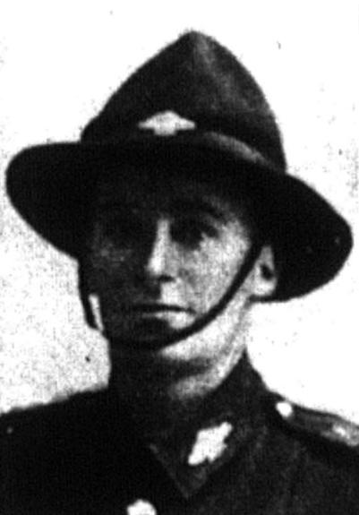
2. Photo of Harry's headshot, unknown source, from family, Pvt. Harry Moffat, KIA in WW1. 
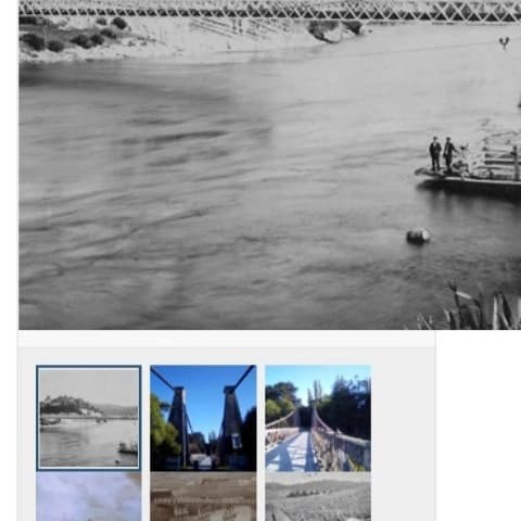
3. Photo from the family files, Pvt. Harry Moffat, KIA in WW1. 4. Copy of Harry's letter to his mother from the family, WW1. 5. Printed transcription of Harry's letter to his mother, by our Archivist. 6. Typed up sheet commemorating Harry's Service, compiled by our Archivist from information from the Auckland War Memorial Museum. 7. Ōrawia District Soldier's Memorial photo showing Harry Moffat's name. 8. Ōtautau District Soldier's Memorial photo showing Harry Moffat's name. 9. Anglican Church of Ōtautau (St. Andrew's) Roll of Honour board showing Harry Moffat's name, taken by Digitising Archivist, Suzie Best 
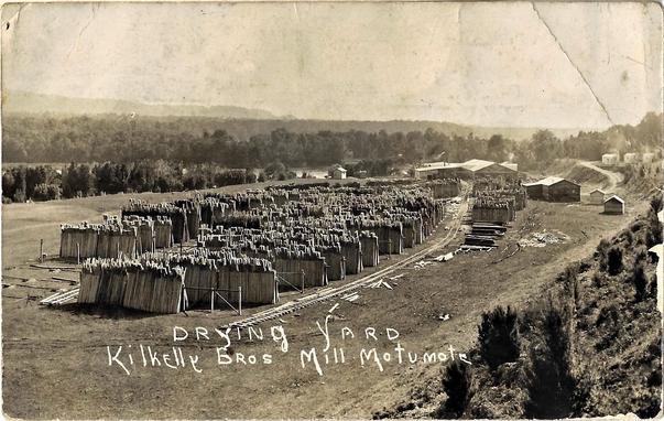
Harry was born at Scott's Gap in 1891 and received his education at both Scott's Gap and Ōrawia schools. At age 17, he moved to Te-Ika-a-Maui North Island to be with older brother Oliver, where they both worked in the timber milling industry here. Oliver also served in WW1. It is recorded that Harry was engaged to a Miss Carpenter in 1913, but with WW1 happening soon afterwards, their wedding plans were then delayed as Harry went off to fight, joining the Taranaki Company of the Wellington Infantry Regiment with the NZEF as an early volunteer. He wrote to his mother about his volunteering, saying he was one of only two volunteers who had been in the territorials who were over the age of 20, as requested. Harry enlisted under the command of Lieutenant Colonel William Malone and his army number was 10/1173. Harry was enlisted as a Private on 25 August 1915 at Awapuni Camp in Palmerston North. Prior to this, he had been part of the Territorial's for 4 years, obtaining the rank of Corporal while there. Interestingly, Harry’s record shows that he had originally registered for compulsory military training at the saw milling town of Taurangarere, by Taihape. Harry left Aotearoa New Zealand with the NZEF Main Body on 16 October 1914, via Hobart, Albany in Western Australia, and passing through Colombo and Aden before stopping in Alexandria, Egypt on 3 December. During the voyage, it had been decided that the ANZAC force would stop in Egypt to train. Harry wrote his mother about this. By the end of 1914 Harry had begun his desert warfare training in Egypt and from there it was off to fight in the Gallipoli Campaign, where Harry was wounded on his second day in the fighting. After receiving wounds in battle, Harry was admitted to 15th General Hospital in Alexandria on 30 April 1915, He was discharged again on 8 May. Apparently, his mother initially received a telegram saying he was dead. His being wounded was reported in the Otautau Standard newspaper’ a number of times during May and June 1915. Harry then rejoined his unit again on 30 June. During this time was when a photo of Harry also appeared in the Otago Witness newspaper, on 9 June 1915, and this is believed to be the headshot in the family collection. In a sad twist of fate, Harry's mother Catherine had been sent a telegram saying Harry had been killed in battle when the above transpired. Later, Harry wrote to her (see letter attached to this archive entry), saying how sorry he was that she got such a fright from being told he had been KIA when he had only been wounded. Tragically, Harry was indeed to die soon after this letter was sent to his mother, on 7 August 1915. What horrendously bad luck for this to happen. In the infamous assault on the hill Chunuk Bair, where the Wellington Battalion was held up on 7 August, is when Harry lost his life. It is most probable that Harry was also hit while the bulk of the New Zealander's were situated there. In, ‘The Wellington Regiment NZEF 1914-1919’, book it states: that at the Apex, on 7 August “sniping and machine-gun fire [from the Turks] had commenced and casualties were constantly occurring among the troops on the hillside.” Quoted. In Harry’s military file, it says under 8 August that he was wounded in action on 7 August, and this was later confirmed as "believed dead". Harry is commemorated at Embarkation Pier Cemetery, where he is named on Special Memorial C 62. The gravestone reads “believed to be buried in this cemetery” and 8 August 1915 is the date shown on this memorial. Of special note is that Harry was buried in a cemetery, meaning either he was wounded in action and returned to the beach before dying, or that his body was later recovered and identified. Allied Troops were finally evacuated from Gallipoli in December 1915. It is noted in Harry’s military file that the finding of the Board of Enquiry, although not until 16 January 1916, that he was “now believed to be dead”, “On or about 7 August”, of “Cause unknown”. This message was also was cabled from Alexandria on 24 January 1916. Nowhere on his army file at all, is it mentioned where he was buried. A death notice for Harry was then published in the Otautau Standard newspaper on 15 February 1916, reading: “Moffat – Killed in action at the Dardanelles, 8th August, 1915, Harry, youngest son of Mrs C.S. Moffat, Orawia, age 23 – For the Empire’s sake.” Although it is of note that Harry was actually 24 years old when he died. What anguish so many parents and siblings must have gone through with so long of a wait between the battle and soldier's deaths, to having this confirmed. However, even if buy chance Harry had not been wounded on 7 August, tragically, it is unlikely that he would have escaped being wounded or killed on 8 August on Chunuk Bair anyway. When Chunuk Bair returned to enemy hands a couple of days later after the his Wellington Battalion that Harry was serving in was decimated: only around 80 out of 800 were still alive and unwounded. What dreadful odds of survival. What is more, the majority of New Zealanders who died there have no known grave and are commemorated on NZ Memorial to The Missing. Of this battle, Harry is one of the few who has an individual memorial or gravestone. Harry is one of only six from the Wellington Battalion killed in action on 7 August, rather than 8 August. However, there are conflicting dates of Harry's death. 7 August is mentioned by the following sources: Wellington Regimental Roll of Honour (KIA), Auckland War Memorial Museum Cenotaph Database (KIA), also his Parents’ gravestone which says“Killed at Gallipoli”, and his military service file. His Death Certificate itself states that he was Killed in Action “on or about 7 August”. Whereas the 8 August date is mentioned by the following places: Commonwealth War Graves Commission website, and Harry's Special Memorial at Gallipoli. We used the 7 August date for this memorial entry in Harry's honour, as that has most sources. Harry's other brothers, Norman and Oliver, also from Ōrawia. also served in WW1, but thankfully returned home, even though both were injured, Oliver not so badly, but Norman was invalided out in 1917. Oliver Army number #11501 enlisted with the NZEF in the 12th Reinforcements and joined a machine gun section in the 3rd Auckland Company of the 2nd Auckland Infantry Battalion. While Norman Army number #39413 enlisted with the 24th Reinforcements and was also with a machine gun section. More can be seen about Norman's later history in CWA.004.2, as he bought a farm in the local area, which until recently (2022) was still farmed by a grandson of his. NOTE: I am indebted to the Moffat family descendants, who have so generously and willingly shared their interesting family history with us. I would also like to especially note Phil O'Malley's history of Henry and his family for providing some of the details used in this entry above. The photos and letters of Harry Moffat are from the family collection. The Soldier Memorial photos showing Harry's name are thanks to our Digitising Archivist for this online project. This whole archive entry is a memorial to Harry Moffat's bravery and subsequent loss of life, so if anyone in the family has more information to add to this, please let us know. Your photos, reports, letters and comments can be added in.

eHive

The word for Day 17 in English then Māori of #Museum30 #Origin #Pūtake

The origin or pūtake of all the wood drying here, was nearby kahikatea stands, virtually decimated to provide wood for the local and national dairy trade as the trees became harder to find. Read more about it here: https://ehive.com/collections/202139/objects/1564901/motu-kilkellys-mill-settlement

#History #Heritage #Aotearoa #NZ #NZTwits #GLAM #Museums #Archives #digipres
#EasternBush #Waiau #Ōtautau #Murihiku #Southland #Farming
#CommunityCollaboration
#CentralAndWesternArchive

Motu - Kilkelly's Mill & Settlement ; Unknown; 1925-1935; CWA.028.120.5 on eHive

Postcard of Kilkelly's Drying Yards at the Motu: The Kilkelly’s had a number of mills over the years across the Murihiku Southland region. It appears in later years their venture was run out of Waihōpai Invercargill, which is borne out by the postcard pictured here: "WITH COMPLIMENTS, KILKELLY BROS LTD, BOX 6, INVERCARGILL" is typed across the back of the card, which contains the above photo. In a news article earlier this year, Isabelle Burgess-Matthews, who just turned 106, recalls her childhood at Spar Bush, where the town was sustained by the local Kilkelly Sawmill there. But when the mill was moved to Tūātapere, the school closed, and she had to go to Lochiel. According to John Fraser’s article on the history of the area, the Waiau Kilkelly Bros. mill was on the Pearce’s Otahu property and it was very large. As you can see by the photo attached to this entry, their drying yard alone was huge, so the mill itself must have been impressive. We hear from John about how logs would be dragged through the river up to the mill site, and that had two breast benches operating. The history continues to tell us about a dangerous ford that was somewhere about the Motu, with photos (I would love to see these), showing “haulers and engines being dragged through the river, via a team of horses on an endless rope.” What a sight that would have been, back in the day. As John rightly says, we now wonder at the ability of those men who were able to transport two half ton flywheels into the Motu back in the day. Another interesting account he relates is about a horse who was in front of a ten ton load while it was winched down a steep incline and when the rope broke, the clever draught horse managed to “magnificently” skid and steer the huge heavy load to safety, without it tipping over. Those men and horses really worked hard. In the “Southwest Sawmill’s” history of Allen Templeton’s, we hear how a smithy and stable for the horses working at the timberyard as well as the two shoe horses, was near the mill. The milling area which was about a mile from Lonnekers Bush, held stands of white, black and red pine and totara. These were bought out of the bush with a solid-tyred international truck. However the majority of the wood was taken out via the typical type of bush tramway system and rail tractor from the Deanburn Flat, which is on the western side of the Waiau River. This was a 75/25 mix of white pine and beech forest, according to Allen’s account. Immense gratitude to Larry Mouat, a descendant of local landowners in the district, for pointing out how the white pine milled here was in fact Kahikatea, which was virtually slaughtered out of existence for the production of food packaging for Aotearoa New Zealand industries. The family have donated more material on the Kilkelly's mill shown here to the archive and in time we will put these up in new entries. In Te Aka, the Māori Dictionary, it is described thus: "kahikatea, white pine, Dacrycarpus dacrydioides - a tall coniferous tree of mainly swampy ground, the leaves are scale-like and soft to touch." In a blog on EnviroHistory (link included in place notes below), this notes that while earlier findings revealed the soft wood of this tree made it unsuitable for marine applications and therefore initially spared its life for some time, the reason much of it was initially cleared was to make way for farmland, in a colonial crash course of clearing the land to make it 'profitable', after it was discovered that the land underneath the stands of these trees was most suitable to farming and in particular, dairy farming. Dairying was to have even more of an impact in the near total extinction of this species however, as the flow-on from the dairy industry led to the Kahikatea's wholesale destruction, and this was in 1882, when refrigerated shipping was developed. Not only did this allow frozen meat to be exported, particularly from Murihiku Southland as one of the early experiments, it also created massive demand for literally millions of boxes for all of the butter and cheese products now being produced by a new industry, dairy farms. It was sadly the kahikatea’s soft, pale, odourless wood which made it perfect for these product packaging boxes, at it was not able to taint the products taste during it's long sea journey to Britain. Across Aotearoa New Zealand and also here in Murihiku Southland, loggers were frantic to fell and mill these now known to be giant Jurassic period survivors. Kahikatea forests across the country were therefore doomed to destruction; astonishingly, between 1909 - 1917 in just 8 years, remains of kahikatea stands were reduced by 63 per cent! It is interesting also to note that it appears some of the descendants of those who cleared entire forests of these towering giants, had the most sincere regrets after the fact, of course too long later to do any good. It is therefore a good reminder of how necessary it is for us to ensure that the species we still have on our earth and in our relatively young country, survive for all to enjoy today, into the future and beyond. It is amazing how much history there is in one small settlement. It would be wonderful for more people to contribute memories, photos and other memorabilia to add to the story. If you can help with this, please comment in the section under this image page, or contact us.

eHive

The word for Day 16 in English then Māori of #Museum30 #Break #Whakatā

These workers on the massive Merrivale Estate, once owned by the Ellis Brothers of Australia, can be seen taking a break or whakatā from their hardworking hand harvesting. Image believed to be from around 1900-1920: https://ehive.com/collections/202139/objects/1598933/eastern-bush-orawia-otautau-districts-moffat-family-history-from-laurie-collection

#History #Heritage #Aotearoa #NZ #NZTwits #GLAM #Museums #Archives #digipres
#EasternBush #Waiau #Ōtautau #Murihiku #Southland #Farming
#CommunityCollaboration
#CentralAndWesternArchive

Eastern Bush, Ōrawia & Ōtautau District's - Moffat Family History, from Laurie C... on eHive

Photo labelled: Norman Moffat sitting at back after harvesting, at Ōrawia? This photo is a wonderful piece of the past, in that it combines the history of two well-known district families. Jim Laurie of the Clifden Limeworks fame, married Olive Catherine Moffat, who was daughter of the flour miller at Ōtautau, Henry Moffat. Jim and Olive married in 1909 and had one son. Norman Moffat pictured here, was a sister to Jim's wife Olive. They both lived at the Ōrawia and Eastern Bush districts. Norman knew about hard work and was often employed to do contract ploughing and road work. We believe this photo would be from somewhere around the district, not necessarily on his own property. Norman was often out doing harvesting work. Another photo of him doing contracting for the Ellis brothers of Merrivale Estate, can also be seen in this archive, under number CWA.004.5 In Henry's son's, Norman Edwin Moffat’s obituary in 1956, this recounts how Norman was the earliest farm to grow wheat in the district. His short education was gained from time at schools as far apart as Lincoln (Canterbury), Scott’s Gap and Ōrawia. The family history recounts how Norman had to leave school at just ten years of age to help his father Henry on the family farm and sawmill at Ōrawia. His obit continues to inform us that while still a boy, Norman was carting firewood across the swift flowing Wairaki River, a trip requiring him to cross twice a day in a horse and dray, to ensure that the Grassy Creek flaxmill had the wood needed to operate, which was hauled from the Otahu Bush. As was detailed earlier, this was on top of his work while still a teenager, hauling sleepers for the new railway being put in from Aparima Riverton, north west along the coast. His son Charlies adds more memories to the story from the “Southwest Sawmills” book, telling us that the trip from the farm’s sawmill on what is now Moffat & Forbes Road, was about a 30 mile trip to Orepuki and a two day journey. He recounts how grandfather Henry was a wealthy man when he arrived in Aotearoa New Zealand and knew a thing or two about ‘horseflesh’. He accordingly gave son Norman, now 15, a good ‘shafter’ horse and “two good leaders in leading harness” to card the sleepers through the bush. NOTE: I need to comment here that a lot of the information on the Moffat family, could not have been done without contributions from the Moffat and Laurie families, so this is a thank you to them for this. This will be added to as more information comes to hand. If you or anyone you know has any more information to share or accounts of the Moffat’s during the years, on aspects of their family, farming or community life in the area, please do share in the comments section. You can do this by making a comment in the space provided under the image page.

eHive

#Museum30 Day14 Today's topic is #Winter or #Makariri in Māori #NZTwits #Aotearoa #History #Murihiku #Southland #NZ
#Waiau #Ōtautau #Archives
#CentralWesternSouthland #GLAM #CommunityHistory #digipres

Some great winter or makariri scenes from #EasternBush in #WaiauDistrict. These photos from the Mouat Family property are now part of our community history collections in the new Central & Western Murihiku Southland Archive, check out more here: https://ehive.com/collections/202139/objects/1564623/eastern-bush-properties-braeview-in-mouat-ownership-1905-2004

Can't seem to post photo!

Eastern Bush Properties - "Braeview" in Mouat Ownership (1905-2004): ; Mouat, S... on eHive

"Braeview Farm" property - Mouat Family ownership: Colour Photo's of the Braeview property during the snow of the 1979 winter: The first Mouat to live and work at Eastern Bush, was Malcolm. When the land in the district was taken up by the Government for closer settlement, Malcolm also entered the ballot for land there, but missed out, as apparently that land was drawn out by another local settler, Scott. So as the story goes, Malcolm then purchased J Woods property ‘Woodlands’ off him instead, the year is said to have been 1891. In earlier days, Malcolm Mouat was reportedly an intrepid explorer of the Western Murihiku and Fiordland areas, and even has a lake named after him, Mouat Lake, which is west of Lake Poteriteri, nesting between the Princess and Cameron Mountain Ranges. He was also an one of the early ones in the Clifden district to operate a punt to ferry people and stock. More can be read on this in the Mouat history of the Eastern Bush Hotel. Marrying Anna Bella Scobie, the daughter of the Eastern Bush Accommodation House/Hotel, Store and Post Office owner William Scobie (and wife) the following year, Malcolm purchased this property himself in 1905, (a fact which I have verified against legal land records) and the following year in 1906, Malcolm transferred this property into the name of his wife. In the intervening years, as the ‘Woodlands’ property was on the other side of the Waiau, the family had to get across the river to get to and from their home, which until the bridge was opened in 1899 (see separate entry for the Clifden Suspension Bridge), was a rather arduous affair. They later shifted to "Braeview". Neighbour Charlie Moffat, born in 1922 recalls some history of the Mouat family farm, in records faithfully kept by son Lincoln, who has graciously gifted copies of these to this archive. Charlie recalls that there was pretty much an unlimited supply of flax on the Mouat property called ‘Braeview’ next door, and they employed a man, who he remembers as being Ossie Sheringham (unsure of exact spelling?), to cut the flax. He lived on what the Mouat’s called ‘The Farm’ in a cottage with his wife and had come out from England. This flax-cutter was employed by the Mouat’s for quite some years, from Charlie’s memory. He also recalls that the Mouat’s had some of the best land in Eastern bush, but it was largely undeveloped. My own guess is that their other occupations as Hotel and Store keepers, kept them busy. When Malcolm died in 1932, his wife continued on at the property with her sons, until Anna Bella herself, died in 1950. According to her will, she left the property in the hands of her three sons, William J (whose diary FWG Miller has listed as a reference for the family’s story), Malcolm Jnr., both of Eastern Bush, and Magnus Mouat at the ‘Woodlands’ property. Peter Begg’s recollections of the area as quoted in Miller’s book, cover the following points: “My first recollection of ‘Woodlands’ was that it was occupied by a Mr Manson, father of the well-known athlete and shearer, D Manson. Malcolm Mouat, a hardy Shetland Islander and for many years head shepherd on Clifden, married Miss Scobie and took over Woodlands, and a son owns the property.” The last Mouat the property was in the ownership of, was Stewart who farmed the property with his wife and family. They took great care to save the records of the Accommodation House/Hotel and there are many more photos and records to share on this with the archive, I have simply run out of time to get them all online at this point, so more later! He is also the one to thank for supplying such an array of wonderful historic photos and records of the property over many years & owners, and these "Braeview Farm" photographs all came from Stewart's time. If you or anyone you know has any more photos, information or accounts of the Mouat’s during the years, on any aspects of their business, farming or community life in the local area, please do share these in the comments section. You can do this by making a comment in the space provided under the image page. Please let us know if you have more records to add, they will add the heritage of the property.

eHive