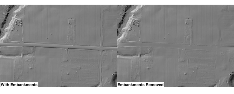
The EmbankmentMapping tool in #WhiteboxTools, transforms how DEMs are hydrologically corrected prior to analysis. This tool modifies fine #LiDAR DEMs by mapping and optionally removing road embankments that can present problems for some modelling. #DEMMapping #TransportationModeling #GIS #geospatial #QGIS #GeoNews #geomatics #gischat #hydrology #geomorphometry