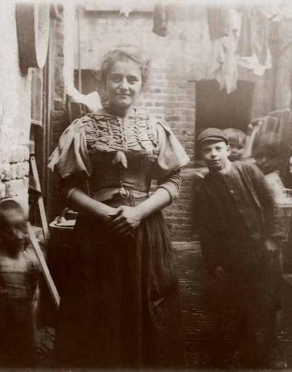
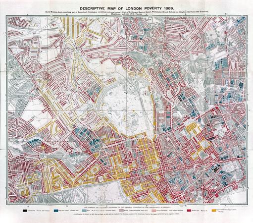
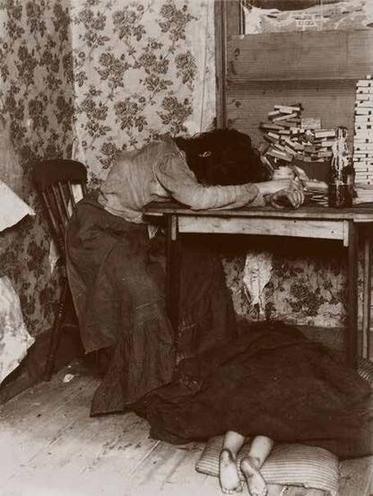
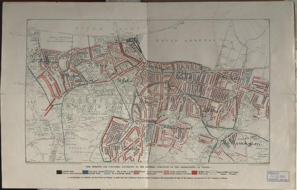
19th-Century London’s Extreme Wealth And Poverty, Mapped [Charles Booth's mapping]
--
https://www.bloomberg.com/news/articles/2019-11-04/charles-booth-s-london-poverty-maps-revisited <-- shared article
--
https://www.bbc.co.uk/programmes/m000wsxf <-- wonderful BBC podcast, #InOurTime
--
https://booth.lse.ac.uk/ <-- interactive website of Charles Booth’s London, London School Of Economics
--
[alongside John Snow’s famous “GIS” maps of disease mapping (specifically cholera in PWS in London in the 1850s), these 1890s and 1900s maps from Charles Booth were some of the defining ones of the history of spatial analyses]
#GIS #spatial #mapping #history #poverty #spatialanalyses # #people #research #london #UK #food #publichealth #publicsafety #demographics #CharlesBooth #maps #abjectpoverty #lowincome #gischat #CityLab #MapLab #historicmaps #historyfacts #demography #demographic #economics #income #poor #poorpeople #qualityoflife #LSE
--
https://www.bloomberg.com/news/articles/2019-11-04/charles-booth-s-london-poverty-maps-revisited <-- shared article
--
https://www.bbc.co.uk/programmes/m000wsxf <-- wonderful BBC podcast, #InOurTime
--
https://booth.lse.ac.uk/ <-- interactive website of Charles Booth’s London, London School Of Economics
--
[alongside John Snow’s famous “GIS” maps of disease mapping (specifically cholera in PWS in London in the 1850s), these 1890s and 1900s maps from Charles Booth were some of the defining ones of the history of spatial analyses]
#GIS #spatial #mapping #history #poverty #spatialanalyses # #people #research #london #UK #food #publichealth #publicsafety #demographics #CharlesBooth #maps #abjectpoverty #lowincome #gischat #CityLab #MapLab #historicmaps #historyfacts #demography #demographic #economics #income #poor #poorpeople #qualityoflife #LSE