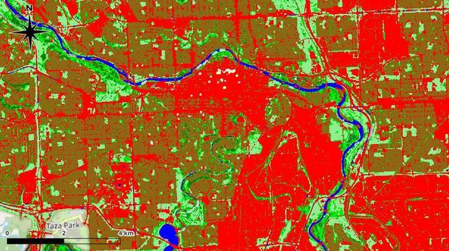
🌳 I am finalizing a tool that allows for a rapid and accurate assessment of the green infrastructure in any Calgary community. This isn't just "green color" on a map—my algorithm recognizes the differences in the quality and structure of the urban environment.
What we can quantify right now:
🔹 Lawn (Grasses, low shrubs): Open spaces that tend to dry out and heat up quickly during summer.
🔹 Park (Sparse Canopy): Scattered groups of trees in parks and private yards.
🔹 Forest (Dense Canopy): The "lungs" of a neighborhood, characterized by closed canopies and thick undergrowth. These areas provide vital protection against urban heat.
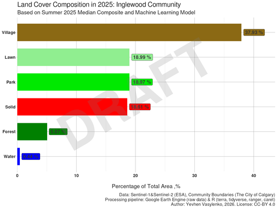
❗ Why does this matter?
Using Inglewood as an example (see the chart), we can see that "dense forest" covers only about 5% of the area. This is a critical indicator of the territory's climate resilience.
#Calgary #UrbanForestry #CityPlanning #DataScience #Inglewood #CalgaryEnvironment #GIS #RemoteSensing #MachineLearning #Inglewood #Rstats #GreennesOfCalgary #YYC #yycPlanning