Experimenting with a blur filter (made with a GLSL shader) in Processing that gives a sort of neon light/glowing effect.
| Website | https://www.sladedesign.co.uk |

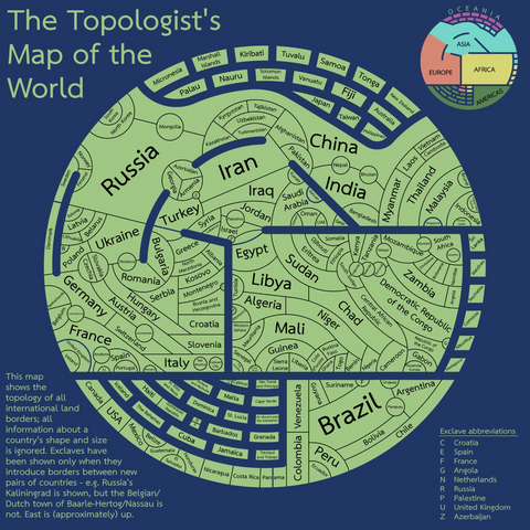
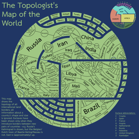
Really charming "topologists world map."
Forget size or position, this map *only* shows which countries border which other countries: http://tafc.space/qna/the-topologists-world-map/
Here are the lighthouses of Europe.
The map is even better than it might seem at first glance: the colors are the real colors, the patterns are the real patterns, and the size of the dots is the distance at which each light is visible.
Made with @openstreetmap, Leaflet, and the Overpass API.
https://geodienst.github.io/lighthousemap/
From the Geodienst researchers of Groningen University (NL), via Ethan Mollick