@jameslmilner

139 Followers
50 Following
20 Posts
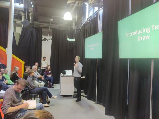
Thanks for listening to my talk #foss4guk2024 - here's the link to the Terra Draw project on GitHub for anyone interested: https://github.com/JamesLMilner/terra-draw
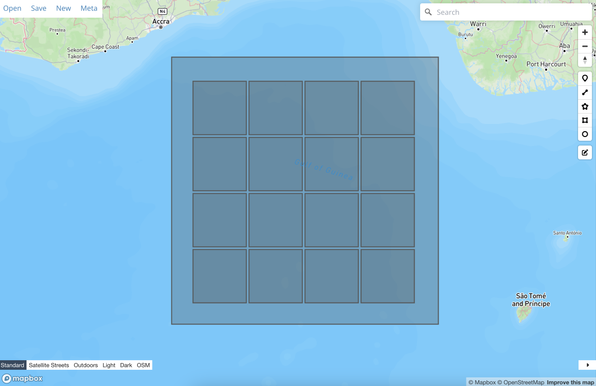
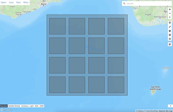
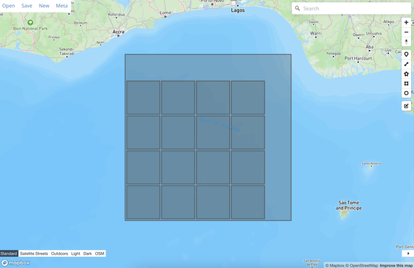
GitHub - JamesLMilner/terra-draw: A library for drawing on maps that supports Mapbox, MapLibre, Google Maps, OpenLayers and Leaflet out the box

A library for drawing on maps that supports Mapbox, MapLibre, Google Maps, OpenLayers and Leaflet out the box - GitHub - JamesLMilner/terra-draw: A library for drawing on maps that supports Mapbox...

GitHub
Next up - @jameslmilner at #foss4guk2024 talking about TerraDraw and the story of its growth - btw slides are on the website (or will be...), along with recordings 🤞https://uk.osgeo.org/foss4guk2024/bristol.html
OSGeo:UK

I'll be in Bristol today for #foss4guk2024 enjoying the event but also speaking about experiences running Terra Draw at 10:50am. Come say hi if you're around!
Been experimenting with some geo polygon packing code - kind of fun, will see where it leads #geojson #gis #geospatial

14 fantastic speakers, one day in Bristol, lunch, coffee, and an evening in the pub (drinks extra...) for £20 - what are you waiting for? Tickets are limited, check out the programme then sign up now 😎 #foss4guk2024

https://uk.osgeo.org/foss4guk2024/index.html

OSGeo:UK

Mr. @marcthiele wants to know why you're not attending in-person conferences anymore.

Help him out.

https://marcthiele.com/notes/why-are-you-not-attending-events-anymore

(via his RSS feed)

#webdev

Why Are You Not Attending Events Anymore? – a post by Marc Thiele

What do events/conferences/design festivals/younameit mean to you? I'd be interested in a conversation.

@stevenfeldman will be interested to see - cameras is the obvious one, but could also be useful for other sensors like LIDAR perhaps
@stevenfeldman great question! This feature was specifically requested by https://www.cofiretech.org/ who use it map line of sight for public cameras - I think this is mostly used in mountain rescue efforts to help figure out if a camera could help located a missing person (is my understanding!)
Center of Excellence

Center of Excellence for Advanced Technology Aerial Firefighting

Colorado Center of Excellence for Advanced Technology Aerial Firefighting
Work in progress for Sensor drawing mode for Terra Draw - sort of like sector mode but for drawing donuts. #terradraw #geojson #gis #geospatial #opensource
So, who are the best web geo follows on Mastadon 😀 ?