Simon Polster

268 Followers
156 Following
174 Posts
mapmaker, mainly topo & hiking maps of the Caucasus. Co-founder of cartisan. All maps made with 
Websitehttps://cartisan.org
Hey look, Adobe: you can change the interface language of an app without having to uninstall and reinstall it! 🤯 #inkscape
Love this flowy transit chart from the Baden-Württemberg train network #MapsintheWild

Contours in flat terrain are often very jagged for detailed DEMs.

To have smooth contours in flat terrain while preserving the details in the slopes I create a stronger filtered DEM, clip this with a slope mask and then merge it with the original DEM. #gischat #qgis #mapping

I just finished the maps for the first 22 trailhead information boards for the new Armenian National Trail 😊 . The ANT logo is very colorful & playful and I tried to reflect that in the map design #qgis #inkscape #armenia #hiking #OpenStreetMap
A very cool (bad pun alert!) map for a hot Berlin summer day.
it is remarkable how much information is packed into the map while keeping it easy to read:
- wind
- temperature
- shadows
- "summer" amenities (only ice cream parlors and spätis are missing 😉 )
https://erfrischungskarte.odis-berlin.de
#gischat #berlin
I reproject DEMs for terrain shading just seldom enough to reliably forget to change the resampling method to cubic #gischat #qgis
My latest trailhead map, will be installed at Debed Canyon, Armenia. Played around with alternating dashes for overlapping trail types. #qgis #gischat
the biggest bug for me in   #qgis (not being able to export correctly when blend modes & masks are enabled) might be getting some attention: https://github.com/qgis/QGIS/issues/50526 🤞🤞
Layer blending mode reset on export for all file types · Issue #50526 · qgis/QGIS

What is the bug or the crash? When exporting files with multiple overlayed rasters, upon export all of the layers are exported as if the blending more was set to 'Normal' Expected (preiview) is on ...

GitHub
Tha map board with my overview map of the transcaucasian trail has been installed at Lake Arpa, Armenia 😊 #gischat #mapsinthewild
My very first time getting interviewed as a map maker 🫣. Evan Applegate and I talk on his podcast "very expensive maps" about creating maps in #qgis, #OpenStreetMap editing and the Caucasus. #gischat
https://open.spotify.com/episode/0oLdHEpzFpHYuB9YFhAuCm?si=lcgoNOvxRYqd-O8iWjjOOQ
Simon Polster: “I was hitchhiking from Iran to Berlin and spent quite a long time in the Caucasus.”

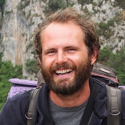
Listen to this episode from Very Expensive Maps on Spotify. Königs Wusterhausen mapmaker Simon Polster discusses falling into his first topo mapping project after hitchhiking from Iran to Berlin, using Soviet topographic maps as a starting point to map Armenian hiking trails, donating data to OpenStreetMap, the eternal method of “play around with it ‘til it looks okay,” completing most of his map layouts in QGIS, spending hours in the map shop inspecting good topos, and turning order fulfillment into a geography lesson for his kid. See Simon’s maps at https://cartisan.org Dilijan National Park Hiking Topo Map QGIS OpenStreetMap JOSM editor Geonames Swisstopo maps Ordnance Survey maps Daniel Huffman Anita Graser Andrew Tyrell Tom Patterson Sarah Bell Klas Karlsson Need maps for your org’s reports, decks, walls and events? ⁠⁠⁠⁠⁠⁠⁠⁠⁠The Map Consultancy makes real nice maps, real fast.⁠⁠⁠⁠⁠⁠⁠⁠⁠ See what good maps can do for you at themapconsultancy.com I have three words for you: Big. Glowing. Maps. Depending on how that makes you feel, you might like two more words: ⁠⁠⁠⁠⁠⁠⁠⁠⁠Radiant Maps⁠⁠⁠⁠⁠⁠⁠⁠⁠. See ultra-detailed backlit maps at radiantmaps.co Time for some map gifts: get 15% off woven map blankets and backlit map decor with code 15OFF, everything ships free – ⁠⁠https://www.etsy.com/shop/RadiantMaps?coupon=15OFF

Spotify