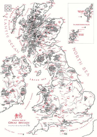
Beautiful hand-drawn map of UK in Lord of the Rings / Tolkien style
by Reddit user: u/NACHODYNAMYTE
https://www.reddit.com/r/lotr/comments/1oseuzg/a_map_of_great_britain_handdrawn_by_myself_using/
Beautiful hand-drawn map of UK in Lord of the Rings / Tolkien style
by Reddit user: u/NACHODYNAMYTE
https://www.reddit.com/r/lotr/comments/1oseuzg/a_map_of_great_britain_handdrawn_by_myself_using/
@infobeautiful I have waited a week, and no response.
When I sent my previous reply, I was presuming it must be an honest mistake. Two points which gave me this confidence:
(i) you've changed the title of the map from the author's title of "Great Britain" to "UK". At the very least that seems egregious. I still think it's a poor choice, but there's at least some historical argument to be made for the term "Great Britain". The "UK", on the other hand, is a relatively recent political term whose history is rooted in English colonial domination of the two islands.
I invite any interested reader to go read the wikipedia articles on the subject. During the ~700 years of colonial exploitation of Ireland, the term "UK" designated the whole island of Ireland for ~120 of those years, during, notably, the Great Famine, which perhaps I'll avoid detailing the horrors of here.
(ii) the author of the map repeatedly agrees that he'll change the name, and repeatedly apologises for the misnaming. If you simply wanted to respect the author of the map's wishes, you would either call it a map of "Great Britain", or call it what he says he'll update it to in future in the screenshots I attached.
But apparently no. I would have loved to hear the reasoning, but it appears you are determined to alter the author's name for their work, and to ignore my points (and the points of the various redditors who found the naming disrespectful).
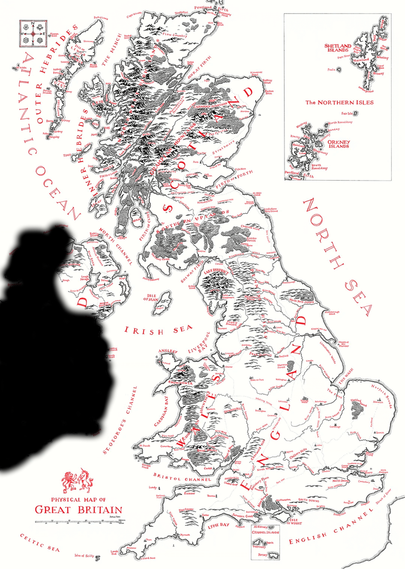
If you won't change the name, perhaps you'd consider updating the map to match it? Something like my rough attempt here?
Tagging my Celtic & Saxon brethren, if anyone wants to chime in.
#ireland #northernireland #scotland #wales #england #greatbritain #britain #uk #colonialism #famine
@pozorvlak @infobeautiful It includes, I don't know, maybe 3% of France? 2%? And maybe something like... 65%? 70? of the Republic of Ireland. So I don't think that's of any relevance to my points.
And, again, saying they're "correct" confuses me - the original author called it a map of "Great Britain", and when four or five Redditors said that it was politically insensitive / geographically not correct, the original author apologised, and said they'd change the name to something like "Great Britain and the East of Ireland".
If the poster here is correct to rename it to "UK", Is the original author of the map wrong, then? And was the original author of the map wrong to immediately concede to the Redditors, and say they will change the name going forward?
If you look up maps of the UK, they basically always make a clear distinction between ROI and UK, sometimes with different colours, sometimes even just having nothing where ROI is.
Here, it is a drawing of the UK, plus also the majority of the ROI, with no distinction between them.
So I would say that no, they quite literally are not following standard practice in calling it a "map of the UK". So, not "correct". I suggest doing an image search of "map of UK" and you will perhaps see what I mean?
@jbc yes, the original title was incorrect, so no, the original author was not wrong to change the title. Yes, making the RoI more visually distinct would improve the map.
By the way, @infobeautiful is clearly a broadcast-mode account: look at their "posts and replies" tab. I doubt they even monitor their inbox here.
@pozorvlak the original author was not wrong to say he'd change the title from "Great Britain" to "Great Britain and the East of Ireland"?
Then we agree?
Also, (and I think unrelatedly, personally, but unsure if you agree) I was curious about Orkney and Shetland, so went off to have a good read there.
In summary:
Geographical "Great Britain" = the main island, not including Orkney and Shetland, so I guess that's the definition you mean when you say the original title is wrong.
Political/Legal "Great Britain" = the main island (England + Scotland + Wales) and offshore islands belonging to them, i.e., including Orkney and Shetland.
See https://en.wikipedia.org/wiki/Law_of_the_United_Kingdom#Structure_and_history and https://en.wikipedia.org/wiki/Great_Britain#Political_definition for more gory detail.
So your claim that the original title (of Great Britain) is incorrect is false, if you're basing that claim on the idea that Orkney and Shetland are not a part of Great Britain. They apparently are, under legally and politically established definitions, which the original map author is presumably free to use.
Unless wikipedia is peddling falsehoods, which is possible. Please inform me if so! Regardless, I've enjoyed reading about it.
And thanks for the tip-off about it being a broadcast-mode account! Very useful info.