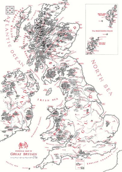
Beautiful hand-drawn map of UK in Lord of the Rings / Tolkien style
by Reddit user: u/NACHODYNAMYTE
https://www.reddit.com/r/lotr/comments/1oseuzg/a_map_of_great_britain_handdrawn_by_myself_using/
Beautiful hand-drawn map of UK in Lord of the Rings / Tolkien style
by Reddit user: u/NACHODYNAMYTE
https://www.reddit.com/r/lotr/comments/1oseuzg/a_map_of_great_britain_handdrawn_by_myself_using/
@infobeautiful I have waited a week, and no response.
When I sent my previous reply, I was presuming it must be an honest mistake. Two points which gave me this confidence:
(i) you've changed the title of the map from the author's title of "Great Britain" to "UK". At the very least that seems egregious. I still think it's a poor choice, but there's at least some historical argument to be made for the term "Great Britain". The "UK", on the other hand, is a relatively recent political term whose history is rooted in English colonial domination of the two islands.
I invite any interested reader to go read the wikipedia articles on the subject. During the ~700 years of colonial exploitation of Ireland, the term "UK" designated the whole island of Ireland for ~120 of those years, during, notably, the Great Famine, which perhaps I'll avoid detailing the horrors of here.
(ii) the author of the map repeatedly agrees that he'll change the name, and repeatedly apologises for the misnaming. If you simply wanted to respect the author of the map's wishes, you would either call it a map of "Great Britain", or call it what he says he'll update it to in future in the screenshots I attached.
But apparently no. I would have loved to hear the reasoning, but it appears you are determined to alter the author's name for their work, and to ignore my points (and the points of the various redditors who found the naming disrespectful).
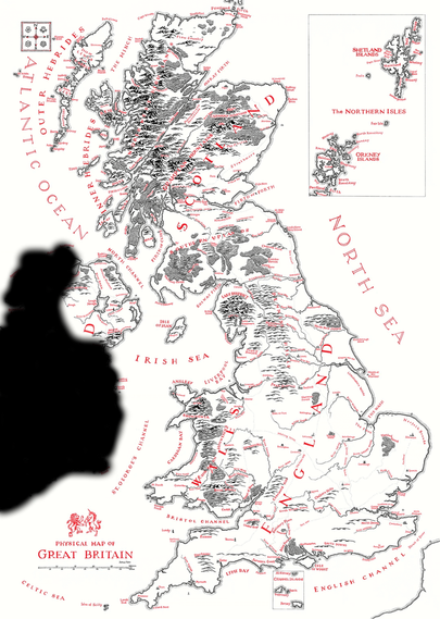
If you won't change the name, perhaps you'd consider updating the map to match it? Something like my rough attempt here?
Tagging my Celtic & Saxon brethren, if anyone wants to chime in.
#ireland #northernireland #scotland #wales #england #greatbritain #britain #uk #colonialism #famine
@iBallesty cos there's below 5% of France, and above 60% of the Republic of Ireland?
Some ROI people are very allergic to "British Isles", but I'm not actually. There's historical lineage from Roman times, I don't love it but it's not that bad, as in, I can accept it as a geographical term.
I think British Isles would have been better than Great Britain, and both of those better than UK, which I think it'd be a challenge to do worse than.
And, again, the original author called it a map of "Great Britain" (I mean, it's written on the map there) before it being changed to "UK" here, for some reason.
"UK and Ireland and the Isle of Man and a bit of France" would be wordy, but far more accurate, yes.
Anyway, I'm glad we somewhat agree 😂
@klu9 @iBallesty Problem solved! Someone call the King and we get the ball rolling on this 😂
Jokes aside, that's actually excellent. Will be using this (somewhere) going forward.
NEA (as an acronym, with "Northwest", pronounced like the name "Nia") or NWEA (as an initialism) as well, for the NWA reference. So many options.
His Noweannic Majesty!