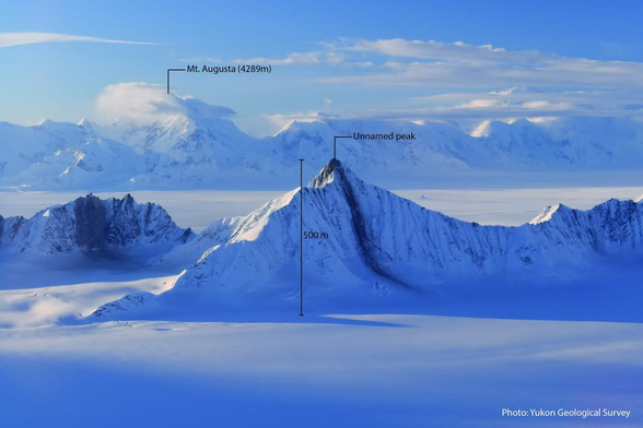
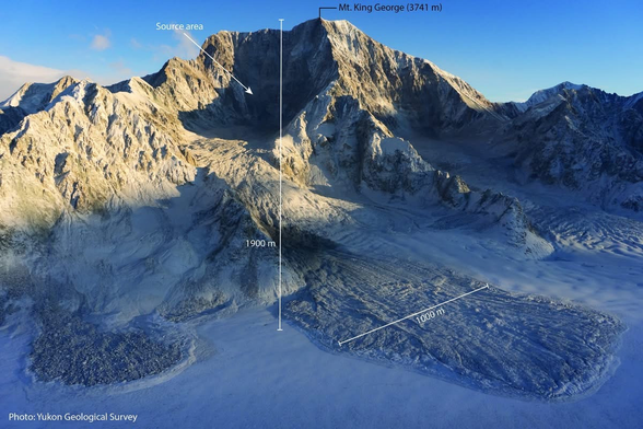
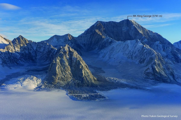
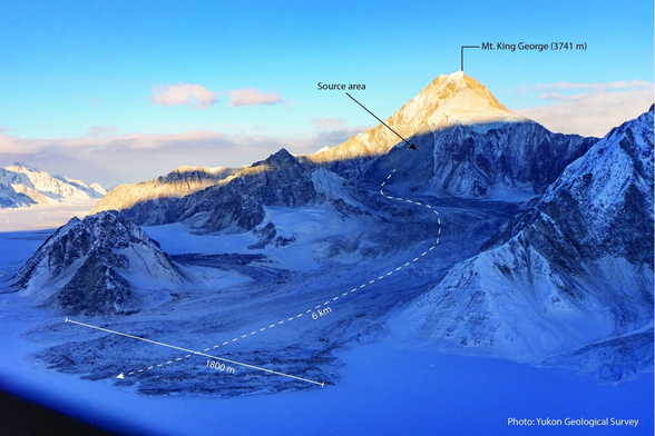
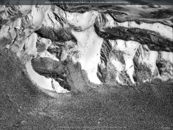
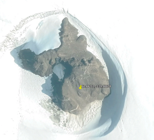
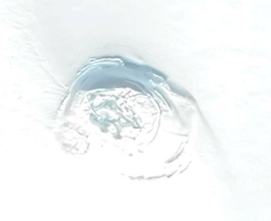
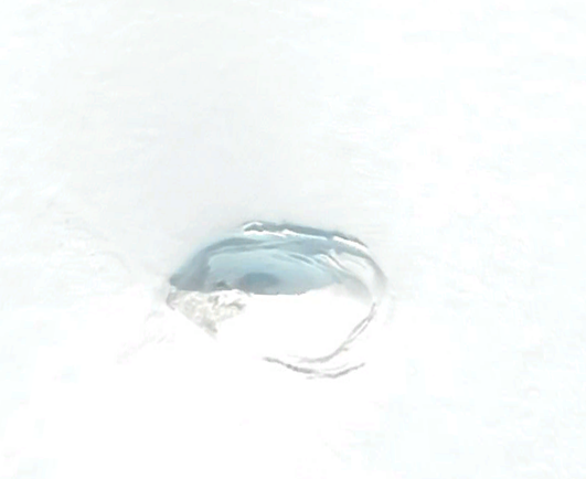
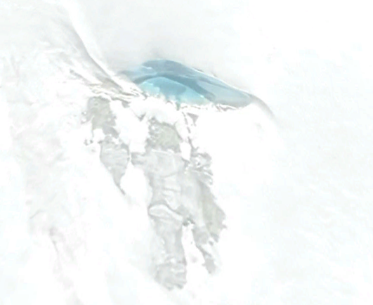
Oh wow, photos of the damage from the M7.0 earthquake in Alaska (originally Yukon Geological Survey on FB, via Dan Shugar). #earthquake #Alaska #landslide
Sentinel-1 before/after (in 3D) of that last one... Which I pulled off Copernicus a second ago. Wow! #MountKingGeorge #MtKingGeorge #geology #landslide #earthquake #RemoteImaging
This could be a synthetic aperture radar artifact, but at the base of that landslide is a strange topology anomaly. 🤔
Hmm, what funky object is radar reflective in a weird way on an ice sheet? Ice itself? Ground down granite? So many odds things out there, LOL.
Oooh, the second one, the strange ring, is this. I wonder if that's volcanic? There appears to be a lot of dust stuck to the walls of the snow around that structure, which is causing those reflections. 🤷 #mystery #geology

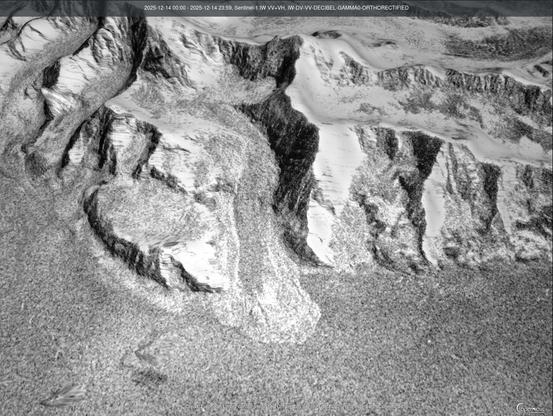
This one looks like there's a door in it 🤪

Secret villain lair?

Spaceship?

(probably the top of a buried mountain 😉 )

For the record, 60.4893, -139.9348

#mystery

Oooh, it's VERY radar reflective. Whatever it is. Super secret Canadian military base encased in a glacier? 🤪
@ai6yr very rough rocks can be highly radar reflective. That's what all the "bright areas" on early radar maps of Venus turned out to be. It's just a very difficult place to lose a cow.

@llewelly

My first guess would have been coherent backscatter from multiple reflections within a pit.

Polarization maps would help resolve that, if @ai6yr has them.

@michael_w_busch @ai6yr well, your guess is probably better than mine.

@llewelly @ai6yr

In the case of Venus, some of the radar bright regions are metallic frost that condenses out on the tops of mountains.

Fortunately, we do not have to deal with that possibility around here.

@michael_w_busch @llewelly Looks like the flaws are from the Copernicus DEM layer, which apparently has a problem acquisition on glaciers. From visual inspection, it looks like pits/crevasses which have material deposition on top of the ice (from the mountains... I assume eroded rocks of some sort), which must be causing that backscatter on those particular satellites they used. Must be particularly reflective material that is in those pits.
@michael_w_busch @llewelly Radar reflective crevasse? LOL.
@michael_w_busch @llewelly No idea what these are, but that glacier has a lot of these on the surface... looks like pits of some sort. Probably end up as unintentional radar reflectors!

@ai6yr @llewelly

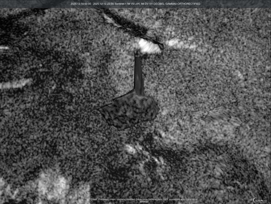
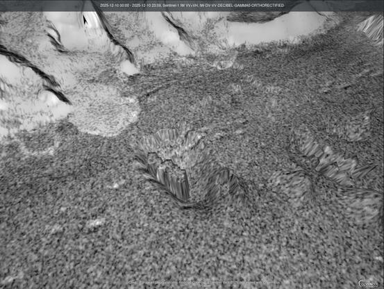
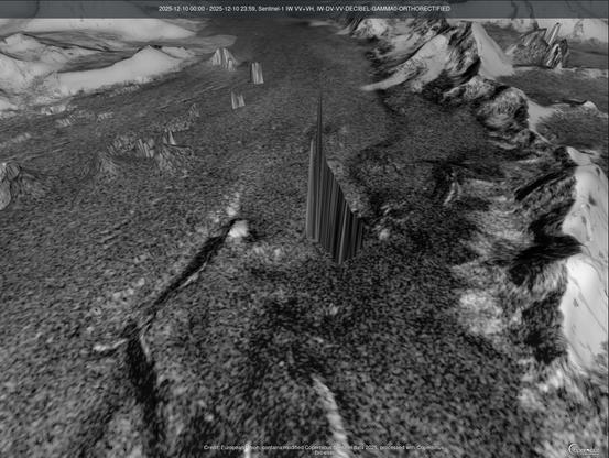
It does not require particularly reflective material to get coherent backscatter, just two signal paths that have the same path length (e.g. double bounces where swapping the inbound and outbound gives the same length).

Ice and snowpack are infamous for this happening.

Because the backscatter is coherent, it is also a great way to mess up phase and get glitches in SAR elevation maps.

Polarization maps can resolve it by separating even-order scattering from odd-order.

@michael_w_busch @llewelly Oooh, interesting, didn't know it just requires the same path length! I did figure it was some kind of SAR artifact 🤪

@ai6yr @llewelly

On this I recommend Elachi & van Zyl's "Introduction to the Physics and Techniques of Remote Sensing", which Jakob van Zyl taught me from in grad school.

(Both authors were experts on SAR, so the book covers it extensively as compared to other remote sensing techniques.)

@michael_w_busch @llewelly Thanks! I teach undergrads how to use the tools and the principles of remote sensing, but we don't get into the physics and math (only the application), and I have come in to this in a roundabout manner (ie using the tools for practical reasons, vs. the theoretical/academic route), so this is all appreciated!