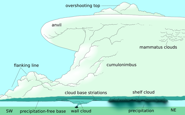
2005 August 21

A Lenticular Cloud Over Hawai'i
* Credit & Copyright: Peter Michaud (Gemini Obs.)
https://www.gemini.edu/

Explanation:
Can a cloud do that? Actually, pictured above are several clouds all stacked up into one striking lenticular cloud. Normally, air moves much more horizontally than it does vertically. Sometimes, however, such as when wind comes off of a mountain or a hill, relatively strong vertical oscillations take place as the air stabilizes. The dry air at the top of an oscillation may be quite stratified in moisture content, and hence forms clouds at each layer where the air saturates with moisture. The result can be a lenticular cloud with a strongly layered appearance. The above picture was taken near Mauna Kea, Hawaii, USA.

https://apod.nasa.gov/apod/ap050821.html

#space #earth #atmophere #clouds #weather #photography #science #physics #meteorology #nature #education

2003 March 26

A Lenticular Cloud Over Wyoming
* Credit & Copyright: Mark Meyer (Photo-Mark.com)

Explanation:
Is that a cloud or a flying saucer? Both, although it is surely not an alien spacecraft. Lenticular clouds can be shaped like a saucer, and can fly in the sense that, like most clouds, they are composed of small water droplets that float on air. Lenticular clouds are typically formed by high winds over rugged terrain and are particularly apparent when few other clouds are in the sky. Lenticular clouds can take on particularly strange, layered shapes. Above, a couple stopped their car near Yellowstone National Park in Wyoming, USA to photograph this lenticular cloud behind picturesque windmills.

https://apod.nasa.gov/apod/ap030326.html

#space #earth #atmophere #clouds #weather #photography #science #physics #meteorology #nature #education

Lenticular Cloud, Moon, Mars, Venus
* Image Credit & Copyright: Nuno Serrao

Explanation:
It is not every day that such an interesting cloud photobombs your image. The original plan was to photograph a rare angular conjunction of Mars and Venus that occurred a week and a half ago, with the added bonus of a crescent Moon and the International Space Station (ISS) both passing nearby. Unfortunately, on Madeira Island, Portugal, this event was clouded out. During the next day, however, a spectacular lenticular cloud appeared before sunset, so the industrious astrophotographer quickly formulated a new plan. A close look at the resulting image reveals the Moon visible toward the left of the frame, while underneath, near the bottom, are the famous planets with Venus being the brighter. It was the unexpected lenticular cloud, though, perhaps looking like some sort of futuristic spaceship, that stole the show. The setting Sun illuminated the stationary cloud (and everything else) from the bottom, setting up an intricate pattern of shadows, layers, and brightly illuminated regions, all seen evolving in a corresponding video. Mars and Venus will next appear this close on the sky in late August, but whether any place on Earth will catch them behind such a photogenic cloud is unknown.

https://apod.nasa.gov/apod/ap150302.html

#space #earth #atmophere #clouds #weather #photography #science #physics #meteorology #nature #education

From Wikipedia, the free encyclopedia

Lenticular clouds

Lenticular clouds
(from Latin lenticularis 'lentil-shaped', from lenticula 'lentil') are stationary clouds that form mostly in the troposphere, typically in parallel alignment to the wind direction. They are often comparable in appearance to a lens or saucer. Nacreous clouds that form in the lower stratosphere sometimes have lenticular shapes.

There are three main types of lenticular clouds:
+ altocumulus standing lenticular (ACSL),
+ stratocumulus standing lenticular (SCSL), and
+ cirrocumulus standing lenticular (CCSL),
varying in altitude above the ground.

[...] more in the reply

#space #earth #atmophere #clouds #weather #photography #science #physics #meteorology #nature #education

Lenticular clouds

From Wikipedia, the free encyclopedia

[...]
Formation and appearance

As air travels along the surface of the Earth, obstructions are often encountered, including natural features, such as mountains or hills, and artificial structures, such as buildings and other constructions, which disrupt the flow of air into "eddies", or areas of turbulence.

When moist, stable air flows over a larger eddy, such as those caused by mountains, a series of large-scale standing waves form on the leeward side of the mountain. If the temperature at the crest of the wave drops below the dew point, moisture in the air may condense to form lenticular clouds. Under certain conditions, long strings of lenticular clouds may form near the crest of each successive wave, creating a formation known as a "wave cloud". Those wave systems can produce large updrafts, occasionally enough for water vapour to condense and produce precipitation https://en.wikipedia.org/wiki/Precipitation

[...] more in the reply

#space #earth #atmophere #clouds #weather #photography #science #physics #meteorology #nature #education

Lenticular clouds

From Wikipedia, the free encyclopedia

[...]

Lenticular clouds have been said to be mistaken for UFOs, because many of them have the shape of a "flying saucer", with a characteristic "lens" or smooth, saucer-like shape. Lenticular clouds generally do not form over low-lying or flat terrain, so many people may have never seen one before and don't know that they can exist. Bright colours (called iridescence) are sometimes seen along the edge of lenticular clouds.

Pilots of powered aircraft tend to avoid flying near lenticular clouds because of the turbulence and sinking air of the rotor generated at the trailing edge of these clouds, but glider pilots actively seek them out in order to climb in the upward moving air at the leading edge. The precise location of the rising air mass is fairly easy to predict from the orientation of the clouds. "Wave lift" of this kind is often very smooth and strong, and enables gliders to soar to remarkable altitudes and to cover great distances. As of 2020, the gliding world records for both distance (over 3,000 km; 1,864 mi) and absolute altitude (over 22,000 metres; 74,334 ft) were set using such lift.

https://en.wikipedia.org/wiki/Lenticular_cloud

CREDIT
Contributors to Wikimedia projects

#space #earth #atmophere #clouds #weather #photography #science #physics #meteorology #nature #education

2019 August 19

Lenticular Clouds over Mount Etna
* Image Credit & Copyright: Dario Giannobile
https://www.dariogiannobile.com/blog

Explanation:
What's happening above that volcano? Although Mount Etna is seen erupting, the clouds are not related to the eruption. They are lenticular clouds formed when moist air is forced upwards near a mountain or volcano. The surreal scene was captured by chance late last month when the astrophotographer went to Mount Etna, a UNESCO World Heritage Site in Sicily, Italy, to photograph the conjunction between the Moon and the star Aldebaran. The Moon appears in a bright crescent phase, illuminating an edge of the lower lenticular cloud. Red hot lava flows on the right. Besides some breathtaking stills, a companion time-lapse video of the scene shows the lenticular clouds forming and wavering as stars trail far in the distance.

https://apod.nasa.gov/apod/ap190819.html

#space #earth #atmophere #clouds #weather #photography #science #physics #meteorology #nature #education

Scenery timelaps for the previous post

Lenticular Clouds over Mount Etna
* Image Credit & Copyright: Dario Giannobile
https://www.dariogiannobile.com/blog

https://apod.nasa.gov/apod/ap190819.html

#space #earth #atmophere #clouds #weather #photography #science #physics #meteorology #nature #education

2012 November 4

Lenticular Clouds Over Washington
* Credit & Copyright: Tim Thompson
https://www.dariogiannobile.com/blog

Explanation:
Are those UFOs near that mountain? No -- they are multilayered lenticular clouds. Moist air forced to flow upward around mountain tops can create lenticular clouds. Water droplets condense from moist air cooled below the dew point, and clouds are opaque groups of water droplets. Waves in the air that would normally be seen horizontally can then be seen vertically, by the different levels where clouds form. On some days the city of Seattle, Washington, USA, is treated to an unusual sky show when lenticular clouds form near Mt. Rainier, a large mountain that looms just under 100 kilometers southeast of the city. This image of a spectacular cluster of lenticular clouds was taken in 2008 December.

https://apod.nasa.gov/apod/ap121104.html

#space #earth #atmophere #clouds #weather #photography #science #physics #meteorology #nature #education

Lenticulars form and move differently than other clouds

Lenticular clouds are different from other clouds because they don’t form and move along but rather sit in one place, continually re-formed as air moves through them, causing them to morph slightly over time. They are the result of air rising to its condensation point over and downstream of an object, typically a mountain; however, they can also result from waves generated in the atmosphere itself.

Quote by Jesse Ferrell, AccuWeather meteorologist and senior weather editor

https://www.accuweather.com/en/weather-news/lenticular-clouds-sometimes-mistaken-for-ufos-are-in-a-league-of-their-own/1694242

#space #earth #atmophere #clouds #weather #photography #science #physics #meteorology #nature #education

2013 November 26

Cap Cloud over the Sierra Nevadas
* Image Credit & Copyright: GUIDO MONTAÑÉS
https://guidomontanes.wordpress.com/

Explanation:
One might say this was a bell weather day for the Sierra Nevada mountains. In January, just as the Sun was setting above the district of Albaicín in Grenada, Spain, a huge cloud appeared as a bell capping the Veleta peak. Such a Cap cloud is formed by air forced upwards by a mountain peak, with the air then cooling, saturating with moisture, and finally having its molecular water condense into cloud droplets. Such a bell-shaped cloud structure is unusual as air typically moves horizontally, making most clouds nearly flat across at the bottom. Vertical waves can also give additional lenticular cloud layers, as also seen above. Given the fleeting extent of the great cloud coupled with momentarily excellent sunset coloring, one might considered this also a bellwether day for an accomplished photographer.

https://apod.nasa.gov/apod/ap131126.html

#space #earth #atmophere #clouds #weather #photography #science #physics #meteorology #nature #education

2013 April 17

Mt. Hood and a Lenticular Cloud
* Image Credit & Copyright: Ben Canales
https://www.facebook.com/BCstartrail

Explanation:
What kind of cloud is next to that mountain? A lenticular. This type of cloud forms in air that passes over a mountain, rises up again, and cools past the dew point -- so what molecular water carried in the air condenses into droplets. The layered nature of some lenticular clouds may make them appear, to some, as large alien spaceships. In this case, the mountain pictured is Mt. Hood located in Oregon, USA. Lenticular clouds can only form when conditions are right -- for example this is first time this astrophotographer has seen a lenticular cloud at night near Mt. Hood. The above image was taken in mid-March about two hours before dawn.

https://apod.nasa.gov/apod/ap130417.html

#space #earth #atmophere #clouds #weather #photography #science #physics #meteorology #nature #education

Mammatus cloud

From Wikipedia, the free encyclopedia

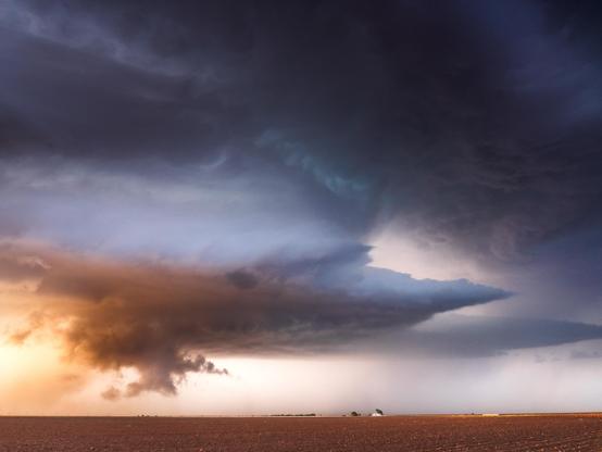
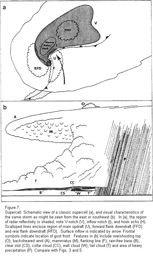
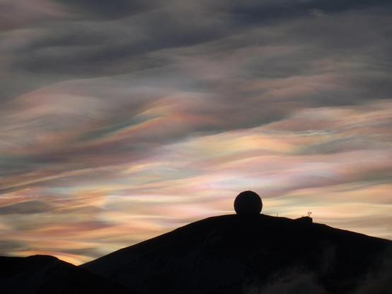
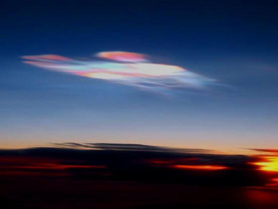
Mammatus (also called mamma or mammatocumulus, meaning "mammary cloud") is a cellular pattern of pouches hanging underneath the base of a cloud, typically a cumulonimbus raincloud, although they may be attached to other classes of parent clouds. The name mammatus is derived from the Latin mamma (meaning "udder" or "breast").

According to the WMO International Cloud Atlas, mamma is a cloud supplementary feature rather than a genus, species or variety of cloud. The distinct "lumpy" undersides form as cold air sinks, creating pockets that contrast with the rising puffs of clouds caused by the convection of warm air. These formations were first described in 1894 by William Clement Ley.

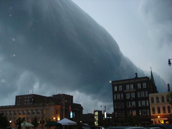
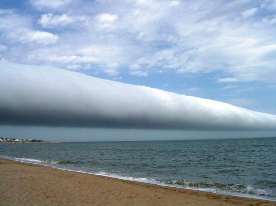
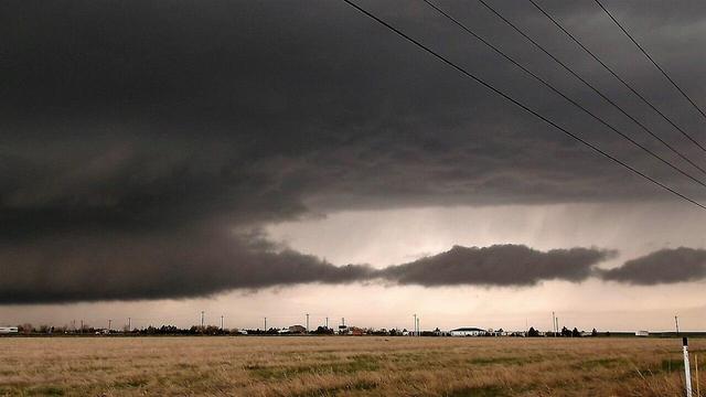
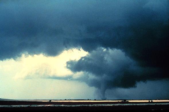
Mammatus are most often associated with anvil clouds and also severe thunderstorms. They often extend from the base of a cumulonimbus cloud, but may also be found under altostratus, and cirrus clouds, as well as volcanic ash clouds. When occurring in cumulonimbus, mammatus are often indicative of a particularly strong storm. Due to the intensely sheared environment in which mammatus form, aviators are strongly cautioned to avoid cumulonimbus with mammatus as they indicate convectively induced turbulence. Contrails may also produce lobes but these are incorrectly termed as mammatus.

Mammatus may appear as smooth, ragged or lumpy lobes and may be opaque or translucent. Because mammatus occur as a grouping of lobes, the way they clump together can vary from an isolated cluster to a field of mammae that spread over hundreds of kilometers to being organized along a line, and may be composed of either unequal or similarly-sized lobes.
[...] read more in the next reply

CREDIT
Contributors to Wikimedia projects
* Image - Dr Ashok Kolluru

#space #earth #atmophere #clouds #weather #photography #science #physics #meteorology #nature #education

Mammatus cloud

From Wikipedia, the free encyclopedia

[...]
The individual mammatus lobe average diameters of 1–3 kilometres (0.6–1.9 mi) and lengths on average of 1⁄2 kilometre (0.3 mi). A lobe can last an average of 10 minutes, but a whole cluster of mamma can range from 15 minutes to a few hours. They are usually composed of ice, but also can be a mixture of ice and liquid water or be composed of almost entirely liquid water.

True to their ominous appearance, mammatus clouds are often harbingers of a coming storm or other extreme weather system. Typically composed primarily of ice, they can extend for hundreds of miles in each direction and individual formations can remain visibly static for ten to fifteen minutes at a time. They usually appear around, before, or even after severe weather.

Hypothesized formation mechanisms

The existence of many different types of mammatus clouds, each with distinct properties and occurring in distinct environments, has given rise to multiple hypotheses on their formation, which are also relevant to other cloud forms.

One environmental trend is shared by all of the formation mechanisms hypothesized for mammatus clouds: sharp gradients in temperature, moisture and momentum (wind shear) across the anvil cloud/sub-cloud air boundary, which strongly influence interactions therein.
[...] Please read further next reply.

#space #earth #atmophere #clouds #weather #photography #science #physics #meteorology #nature #education

[...]
The following are the proposed mechanisms, each described with its shortcomings:

+ The anvil of a cumulonimbus cloud gradually subsides as it spreads out from its source cloud. As air descends, it warms. However, the cloudy air will warm more slowly (at the moist adiabatic lapse rate) than the sub-cloud, dry air (at the dry adiabatic lapse rate). Because of the differential warming, the cloud/sub-cloud layer destabilizes and convective overturning can occur, creating a lumpy cloud-base. The problems with this theory are that there are observations of mammatus lobes that do not support the presence of strong subsidence in the lobes, and that it is difficult to separate the processes of hydrometeor fallout and cloud-base subsidence, thus rendering it unclear as to whether either process is occurring.
+ Cooling due to hydrometeor fallout is a second proposed formation mechanism. As hydrometeors fall into the dry sub-cloud air, the air containing the precipitation cools due to evaporation or sublimation. Being now cooler than the environmental air and unstable, they descend until in static equilibrium, at which point a restoring force curves the edges of the fallout back up, creating the lobed appearance. One problem with this theory is that observations show that cloud-base evaporation does not always produce mammatus. This mechanism could be responsible for the earliest stage of development, but other processes (namely process 1, above) may come into play as the lobes are formed and mature.
+ There may also be destabilization at cloud base due to melting. If the cloud base exists near the freezing line, then the cooling in the immediate air caused by melting can lead to convective overturning, just as in the processes above. However, this strict temperature environment is not always present.
[...] Please read next reply

#space #earth #atmophere #clouds #weather #photography #science #physics #meteorology #nature #education

[...]
+ The above processes specifically relied on the destabilization of the sub-cloud layer due to adiabatic or latent heating effects. Discounting the thermodynamical effects of hydrometeor fallout, another mechanism proposes that dynamics of the fallout alone are enough to create the lobes. Inhomogeneities in the masses of the hydrometeors along the cloud-base may cause inhomogeneous descent along the base. Frictional drag and associated eddy-like structures create the lobed appearance of the fallout. The main shortcoming of this theory is that vertical velocities in the lobes have been observed to be greater than the fall speeds of the hydrometeors within them; thus, there should be a dynamical downward forcing, as well.
+ Another method, that was first proposed by Kerry Emanuel, is called cloud-base detrainment instability (CDI), which acts very much like convective cloud-top entrainment. In CDI, cloudy air is mixed into the dry sub-cloud air rather than precipitating into it. The cloudy layer destabilizes due to evaporative cooling and mammatus are formed.
+ Clouds undergo thermal reorganization due to radiative effects as they evolve. There are a couple of ideas as to how radiation can cause mammatus to form. One is that, because clouds radiatively cool (Stefan–Boltzmann law) very efficiently at their tops, entire pockets of cool, negatively buoyant cloud can penetrate downward through the entire layer and emerge as mammatus at cloud-base. Another idea is that as the cloud-base warms due to radiative heating from land surface's longwave emission, the base destabilizes and overturns. This method is valid for only optically thick clouds. However, the nature of anvil clouds is that they are largely made up of ice, and are therefore relatively optically thin.

From Wikipedia, the free encyclopedia
CREDITS
Contributors to Wikimedia projects

#space #earth #atmophere #clouds #weather #photography #science #physics #meteorology #nature #education

Gravity waves

are proposed to be the formation mechanism of linearly organized mammatus clouds. Indeed, wave patterns have been observed in the mammatus environment, but this is mostly due to gravity wave creation as a response to a convective updraft impinging upon the tropopause and spreading out in wave form over the entirety of the anvil. Therefore, this method does not explain the prevalence of mammatus clouds in one part of the anvil versus another. Furthermore, time and size scales for gravity waves and mammatus do not match up entirely. Gravity wave trains may be responsible for organizing the mammatus rather than forming them.

From Wikipedia, the free encyclopedia
CREDITS
Contributors to Wikimedia projects

#space #earth #atmophere #clouds #weather #photography #science #physics #meteorology #nature #education

"Here is a representative [Representative in both senses of the word (just kidding..)] example of the structural organization of mammatus-cloud-formations by atmospheric gravitational waves:"

2020 December 7

Mammatus Clouds over Mount Rushmore
* Image Credit & Copyright: Laure Mattuzzi

Explanation:
What's that below those strange clouds? Presidents. If you look closely, you may recognize the heads of four former US Presidents carved into famous Mount Rushmore in South Dakota, USA. More obvious in the featured image are the unusual mammatus clouds that passed briefly overhead. Both were captured together by a surprised tourist with a quick camera in early September. Unlike normal flat-bottomed clouds which form when moist and calm air plateaus rise and cool, bumpy mammatus clouds form as icy and turbulent air pockets sink and heat up. Such turbulent air is frequently accompanied by a thunderstorm. Each mammatus lobe spans about one kilometer. The greater mountain is known to native Lakota Sioux as Six Grandfathers, deities responsible for the directions north, south, east, west, up, and down.

https://apod.nasa.gov/apod/ap201207.html

#space #earth #atmophere #clouds #weather #photography #science #physics #meteorology #nature #education

Kelvin–Helmholtz (K–H) instability

is prevalent along cloud boundaries and results in the formation of wave-like protrusions (called Kelvin-Helmholtz billows) from a cloud boundary.

Mammatus are not in the form of K-H billows, thus, it is proposed that the instability can trigger the formation of the protrusions, but that another process must form the protrusions into lobes. Still, the main downfall with this theory is that K-H instability occurs in a stably stratified environment, and the mammatus environment is usually at least somewhat turbulent.

From Wikipedia, the free encyclopedia
CREDITS
Contributors to Wikimedia projects
* Image: UCAR

Rayleigh–Taylor instability

is the name given to the instability that exists between two fluids of differing densities, when the denser of the two is atop the less dense fluid. Along a cloud-base/sub-cloud interface, the denser, hydrometeor-laden air could cause mixing with the less-dense sub-cloud air. This mixing would take the form of mammatus clouds. The physical problem with this proposed method is that an instability existing along a static interface cannot necessarily be applied to the interface between two sheared atmospheric flows

From Wikipedia, the free encyclopedia
CREDITS
Contributors to Wikimedia projects

Image:
Shengtai Li, Hui Li - "Parallel AMR Code for Compressible MHD or HD Equations"

#space #earth #atmophere #clouds #weather #photography #science #physics #meteorology #nature #education

The last proposed formation mechanism is that mammatus arise from Rayleigh–Bénard convection, where differential heating (cooling at the top and heating at the bottom) of a layer causes convective overturning. However, in this case of mammatus, the base is cooled by thermodynamical mechanisms mentioned above. As the cloud base descends, it happens on the scale of mammatus lobes, while adjacent to the lobes, there is a compensating ascent. This method has not proven to be observationally sound and is viewed as generally insubstantial.

This plenitude of proposed formation mechanisms shows, if nothing else, that the mammatus cloud is generally poorly understood.

From Wikipedia, the free encyclopedia
CREDITS
Contributors to Wikimedia projects

Video and description:
WikiRigaou

#space #earth #atmophere #clouds #weather #photography #science #physics #meteorology #nature #education

"However despite the lack of our understanding, lets enjoy them one more time"

2007 December 30

Mammatus Clouds Over Mexico
* Credit & Copyright: Raymundo Aguirre

Explanation:
Normal cloud bottoms are flat because moist warm air that rises and cools will condense into water droplets at a very specific temperature, which usually corresponds to a very specific height. After water droplets form that air becomes an opaque cloud. Under some conditions, however, cloud pockets can develop that contain large droplets of water or ice that fall into clear air as they evaporate. Such pockets may occur in turbulent air near a thunderstorm, being seen near the top of an anvil cloud, for example. Resulting mammatus clouds can appear especially dramatic if sunlit from the side. These mammatus clouds were photographed over Monclova, Mexico.

https://apod.nasa.gov/apod/ap071230.html

#space #earth #atmophere #clouds #weather #photography #science #physics #meteorology #nature #education

2024 November 19

Undulatus Clouds over Las Campanas Observatory
* Image Credit & Copyright: Yuri Beletsky (Carnegie Las Campanas Observatory, TWAN); h/t: Alice Allen
https://www.instagram.com/yuribeletsky/
https://en.wikipedia.org/wiki/Alice_Allen_(astronomer)
https://www.lco.cl/
https://carnegiescience.edu/

Explanation:
What's happening with these clouds? While it may seem that these long and thin clouds are pointing toward the top of a hill, and that maybe a world-famous observatory is located there, only part of that is true. In terms of clouds, the formation is a chance superposition of impressively periodic undulating air currents in Earth's lower atmosphere. Undulatus, a type of Asperitas cloud, form at the peaks where the air is cool enough to cause the condensation of opaque water droplets. The wide-angle nature of the panorama creates the illusion that the clouds converge over the hill. In terms of land, there really is a world-famous observatory at the top of that peak: the Carnegie Science's Las Campanas Observatory in the Atacama Desert of Chile. The two telescope domes visible are the 6.5-meter Magellan Telescopes. The featured coincidental vista was a surprise but was captured by the phone of a quick-thinking photographer in late September.

https://climatekids.nasa.gov/cloud-formation/
https://gpm.nasa.gov/education/videos/nasa-our-world-what-cloud
https://en.wikipedia.org/wiki/Periodic_function
https://www.nasa.gov/general/what-is-earths-atmosphere/

https://en.wikipedia.org/wiki/Magellan_Telescopes

https://apod.nasa.gov/apod/ap241119.html

#space #earth #atmophere #clouds #weather #photography #science #physics #meteorology #nature #education

From Wikipedia, the free encyclopedia

Arcus Clouds

An arcus cloud is a low, horizontal cloud formation, usually appearing as an accessory cloud to a cumulonimbus. Roll clouds and shelf clouds are the two main types of arcus clouds. They most frequently form along the leading edge or gust fronts of thunderstorms; some of the most dramatic arcus formations mark the gust fronts of derecho-producing convective systems. Roll clouds may also arise in the absence of thunderstorms, forming along the shallow cold air currents of some sea breeze boundaries and cold fronts.

A shelf cloud is a low, horizontal, wedge-shaped arcus cloud attached to the base of the parent cloud, which is usually a thunderstorm cumulonimbus, but could form on any type of convective clouds. Rising air motion can often be seen in the leading (outer) part of the shelf cloud, while the underside can often appear as turbulent and wind-torn. Cool, sinking air from a storm cloud's downdraft spreads out across the land surface, with the leading edge called a gust front. This outflow cuts under warm air being drawn into the storm's updraft. As the lower and cooler air lifts the warm moist air, its water condenses, creating a cloud which often rolls with the different winds above and below (wind shear).
[..] Read more in the next reply

CREDITS
Contributors to Wikimedia projects
+ Video:
Karthik Easvur
https://commons.wikimedia.org/wiki/User:Karthik_Easvur

#space #earth #atmophere #clouds #weather #photography #science #physics #meteorology #nature #education

[..]
People seeing a shelf cloud may believe they have seen a wall cloud. This is likely to be a mistake, since an approaching shelf cloud appears to form a wall made of cloud. Shelf clouds usually appear on the leading edge of a storm, while wall clouds are usually at the rear of the storm.
[..]

CREDIT
Contributors to Wikimedia projects
+ Image (Example Wallcloud):
Raychel Sanner

#space #earth #atmophere #clouds #weather #photography #science #physics #meteorology #nature #education

[..]
A sharp, strong gust front will cause the lowest part o
f the leading edge of a shelf cloud to be ragged and lined with rising fractus clouds. In a severe case there will be vortices along the edge, with twisting masses of scud that may reach to the ground or be accompanied by rising dust. A very low shelf cloud accompanied by these signs is the best indicator that a potentially violent wind squall is approaching. An extreme example of this phenomenon looks almost like a tornado and is known as a gustnado.
[..]

CREDITS:
Contributors to Wikimedia projects
+ Image (A shelf cloud over Enschede, Netherlands):
John Kerstholt

[Arcus Clouds Side-effects]

---
A squall is a sudden, sharp increase in wind speed lasting minutes, as opposed to a wind gust, which lasts for only seconds. They are usually associated with active weather, such as rain showers, thunderstorms, or heavy snow. Squalls refer to the increase of the sustained winds over that time interval, as there may be higher gusts during a squall event. They usually occur in a region of strong sinking air or cooling in the mid-atmosphere. These force strong localized upward motions at the leading edge of the region of cooling, which then enhances local downward motions just in its wake.

CREDITS:
Contributors to Wikimedia projects
---

#space #earth #atmophere #clouds #weather #photography #science #physics #meteorology #nature #education

[Arcus Clouds Side-effects]

___
A gustnado is a brief, shallow surface-based vortex which forms within the downburst emanating from a thunderstorm. The name is a portmanteau by elision of "gust front tornado", as gustnadoes form due to non-tornadic straight-line wind features in the downdraft (outflow), specifically within the gust front of strong thunderstorms. Gustnadoes tend to be noticed when the vortices loft sufficient debris or form condensation cloud to be visible although it is the wind that makes the gustnado, similarly to tornadoes. As these eddies very rarely connect from the surface to the cloud base, they are very rarely considered as tornadoes. The gustnado has little in common with tornadoes structurally or dynamically in regard to vertical development, intensity, longevity, or formative process—as classic tornadoes are associated with mesocyclones within the inflow (updraft) of the storm, not the outflow.

The average gustnado lasts a few seconds to a few minutes, although there can be several generations and simultaneous swarms. Most have the winds equivalent to an F0 or F1 tornado (up to 180 km/h or 110 mph), and are commonly mistaken for tornadoes. However, unlike tornadoes, the rotating column of air in a gustnado usually does not extend all the way to the base of the thundercloud. Gustnadoes actually have more in common with (minor) whirlwinds. They are not considered true tornadoes (unless they connect the surface to the ambient cloud base in which case they'd become a landspout) by most meteorologists and are not included in tornado statistics in most areas. [...]
Read more:
https://en.wikipedia.org/wiki/Gustnado

CREDITS:
Contributors to Wikimedia projects
___

#space #earth #atmophere #clouds #weather #photography #science #physics #meteorology #nature #education

[..]

Roll Clouds

(Cloud Atlas name volutus) is a low, horizontal, tube-shaped, and relatively rare type of arcus cloud. They differ from shelf clouds by being completely detached from other cloud features. Roll clouds usually appear to be "rolling" about a horizontal axis. They are a solitary wave called a soliton, which is a wave that has a single crest and moves without changing speed or shape. This rolling is due to the variation in speed and direction of the winds with altitude (wind shear).

One of the most famous frequent occurrences is the Morning Glory cloud in Queensland, Australia, which can occur up to four out of ten days in October. One of the main causes of the Morning Glory cloud is the mesoscale circulation associated with sea breezes that develop over the Cape York Peninsula and the Gulf of Carpentaria. Such coastal roll clouds have been seen in many places, including California, the English Channel, Shetland Islands, the North Sea coast, coastal regions of Australia, and Nome, Alaska.

However, similar features can be created by downdrafts from thunderstorms or advancing cold front, and are not exclusively associated with coastal regions. They have been reported at different locations inland, including Kansas.

Roll clouds have not been associated with funnel clouds or tornadoes, as they are a horizontal vortex.

https://en.wikipedia.org/wiki/Arcus_cloud#Roll_cloud

CREDITS:
Contributors to Wikimedia projects
+ Image:
Eazydp

#space #earth #atmophere #clouds #weather #photography #science #physics #meteorology #nature #education

2013 June 2

A Roll Cloud Over Uruguay
* Credit & Licence: Daniela Mirner Eberl

Explanation:
What kind of cloud is this? A roll cloud. These rare long clouds may form near advancing cold fronts. In particular, a downdraft from an advancing storm front can cause moist warm air to rise, cool below its dew point, and so form a cloud. When this happens uniformly along an extended front, a roll cloud may form. Roll clouds may actually have air circulating along the long horizontal axis of the cloud. A roll cloud is not thought to be able to morph into a tornado. Unlike a similar shelf cloud, a roll cloud, a type of Arcus cloud, is completely detached from their parent cumulonimbus cloud. Pictured below, a roll cloud extends far into the distance in 2009 January above Las Olas Beach in Maldonado, Uruguay.

https://apod.nasa.gov/apod/ap130602.html

#space #earth #atmophere #clouds #weather #photography #science #physics #meteorology #nature #education

Video of a Roll Cloud
by reedme76

"This weather phenomenon, known as a Roll Cloud stretched across the sky and spun in a spiral rotation on May 27, 2007. The cloud came in off of Lake Huron and passed over Chief's Point and our family's property at the southern end of Oliphant in Bruce County, Ontario. We quickly realized that this cloud was being pushed by a cold air mass as the temperature dropped from the low-70s down to the mid-50s in about 3 minutes. Chilly gusts of wind picked up as the cloud passed overhead."

CREDIT
Text & Video
reedme76
https://www.youtube.com/@reedme76

#space #earth #atmophere #clouds #weather #photography #science #physics #meteorology #nature #education

From Wikipedia, the free encyclopedia

Wall Cloud

(murus or pedestal cloud) is a large, localized, persistent, and often abrupt lowering of cloud that develops beneath the surrounding base of a cumulonimbus cloud and from which tornadoes sometimes form. It is typically beneath the rain-free base (RFB) portion of a thunderstorm, and indicates the area of the strongest updraft within a storm. Rotating wall clouds are an indication of a mesocyclone in a thunderstorm; most strong tornadoes form from these. Many wall clouds do rotate; however, some do not.

Wall clouds are formed by a process known as entrainment, when an inflow of warm, moist air rises and converges, overpowering wet, rain-cooled air from the normally downwind downdraft. As the warm air continues to entrain the cooler air, the air temperature drops, and the dew point increases (thus the dew point depression decreases). As this air continues to rise, it becomes more saturated with moisture, which results in additional cloud condensation, sometimes in the form of a wall cloud. Wall clouds may form as a descending of the cloud base or may form as rising scud comes together and connects to the storm's cloud base.

Wall clouds can be anywhere from a fraction of 1 mi (1.6 km) wide to over 5 mi (8 km) across. Wall clouds form in the inflow region, on the side of the storm coinciding with the direction of the steering winds (deep layer winds through the height of the storm). In the Northern Hemisphere wall clouds typically form at the south or southwest end of a supercell. This is in the rear of the supercell near the main updraft and most supercells move in a direction with northeasterly components, for supercells forming in northwest flow situations and moving southeastward, the wall cloud may be found on the northwest or back side of such storms.
[..]

CREDITS
Contributors to Wikimedia projects

#space #earth #atmophere #clouds #weather #photography #science #physics #meteorology #nature #education

"I promised the stressed dev-ops among us more relaxation, so after all the thunderstorm rumbling we put on our coloured glasses again and breathe in and out deeply and completely relaxed again ..
Cool and more relaxed:"

SUBTOPIC> Polar Stratospheric Clouds

From Wikipedia, the free encyclopedia

A polar stratospheric cloud (PSC) is a cloud that forms in the winter polar stratosphere at altitudes from 15,000 to 25,000 m (49,000 to 82,000 ft). They are best observed during civil twilight, when the Sun is between 1° and 6° below the horizon, as well as in winter and in more northerly latitudes. One main type of PSC is composed of mostly supercooled droplets of water and nitric acid and is implicated in the formation of ozone holes. The other main type consists only of ice crystals, which are not harmful. This type of PSC is also called nacreous (; from nacre, or mother of pearl), due to its iridescence.
[..]

CREDIT:
Contributors to Wikimedia projects
+ Image:
Alan Light from Charlotte, USA. At Commons

#space #earth #atmophere #clouds #weather #photography #science #physics #meteorology #nature #education

[..]

The stratosphere is very dry; unlike the troposphere, it rarely allows clouds to form. In the extreme cold of the polar winter, however, stratospheric clouds of different types may form, which are classified according to their physical state (super-cooled liquid or ice) and chemical composition.

Due to their high altitude and the curvature of the surface of the Earth, these clouds will receive sunlight from below the horizon and reflect it to the ground, shining brightly well before dawn or after dusk.
[..]

CREDIT:
Contributors to Wikimedia projects
+ Image:
Karin Switzerland

#space #earth #atmophere #clouds #weather #photography #science #physics #meteorology #nature #education

[..]

PSCs form at very low temperatures, below −78 °C (−108 °F). These temperatures can occur in the lower stratosphere in polar winter. In the Antarctic, temperatures below −88 °C (−126 °F) frequently cause type II PSCs. Such low temperatures are rarer in the Arctic. In the Northern hemisphere, the generation of lee waves by mountains may locally cool the lower stratosphere and lead to the formation of lenticular (lens-shaped) PSCs.
[..]

CREDIT:
Contributors to Wikimedia projects
+ Image:
by Brillern

#space #earth #atmophere #clouds #weather #photography #science #physics #meteorology #nature #education

[..]

Forward scattering of sunlight within the clouds produces a pearly-white appearance. Particles within the optically thin clouds cause colored interference fringes by diffraction. The visibility of the colors may be enhanced with a polarising filter.
[..]

CREDIT:
Contributors to Wikimedia projects
+ Image:
NASA
(uploaded by Foobaz)

#space #earth #atmophere #clouds #weather #photography #science #physics #meteorology #nature #education

PSCs are classified into two main types, each of which consists of several subtypes.

+ Type I clouds have a generally stratiform appearance resembling cirrostratus or haze. They are sometimes sub-classified according to their chemical composition which can be measured using LIDAR. The technique also determines the height and ambient temperature of the cloud. They contain water, nitric acid and/or sulfuric acid and are a source of polar ozone depletion. The effects on ozone depletion arise because they support chemical reactions that produce active chlorine which catalyzes ozone destruction, and also because they remove gaseous nitric acid, perturbing nitrogen and chlorine cycles in a way which increases ozone depletion.
++ Type Ia clouds consist of large, aspherical particles, consisting of nitric acid trihydrate (NAT).
++ Type Ib clouds contain small, spherical particles (non-depolarising), of a liquid supercooled ternary solution (STS) of sulfuric acid, nitric acid, and water.
++ Type Ic clouds consist of metastable water-rich nitric acid in a solid phase.

+ Type II clouds, which are very rarely observed in the Arctic, have cirriform and lenticular sub-types and consist of water ice only.

Only Type II clouds are necessarily nacreous whereas Type I clouds can be iridescent under certain conditions, just as any other cloud. The World Meteorological Organization no longer uses the alpha-numeric nomenclature seen in this article, and distinguishes only between super-cooled stratiform acid-water PSCs and cirriform-lenticular water ice nacreous PSCs.
[..]

CREDIT:
Contributors to Wikimedia projects
+ Image:
François Guerraz - own work

https://en.wikipedia.org/wiki/Polar_stratospheric_cloud

#space #earth #atmophere #clouds #weather #photography #science #physics #meteorology #nature #education

2023 February 9

Nacreous Clouds over Lapland
* Image Credit & Copyright: Dennis Lehtonen
https://www.lensculture.com/dennis-lehtonen

Explanation:
Vivid and lustrous, wafting iridescent waves of color wash across this skyscape from Kilpisjärvi, Finland. Known as nacreous clouds or mother-of-pearl clouds, they are rare. But their unforgettable appearance was captured looking south at 69 degrees north latitude at sunset on January 24. A type of polar stratospheric cloud, they form when unusually cold temperatures in the usually cloudless lower stratosphere form ice crystals. Still sunlit at altitudes of around 15 to 25 kilometers, the clouds can diffract sunlight even after sunset and just before the dawn.

https://apod.nasa.gov/apod/ap230209.html

#space #earth #atmophere #clouds #weather #photography #science #physics #meteorology #nature #education

2025 February 1

Nacreous Clouds over Sweden
* Image Credit & Copyright: Vojan Höfer
https://www.astro-novinky.eu/index.php/2025/02/01/cesky-sportovec-k-vlastnimu-prekvapeni-uspel-svym-snimkem-vzacneho-ukazu-v-nasa/

Explanation:
Vivid and lustrous, wafting iridescent waves of color wash across this skyscape from northern Sweden. Known as nacreous clouds or mother-of-pearl clouds, they are rare. But their unforgettable appearance was captured in this snapshot on January 12 with the Sun just below the local horizon. A type of polar stratospheric cloud, they form when unusually cold temperatures in the usually cloudless lower stratosphere form ice crystals. Still sunlit at altitudes of around 15 to 25 kilometers, the clouds diffract the sunlight even when the Sun itself is hidden from direct view

https://apod.nasa.gov/apod/ap250201.html

#space #earth #atmophere #clouds #weather #photography #science #physics #meteorology #nature #education

2020 January 10

Nacreous Clouds over Sweden
* Image Credit & Copyright: P-M Hedén (Clear Skies, TWAN)
https://www.clearskies.se/
https://twanight.org/profile/p-m-heden/

Explanation:
Vivid and lustrous, wafting iridescent waves of color filled this mountain and skyscape near Tanndalen, Sweden on January 3 2020. Known as nacreous clouds or mother-of-pearl clouds, they are rare. This northern winter season they have been making unforgettable appearances at high latitudes, though. A type of polar stratospheric cloud, they form when unusually cold temperatures in the usually cloudless lower stratosphere form ice crystals. Still sunlit at altitudes of around 15 to 25 kilometers the clouds can diffract sunlight after sunset and before the dawn.

https://apod.nasa.gov/apod/ap200110.html

#space #earth #atmophere #clouds #weather #photography #science #physics #meteorology #nature #education

"So dearest dev-ops, are you still breathing? Don't forget, so relaxed in and out .. in and out .. and from now on we think of something very nice and relaxed when we think of the word cloud .."

2024 July 7

Iridescent Clouds over Sweden
* Image Credit: Goran Strand
https://astrofotografen.se/

Explanation:
Why are these clouds multi-colored? A relatively rare phenomenon in clouds known as iridescence can bring up unusual colors vividly -- or even a whole spectrum of colors simultaneously. These polar stratospheric clouds also, known as nacreous and mother-of-pearl clouds, are formed of small water droplets of nearly uniform size. When the Sun is in the right position and, typically, hidden from direct view, these thin clouds can be seen significantly diffracting sunlight in a nearly coherent manner, with different colors being deflected by different amounts. Therefore, different colors will come to the observer from slightly different directions. Many clouds start with uniform regions that could show iridescence but quickly become too thick, too mixed, or too angularly far from the Sun to exhibit striking colors. The featured image and an accompanying video were taken late in 2019 over Ostersund, Sweden.

https://apod.nasa.gov/apod/ap200115.html

#space #earth #atmophere #clouds #weather #photography #science #physics #meteorology #nature #education

This is a GIF i exerpt from a time lapse video of the very beautiful Polar Stratospheric Clouds that was visible on the 12th of December 2019. This footage was taken by Photographer Göran Strand from Sweden between 13:40 and 14:39 UTC on 2019-12-31

CREDITS
Göran Strand
http://www.astrofotografen.se/

Link to original Video:
https://www.youtube.com/watch?v=VljrlBkJUl0

#space #earth #atmophere #clouds #weather #photography #science #physics #meteorology #nature #education