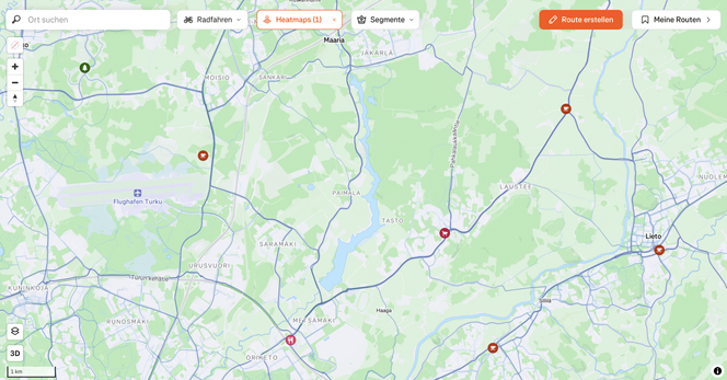
Ok, I need an alternative to Komoot for #CrossBorderRail 🚲🗺️ this summer

@spacehobo suggested cycle.travel that looks good, but on two shorter trips I’ll evaluate this and other options
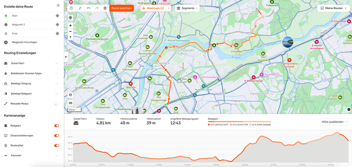
NEEDS
- route planning and saving on a computer and easily on an iPhone
- ability to share routes with others with a link, and export routes as GEOjson or equiv file
- turn by turn navigation (I have an old iPhone on a handlebar mount)

IMPORTANT
- works anywhere in the EU, and Moldova and edge of Ukraine

IDEALLY
- community driven and/or open source

And sorry, solutions only in a web browser are unlikely good enough. An app based solution for saved routes strikes me as important.

And why am I leaving Komoot behind? As @osma documented, the founders sold out to big money enshittifiers 😭

Based on suggestions from a bunch of people, 3 apps are to be assessed more closely

cycle.travel
Ride with GPS
Organic Maps

First test: home to a friend’s place in a neighbouring village

There are two routes: a longer flat route along the canal, and a shorter hilly route on a road with cars

cycle.travel gives me the canal
The other two the hilly road

First win for cycle.travel

@jon One of my favourite features of Strava is the global heatmap. There you can see where people *actually* cycle (or do other sports) and how popular a certain road or path is. I use this info very often in my route planning.

Disclaimer: Strava has more of a sports focus and I can imagine that you don't like its ethics. But for me and my activities (cycling, hiking, skiing, swimming), it's the perfect app in terms of exploring, planning, recording and sharing with others.

@sebwilken @jon I find the heatmap quite useful in addition to other tools, but I would never use Strava as a standalone routing tool. It doesn't show you anything *but* where cyclists go - not what the route is like, what kind of cyclist uses the route...

I use mapy.cz as a map and for the actual routing, and occasionally check the heatmap as I decide where to go.

@moritzkraehe @jon It does show you the type of surface (tarmac, gravel, trail) and you can also set the type of bike you want a route for (road bike, gravel, MTB, ...). In addition, you can also set whether you want to follow the most popular route, whether you want to minimise / maximise the elevation gain, which surface type should be preferred and so on.
@sebwilken @jon It does show the surface, but it does so very imprecisely compared to the data that OpenStreetMap has. Both "Asphalt" and "Gravel" can mean a lot of different things. Plus even in your example screenshot, it doesn't actually have any data for 45% of the route! And it only shows the surface for streets that are part of the route, so I can't see at a glance if maybe one street further to the east has a better surface than the currently selected one. As far as the routing options go, in my experience those just don't really do much of anything.

@moritzkraehe @jon Just wanted to point out that ‘it doesn't show you anything’ was maybe a little exaggerated.

That there are more precise tools: Fair enough! However, let's not forget that there are also people who just want to ride a bike and aren't hobby cartographers 🙂

@sebwilken @jon Of course Strava doesn't give you no information at all, but Strava really just tells me that there are two popular cycle routes there. On Mapy, I can see at a glance that one of them is a dedicated cycle path with a good smooth surface, and the other is a fairly major country road. I feel like that's valuable *especially* for people who just want to ride their bike.