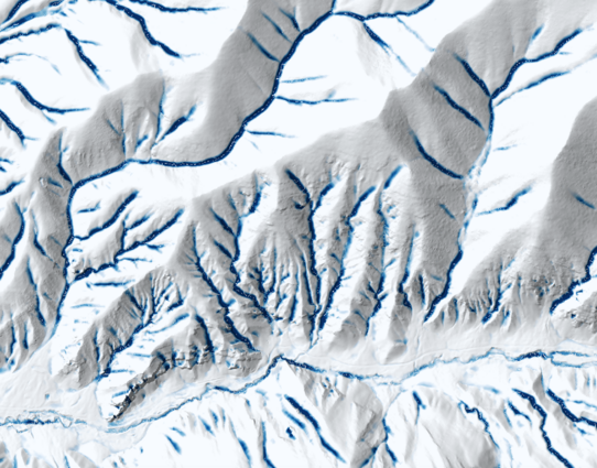
The impoundment size index (ISI) in #WhiteboxTools is great! In the image, sites that are non-impoundable by a 25-m dam are white and the darker blue a pixel is, the larger the upslope impoundment is. ISI could be used for siting #wetland construction projects, #riverrestoration, #flood modelling, #gully mapping, hydroelectric dam siting, and many other applications. #hydrology #spatialhydrology #topography #gis #gismapping #spatialanalysis #lidar