Here is the result of the site analysis by Golombek and colleagues. I should add that Bruce and Matt have been very helpful to me over the years. The sites are all between 10 south and 20 north, preferably at lower elevations. Where there are clusters (e.g. in Chryse), any ellipse in the cluster could be used for that node of the big triangle. Cerberus was not selected but Insight did some of this as a 1-node network.
#maps #mars #cerberus #marsnetwork

I'm back with a new network mission. We have seen that a Mars seismic network has been desired for a long time. In 2009 at LPSC, Bruce Banerdt presented a plan for Cerberus. It would use 3 copies of the Phoenix lander (which had just completed its mission) and would fly in c. 2016. Here is the abstract:

https://www.lpi.usra.edu/meetings/lpsc2009/pdf/2485.pdf

It doesn't say anything about landing site selection but Bruce kindly sent me a study of landing sites by Matt Golombek et al.
#mars #cerberus #marsnetwork

Hard to believe we have had so many plans for network missions, and no actual mission. Here are 3 more plans. At top is Netlander, a French (CNES) design which appeared in several variations. 3 or 4 landers would do geophysics and meteorology. Pascal was a proposal for NASA's Mars Scout program (and we will see others). It would have 18 or 24 small landers, globally distributed, to study meteorology for up to 10 Mars years.
Tomorrow we will slip the surly bonds of Mars.
#maps #mars #marsnetwork
Here are two mission concepts from 1998 and 1999 combined into one map. George James (University of Houston) et al. (1998) identified 3 potential ISRU (in situ resource utilization) sites marked as circles on the map. Antoine Mocquet (1999) (University of Nantes) mapped a geophysical network layout with a large triangle and antipodal point (white dots) and 3 less sensitive stations around each node to make 4 local networks.
#maps #mars #marsnetwork #isru
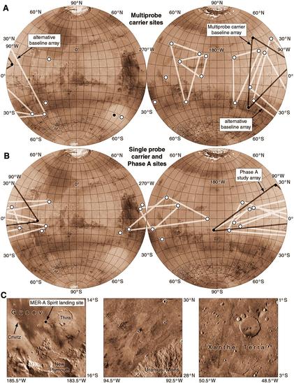
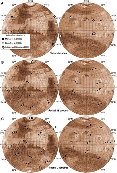
Intermarsnet had many potential sites but only 3 would be used, optimized for seismology. Robert Haberle (NASA Ames) proposed augmenting it with several mini-landers for meteorology, with a much larger latitude range: the Micro-Meteorological Network. The mission could launch in 2003 with up to 16 landers, deployed from the carrier during approach. 8 would be released, entering around the planet's limb to land in a big circle, then 8 more a bit later in a second circle.
#maps #mars #marsnetwork
This map shows some possible Intermarsnet arrays. An array could be deployed from one multiprobe carrier spacecraft or several single probe carriers. Multiprobe arrays (top) include triangles around Tharsis or Elysium with antipodal landers (single points). Single probe arrays had 3 or 4 landers in the same areas. A Phase A study had 3 landers in Gusev crater (Spirit landing site), north Tharsis and near Chryse (Viking 1 area) (shown at bottom).
#maps #mars #marsnetwork
From 1993 to 1995 another network mission was studied in Europe. This was Intermarsnet, a 3-station network for geology, seismology and meteorology. A list of 300 sites was drawn up - but never released (stop doing that!). But 100 of them were listed in a 1996 paper by De Angelis and Chicarro, as shown on this map. A single additional site was mentioned too (101 on this map). From this list, 3-station arrays could be selected. We will see some tomorrow.
#maps #mars #marsnetwork

In 1992 an ESA mission scenario called Marsnet was discussed at a meeting in Germany. It would be a 3 or 4 lander network (the 4th if funding permitted). A 1996 paper said that 50 sites were considered before 3 sets of 4 sites were selected. The one for which we have details is shown here. Sadly the report was not released and I couldn't add it to my first Atlas. Maybe it's accessible now but I have not seen it. Please don't hide important studies!

# maps #mars #marsnetwork

One plan had a single spacecraft deploying 4 balloons each with 5 weather stations and one seismic station. Global climate models suggested wind patterns and these maps show how 3 balloon missions might travel. Every black dot is a touchdown point, and at some of them the landers are released. No balloon has yet flown anywhere off Earth except Venus but there have been plenty of studies for Mars balloons. And we did have a cute helicopter.

#maps #mars #marsballoon #marsnetwork

How do the network landers get to the surface? They could be released by a carrier spacecraft during approach to Mars, or dropped off from orbit. But at the 8th MSWG meeting in February 1993, Jacques Blamont of French space agency CNES suggested dropping landers from a balloon. The balloon is blown by the wind, and either drops landers as needed or touches down periodically and releases its lander on the surface. Some designs land every night and fly in the day.

#mars #marsballoon #marsnetwork