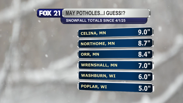
FINAL SNOWFALL TOTALS:

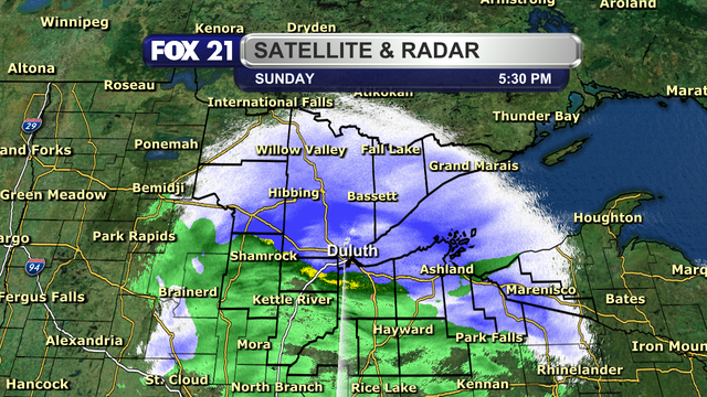
The third major #storm system to impact the #Northland this week is over.

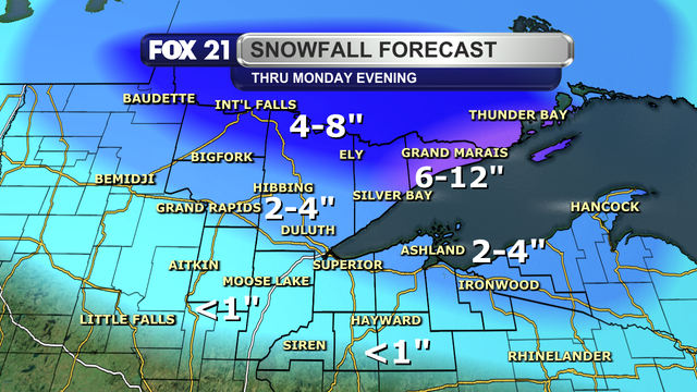
As #forecasted, the North Shore saw the highest #snowfall totals over the past few days with 12 to 15 inches recorded.

The rest of the #Minnesota side north of Highway 2 saw the next highest totals of 6 to 10 inches.

Amounts were below 6 inches elsewhere thanks to the storm's #dryslot limiting precipitation.

#wxtooter #weather #wx #MNwx #WIwx #UPwx

5:30 P.M. #RADAR UPDATE:

A mix of #rain and #snow #showers continues to fall across the #Northland this evening.

The farther north you live, be prepared for plenty of wet and heavy snow to clean up through Monday.

The farther south you live, the system's #dryslot will limit how much snow you see.

Overall, it will be a mess #driving across the region the next 24 hours.

#wxtooter #weather #wx #MNwx #WIwx #UPwx