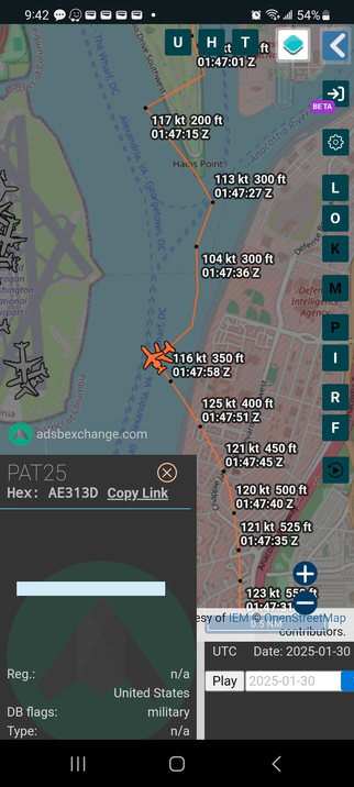
DIY map showing 3 degree Visual Glideslope Path Indicator (PAPI) from RWY33 and Helicopter Route 4 corridor.
This is all approximate obviously as Google Earth isn't exact, as is manually building KMLs, but it illustrates a major procedural issue.
Note: The investigation will determine the actual position of the aircraft at the time of the collision.
Methodology explain in the Alt Text.