Complete view of the second ring of #Myfico
The third ring's panels are complete, and will be posted once I get all of their edge markings appropriately transferred to the mostly-unfinished panels of the fourth ring
Complete view of the second ring of #Myfico
The third ring's panels are complete, and will be posted once I get all of their edge markings appropriately transferred to the mostly-unfinished panels of the fourth ring
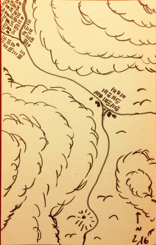
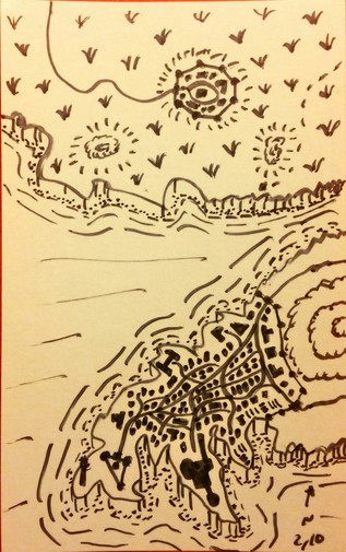
Second ring of #Myfico, North-northwest, Panel #16
Sandwiched between the Northern and Western Pebu Woods, the proximity to the forests have meant the land is fertile and ripe for planting. The plentiful crops clustered along the road are the source of the title The Golden Road.
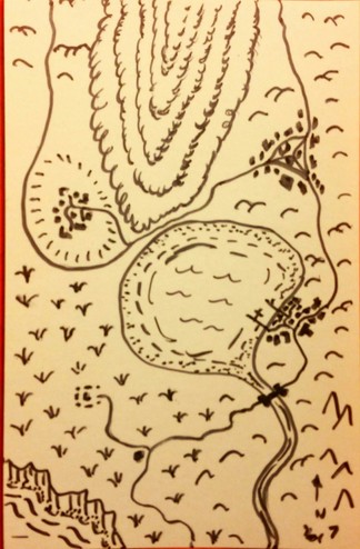
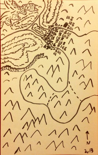
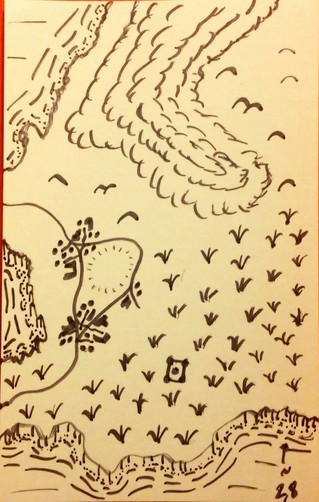
Second ring of #Myfico, Northwest, Panel #15
The edge of the Western Pebu Woods dominates the area, with a small pass-through village leading merchants braving the Soot Teeth to lands to the west. While the village elders have called for it to be named Pebu's Pride, most refer to it by the far less boastful name of Scratchland.
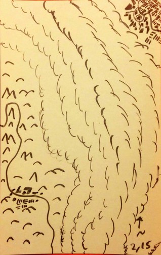
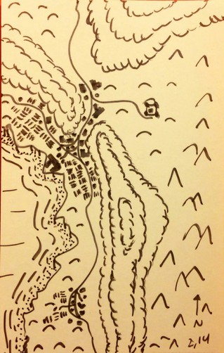
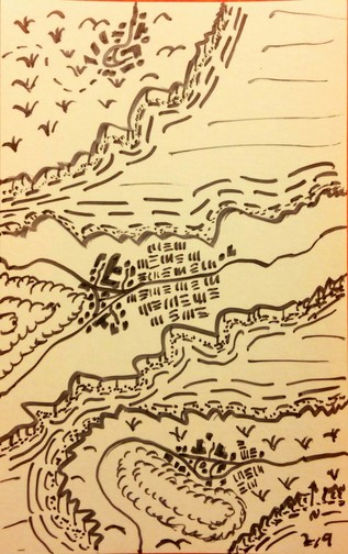
Second ring of #Myfico, West-Northwest, Panel #14
A few towns here grace these shores, with the hills and dunes sheltering the land enough that crops provide plentiful enough yields to export further north and west. To the east, the Sootwatch Castle lies abandoned but intact, empty after the dragons they were meant to watch left. The beasts that once nested near the active volcanoes here left and moved to the south after these peaks grew cold and silent.
Second ring of #Myfico, West, Panel #13
Little life graces the winding road through the Soot Teeth, but a few shortcuts exist for those who know the best paths to speed your travel and avoid marauding griffins. For those who make it through, the town of Nexus has plentiful and cheap food and drink, and for foolhardy travellers the Eastern road crosses back over the Soot Teeth, albeit over the mountains instead of between and right through multiple confirmed griffin nests.
#jerrymap mastoart
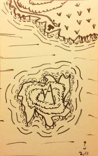
Second ring of #Myfico, Southwest, Panel #11
The forlorn island of the Fangs of Soabisn is host to a pair of sharp once-volcanic peaks, a medly of irritable wildlife, and a few feral tribes of halflings. The founder of the Ihalipo Correctional Boardinghouse on the northern shore was said to be infatuated with the island as a child, and hopes the forbidding island as a backdrop helps serve as inspiration to their imprisoned wards.
Second ring of #Myfico, South-Southwest, Panel #10
The grand metropolis of Fabime's Pride likes to believe itself one of the grandest cities in Myfico itself. While impressive, the city nevertheless remains only powerful enough to warrant a single seat on the Myfician Council, a single seat they weird with great care to represent their magicians in the city's Basilisk Academy to the south.
Second ring of #Myfico, South, Panel #9
To the east lies the first of the mouths leading inland to the Inmysa Strait, a much easier passage than the one plagued by the roaring vortex of the Gnash. The farms here are a vital source of food for the western city of Fabime's Pride.
Second ring of #Myfico, South-southeast, Panel #8
The western edge of the Cronebog barely touches the edge of Treaty Hill, itself surrounded on three sides by alternatively allied or warring townships. In the heart of the Cronebog itself is the Guardian's Vault, said to be constructed over a foul artifact best left undisturbed.
Second ring of #Myfico, Southeast, Panel #7
The Sister's Lake joins the southern half of the Motherwood forest and the northeastern part of the Cronebog as the trio of features nearly completely blocks trade routes between the east and west. Traders unwilling to pay the high fees to cross the Sister's Crossing bridge to the South face either a dangerous path picking through the Cronebog or pirates raiding sea merchants